-

- NEAR COSMO NEWBERRY TO KOORARAWALYEE.
We planned for an early departure to give us extra time to tour the abandoned mining town of Gwalia. Away by 7.00 a.m.
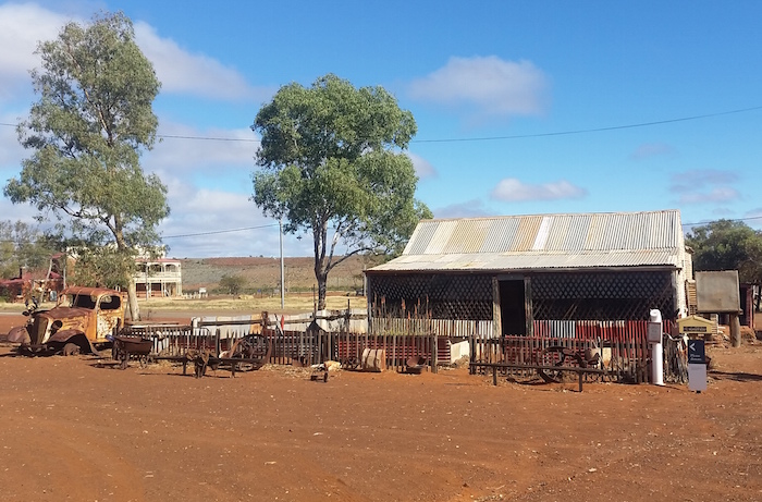
Gwalia
The clouds cleared at Cosmo Newberry. We refuelled at Laverton ($1.68/litre) and pushed on to Leonora, then Gwalia.
-

- Old Gwalia.
-

- Gwalia.
-

- Gwalia.
-
- Gwalia.
-

- How to fix a wheel.
Dan had to meet his dad in Kalgoorlie to swap a fridge and satphone. Kerry and Scott refuelled and went shopping. I took Seb and Marion to the Superpit.
-

- Superpit, Kalgoorlie.
Overnight at Koorarawalyee
It took a bit of coordination but we eventually departed Kalgoorlie at 3.50 p.m., heading for Koorarawalyee. Clearly we were going to arrive after dark. Having refurbished the well and harvest walls at Koorarawalyee over the Anzac Day long weekend in 2016 we knew that it was a good campsite.
-

- Campfire at Koora.
Koorarawalyee to Perth
-
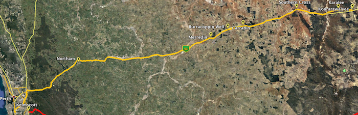
- KOORARAWALYEE TO PERTH.
Karalee
Rather than return to to the bitumen we took back tracks to Karalee Rocks and Dam. This National Trust site is a fascinating example of railway support engineering.
-

- Karalee aqueduct.
-
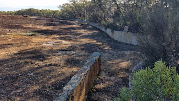
- Harvest walls.
-

- Aqueduct at Karalee.
-

- Karalee.
Morlining Rock
From Karalee we stayed on a bush track to find Morlining Rock and Well.
-

- Kim’s Rodeo at Morlining Rocks.
-

- Morlining Rocks.
-

- Dan, Scott, Seb and Marion at Morlining Well.
-
- Morlining Well.
After Morlining the track opened out, straightened out and led to an unnamed lake three kilometres to the east of Yellowdine. The track along the margin of the lake intersects with the Yellowdine Marvel Lock Road and within a 100 metres leads to Great Eastern Highway.
Rabbit Proof Fence
Into Southern Cross to refuel. At Carrabin we turned off the blacktop onto the Goldfields Road and followed it to the site of the historic Rabbit Proof Fence.

-

- Rabbit Proof Fence.
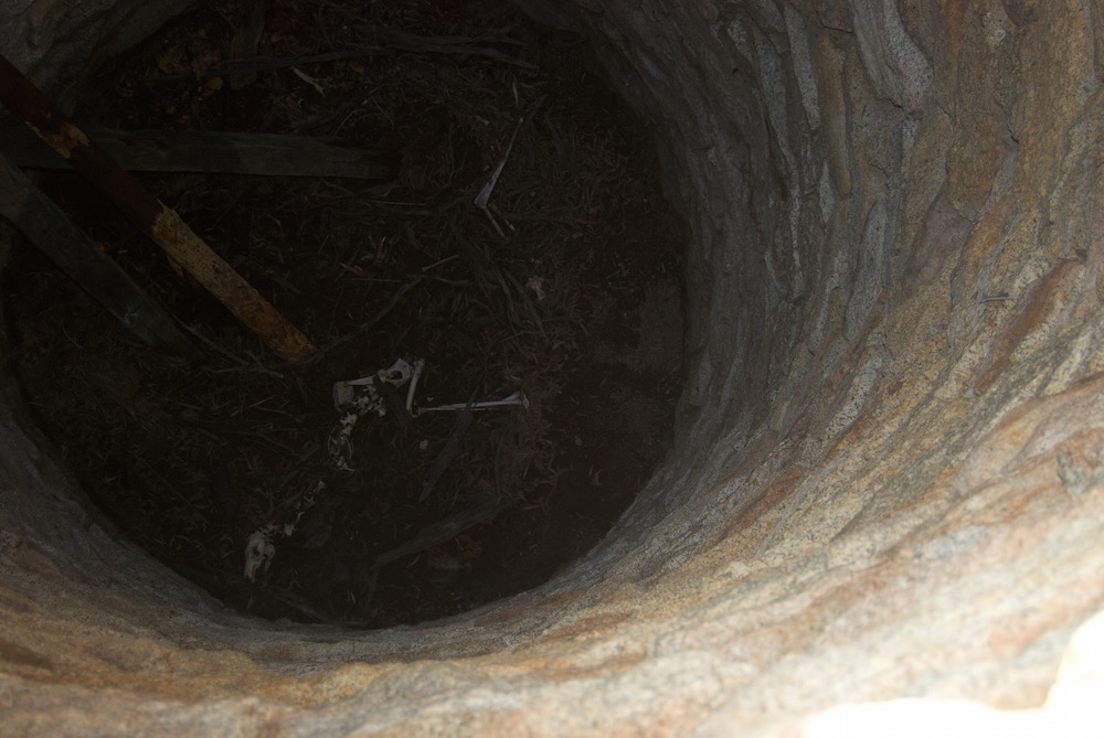
Burracoppin Well
We left the Rabbit Proof Fence, intent on finding Hunt’s Burracoppin Well. This would be the third search for this important historical well. The area near the carpark (signposted ‘Hunts Well 1865’) is a motocross track and after two previous unsuccessful searches we were starting to believe that the well had been destroyed with the construction of the track.
-

- Bicentennial plaque.
-

- Burracoppin Well.
While onsite at the carpark I contacted former champion rally driver and outback explorer, Stuart Kostera, who now has a keen interest in pioneer wells. He told me that he had spent the best part of a day searching for the well and had eventually located it some distance from the signposted location. Following his directions, I was able to quickly find it.
From there it was a straight run home.
Return to Great Central Road
Go to Contents
© Kim Epton 2016-2026
531 words, 19 photographs, two images.
Feel free to use any part of this document but please do the right thing and give attribution to adventures.net.au. It will enhance the SEO of your website/blog and Adventures.
See Terms of Use.

© Kim Epton 2016-2025
6363 words, 303 photographs/images.
Text by Kim Epton
Photographs by:
Scott Overstone
Steve Sporne
Dan Wales
Kim Epton
Feel free to use any part of this document but please do the right thing and give attribution to adventures.net.au. It will enhance the SEO of your website/blog and Adventures.
See Terms of Use.