
The Eastern Goldfields encompasses a vast area of roughly 320,000 square kilometres (about the same size as Norway).
It extends from Wiluna in the north to Norseman in the south and from Southern Cross in the west to the Nullarbor Plain in the east. Forrestania delineates its south-west corner and Fraser Range its south-east corner. Lake Barlee is the extent to the north-west and Cosmo Newberry to the north-east.
Note that the Tropicana Gold Belt is seen as a new gold province and not part of the Yilgarn Craton in which the Eastern Goldfields is located.
The Eastern Goldfields includes seven local government districts and is centred on Kalgoorlie-Boulder.
The geology of the Eastern Goldfields is characterised by ancient volcanic and sedimentary rocks, dating back 2.6 to 2.9 billion years.
-
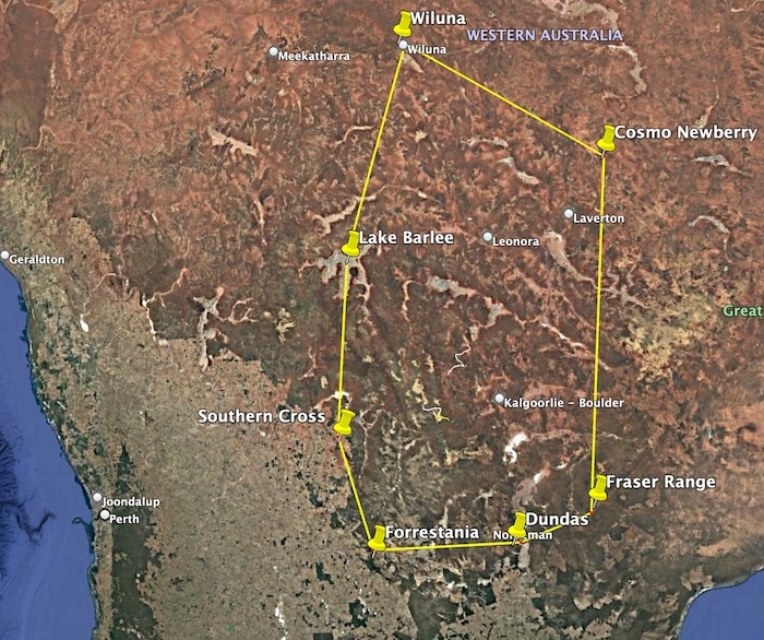
- Extent of the Eastern Goldfields.
© Kim Epton 2026
173 words written entirely by the author, not AI.
One image.
You are welcome to use any part of this document. Please attribute adventures.net.au — it will help your site’s SEO as well as that of adventures.net.au
See Terms of Use.