Tjukaruru Road
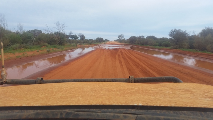
Leaving Kata Tjuta we turned off the bitumen at the start of unsealed section of the Tjukaruru Road. Some deflated tyres slightly for the dirt road.
-
- Tjukaruru Road.
The Tjukaruru Road was in good condition although there were numerous mudholes for many kilometres – the bloke I spoke with half way down Uluru wasn’t lying.
-

- Also known as Tjukaruru Road.
Lunch was under some desert oaks at Puta Puta, in the Petermann Ranges, near Chirnside Creek.
-

- Lunch at Puta Puta.
Lasseters Cave
Next stop was Lasseters Cave at Tjunti, not far from Docker River. It was here that prospector Harold Bell Lasseter sheltered for 25 days in January 1931 after his camels deserted him. He was later found dead by Bob Buck, well-known bush man of central Australia. More information.
-

- Estela at Lasseters Cave (Tjunti).
-

- Hull River at Tjunti.
-

- Plaque at Lasseters Cave.
-
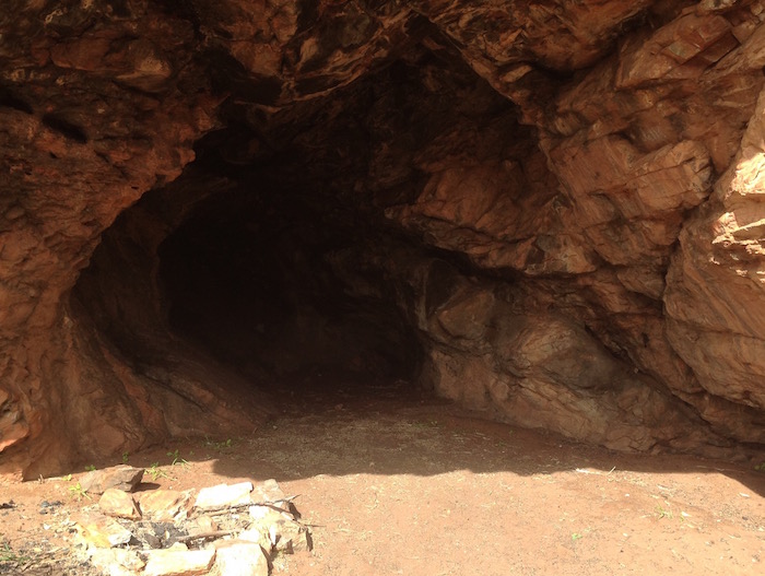
- Lasseters Cave.
-

- Hull River at Tjunti.
WA/NT Border
From Tjunti it is only a short run to the NT/WA border.
-

- WA section of the Outback Way
-

- Its a real problem
The convoy had spread out a bit by Warrakurna and it was clear that the pace of the trip was a little too fast for the guys towing.
Giles/Warrakurna
Giles Weather Station is about a kilometre north of the roadhouse/settlement so we took the opportunity to see one of the Gunbarrel Road Construction Party’s graders. A part of the Blue Streak rocket launched on 5 June 1964 from Woomera found 50 kilometres south-east of Giles in 1980 is on display at the Weather Station.
-
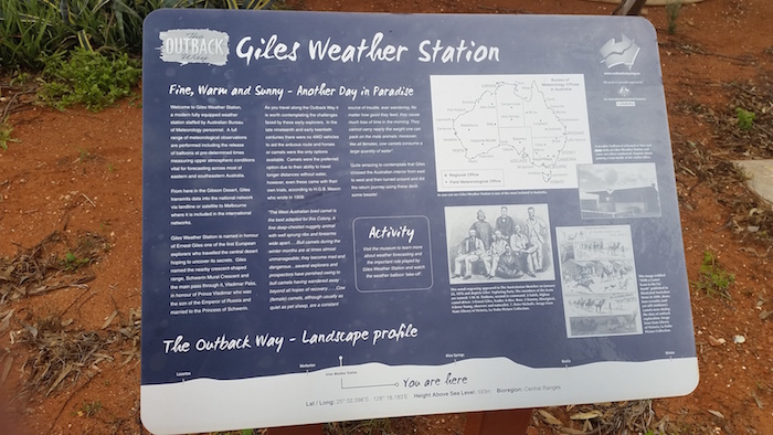
- Giles Weather Station.
-
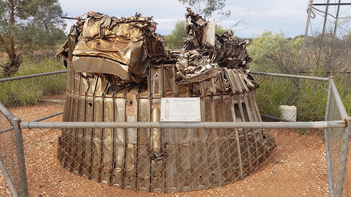
- Remains of Blue Streak rocket.
-
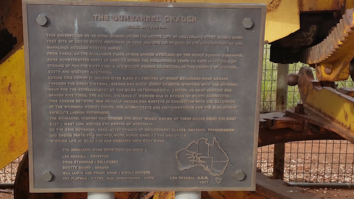
- The Gunbarrel Grader.
-
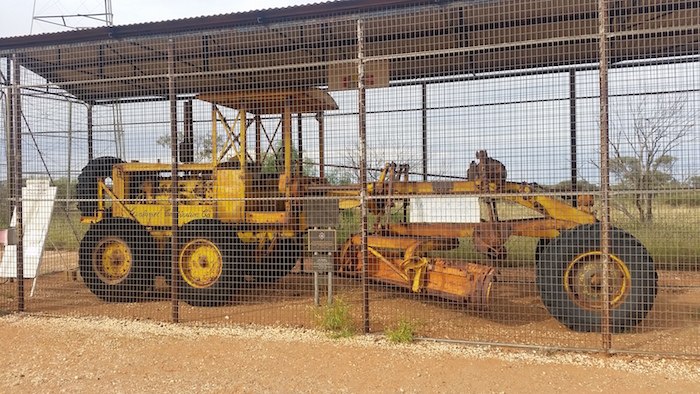
- Gunbarrel Road Construction Part grader.
Kerry topped up at Warakurna roadhouse (diesel $2.45/litre). Cheapest fuel in town. We left Warakurna looking for a camp for the night, deciding on Yarla Kutjarra.
Yarla Kutjarra Campsite
Minutes after we set up camp we were joined by Sebastian and Marion, a young French couple in Australia for a year travelling in a Mitsubishi Challenger 4WD wagon. They were to stay with us for the rest of the trip.
-

- First campsite on the Great Central Road.
-
- NEAR GILES TO PAST CHOOKA.
John and Lesley and Ken and Estela decided to head home at a slower pace. Scott, Kerry, Dan, Seb and Marion, and I departed from our overnight camp spot in a new convoy.
-

- Just before leaving camp.
Great Central Road
From Warburton to Heather Highway turnoff the Great Central Road (GCR) is bitumenised. I’m sure the locals appreciate it but is somewhat detracts from the ‘Outback Experience’.
While waiting for the service station to open at Warburton (9.00 a.m.) I changed the fuel filter on the Rodeo. This is better done on a hoist rather than lying on one’s back in the gravel forecourt of an outback servo.
-

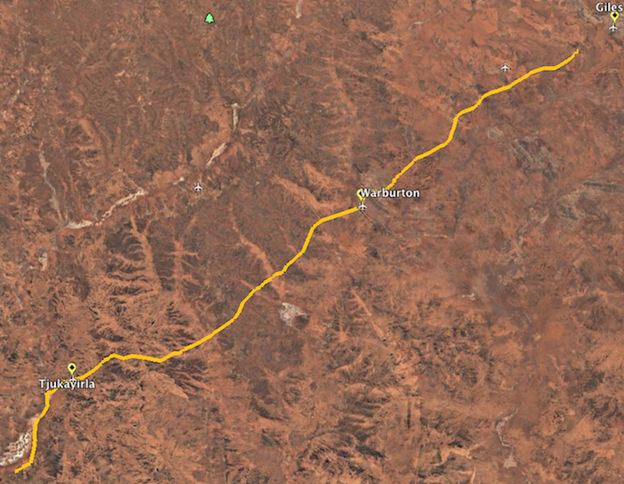
- Near Tjukayirla.
-

- Seb and Marion.
-

- Taking a break on the way to Chooka.
-

- This desert kurrajong – Brachychiton gregorii – is known as the Kurrajong Sentinel, 17 km east of Tjukayirla.
Empress Springs
After refuelling and lunch at Tjukayirla we headed west on the GCR and discussed over the radio whether we should visit Empress Springs. It had long been an interest of mine. Fifteen kilometres west of ‘Chooka’ the David Carnegie Highway leads off to the north – to Breaden Bluff and Empress Springs – before eventually intersecting with the Gunbarrel Highway. The track continues north of the Gunbarrel from where is is known as the Eagle Highway – but often the entire track from the GCR is termed Eagle Highway.
-

- Camels on David Carnegie Track.
-

- Breaden Bluff.
-

- Breaden Bluff.
-

- David Carnegie track.
Empress Springs was revealed to the wider world in 1896 by David Carnegie.
-

- I wonder what was on the missing sign?
-

- At Empress Springs.
-
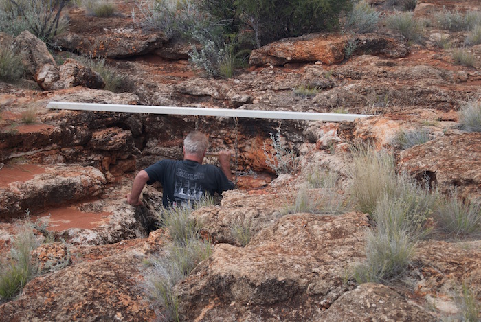
- Scott entering Empress Springs.
-
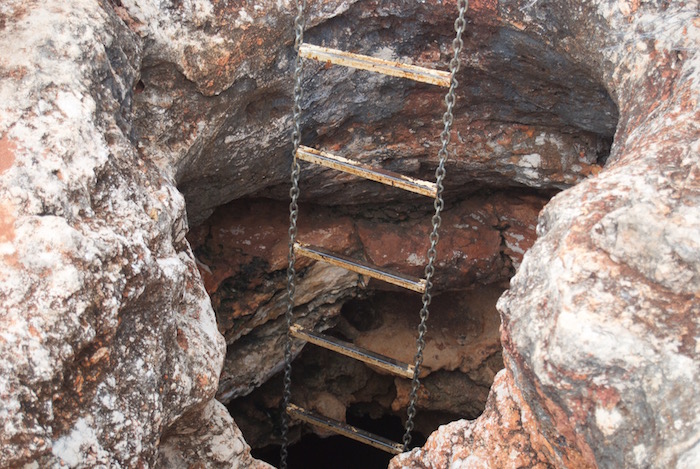
- The chain ladder into Empress Springs is quite robust, however, the mounting of the support beam is a bit sketchy.
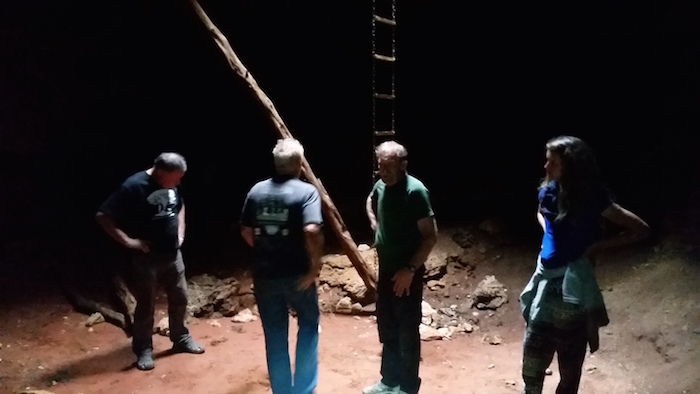
-

- Dan descends into Empress Springs.
-
- In Empress Spring.
Minor Drama on Return to Great Central Road
On the return to the GCR we stopped to collect wood and noticed that Seb’s vehicle was leaking fuel. Scott was carrying some metal sealant that solved the problem.
-

- Last light on the Great Central Road.
The aim was to reach a campsite 95 kilometres to the west but as darkness fell I swung into a earlier parking bay and drove through to the tracks beyond. It opened into a very large gravel pit with masses of wood for our campfire.
The rain blew in horizontally overnight. Not pleasant.