Tony and I headed into Albury in the Triton and waited at the main bridge for the boat crews. Bernie, Rin and Stewart took The Bus into Albury to do some shopping and were then directed to a spot where the Riverina Highway came close top the river. Their lack of understanding of map grid references was disconcerting but, as events unfolded, irrelevant.
- This speed at which the boats left Hume Weir was not to be maintained.
Radio contact with the boat crew made it clear that the rate of progress was slower than first expected – much, much slower. The water level was very low and the crews were out walking for long periods. Corowa was definitely out as the overnight stop. The boats passed under the Hume Highway and Tony and I sped off to locate a suitable overnight stop. It appeared it would have to be a farm.
Darkness fell and we had not seen the boats. Radio contact allowed us to decide on a rendezvous point. The task was then to find the track to the rv. It was shown on the map but incorrect cadastral information (names for farms and the like) made the task of getting to the boats that much more difficult. My immediate need was to establish precisely where they were.
By this time we had met up with The Bus crew. We met persons who had lived in the area all their life but did not know the names of farms, roads and physical features, as listed on the map. This only confirmed what I had learnt on many previous expeditions – local knowledge is often a contradiction of terms.
I decided that the best option was to head to the river along farm tracks on a property shown on the map as Kirrikie. When we got to the homestead the farmer was busy loading cattle onto a truck but stopped long enough to tell me that his property was Bungowannah Park (shown on the map to be five kilometres to the north-west.
As darkness fell the farmer explained how to reach the river.
The problems of people not trained in correct radio procedure became evident. When comms are good this procedure is not important and does not always need to be used. When comms are tentative and other pressures are present, correct procedure is vital. Wandering around the riverside paddock of Bungowannah Park in a 4WD, trying to locate three dinghies stopped somewhere on the river bank and at the same time trying to direct the crew in The Bus to a suitable campsite, all while comms were suspect and standard radio procedure was nonexistent, pushed my patience to the limit.
By radio, Tony and I established that the boat crews were on the river bank and had lit a fire that would possibly act as a beacon, and also keep them warm. In attempting to locate their position Tony flashed the headlights of the Triton. Adrian reported that the flashes could be seen. Tony turned the vehicle 180 degrees and again flashed the headlights.. Adrian reported that the flashes could be seen. Clearly, it wasn’t us. We quickly established that the flashes of headlights seen by the boat crews were those of vehicles travelling along the Murray Valley Highway on the other side of the river.
After a tour of what seemed like the entire river flats of Bungowannah Park and a few close calls with bog holes that would have swallowed the Triton whole, we eventually found the boats. We could not get the Triton any closer than 300 metres from where the boat were so the crews had to drive them back up river, navigating by torchlight. This done, the boats were left on the river bank and the crews loaded into the back of the Triton.
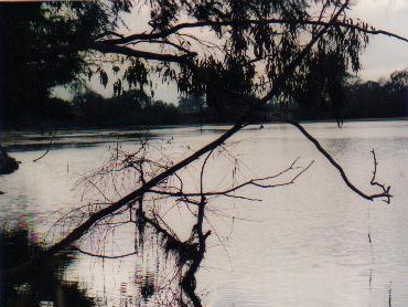
- Between Hume Weir and Albury.
I radioed The Bus crew. They had set up camp on the side of the Riverina Highway about five kilometres west of Bungowannah Park. On arrival at the chosen spot it was clear that the inauspicious start on the water was reflected in the set up of the camp. Poorly laid out, no equipment unpacked, and the annexe erected upside down. Apart from these irritations it was comfortable so I left the annexe as a ‘lean to’ and decided to concentrate on making a better camp tomorrow.
We had learnt that Lake Mulwala (held back by Yarrawonga Weir farther downstream) was to be drained to remove silt. As a consequence very little water was being let out of Hume Weir. It was 82% full instead of the usual 50-55% of capacity leading into winter. All this meant that the ankle deep water encountered since leaving Hume Weir was likely to continue until the river came into the influence of Lake Mulwala.
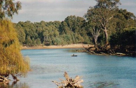
- An idyllic setting but was he catching anything.
We discussed the best course of action. It was evident that to proceed with the water at its present level was impracticable. The water level downstream from Yarrawonga Weir would be higher (hopefully navigable) and so it was decided to head there tomorrow.
At Tony’s insistence we collected the boats from where they had been left on the river bank. A roster was organised. Each trip to the river took an hour and as only one boat at a time could be transported, three trips were needed. Tony finally hit the sack at 0100 after having driven the Triton on each of the three trips, dragged and lifted the boats onto the top of the vehicle, and unloaded them at camp.
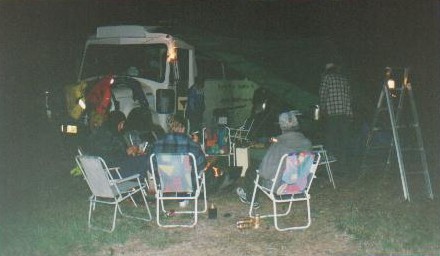
- Camped by the Riverina Highway after a less than perfect day.
Lessons learnt on Day One were fourfold:
- All participants need to be conversant with correct radio procedure.
- Rudimentary navigation skills (grid references, cardinal points) are necessary, particularly for support crew and/or drivers of vehicles.
- Time spent prior to an expedition practising camp establishment procedures is vital.
- The early onset of dark in winter means campsite selection decisions must be made early in the afternoon – as early as 1500.


