Course of the River
Government surveyor Harry Johnston surveyed the Lennard River in 1883 and its course appeared on public plans the next year.
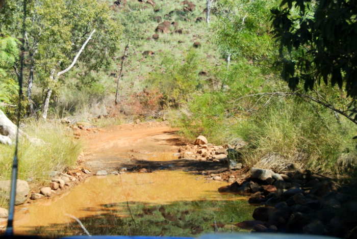
The Lennard River flows across the Gibb River Road.
Naming of the River
Alexander Forrest discovered the Lennard River on 8 June 1879 during his expedition from DeGrey to Port Darwin,
“All the main streams that we have crossed as yet run into the Fitzroy; it is therefore no matter for surprise that during the rainy season the lower flats should suffer from severe inundations. In a pool close by the camp we caught five fish. I have named this large stream the Lennard River.”
Forrest named the Lennard River after Amy Barrett-Lennard, his fiancee. He also named the nearby Mt Eliza after her.
- The Lennard River crosses the Gibb River Road.
Amy Eliza Barrett-Lennard (1852-1897), daughter of Edmund and Elizabeth Ann nee Smith, married Alexander Forrest at Beverley in January 1880. During Forrest’s term as Mayor of Perth from 1893 to 1895 her home in St Georges Terrace became a social centre of Perth. She had one daughter and four sons. In 1897 she went to England to seek medical attention for cancer and died there.
Statistics
LENGTH 81 kilometres.
SOURCE Mount Ord (95 kilometres north of Fitzroy Crossing).
SOURCE (AMG) 771800 metres east 8082800 metres north. (Zone 51)
FLOWS INTO The Meda and May Rivers may be considered as the delta branches of the Lennard.
ENDPLACE Four kilometres north-west of Mount Marmion (75 kilometres east of Derby).
MOUTH (AMG) 641800 metres east 8080400 metres north. (Zone 51)
TRIBUTARIES Richenda River, Barker River, numerous named and un-named streams.
1:100,000 MAPS Mount House 4063, Richenda 3963, Lennard 3863, Meda 3763.
1:250,000 MAPS Lennard River SE 51-8, Derby SE 51-7.
Reference
Epton, Kim, Rivers of the Kimberley, Hesperian Press, Carlisle, 2000.
Read about other rivers in Western Australia and Australia.
© Kim Epton 2019-2025
318 words, one photograph.
Feel free to use any part of this document but please do the right thing and give attribution to adventures.net.au. It will enhance the SEO of your website/blog and Adventures.
See Terms of Use.

