Permits to drive Googs Track are available in Ceduna.
Googs Track crosses more than 300 sand dunes as it traverses 200 kilometres through the Yumbarra Conservation Park and Yellabinna Regional Reserve before it meets the Trans Australia Railway access track at Malbooma.
Trailers and caravans are not permitted on Googs Track.
There is a gate at the start of the Track, informational signage and a small clearing where one can deflate tyres.
- Gate at the start of Googs Track.
Although the recommended direction to traverse the track is from south to north many people travel the Track in the opposite direction. Advice on sign boards at the start of the track is to use UHF18. It is wise to call regularly – particularly approaching the crest of dunes.
It is fairly straightforward to locate oncoming traffic and none of the ‘meetings’ should present a hazard.
What today is known as Googs Track was started in 1955 when some station owners set about cutting a track from Malbooma south through the scrub, aiming for Ceduna’s Port Thevenard. They got as far as what is known today as Drum Camp, before they abandoned construction.
John (Goog) and Jenny Denton established a property at Lone Oak (originally 5800 acres of scrub) just north of the dog fence with thick bush and sandhills extending north. While making improvements to the property Goog constantly contemplated what was out there to the north.
- Track leveller.
In 1973, he started to make Googs Road – north from the farm towards the railway at Tarcoola.
Goog and his wife and children, along with Jenny’s brother Denis Beattie, started clearing a track through the scrub with a Fordson tractor fitted with a blade, backed up by a two-wheel drive Toyota ute. Realising that more power was needed, the tractor was replaced by an Allis Chalmers HD14 bulldozer. They worked on the road every weekend for 18 months, to as far as what is now the turnoff to Googs Lake – a salt lake about 55 km from their Lone Oak property. The Dentons built a shack here to serve as a base for the next leg of the track construction.
- Top of a dune.
- Crest of a dune.
A grader was added to the fleet in early 1976. Three years after it began, Googs Track was cleared as far as the existing track to Drum Camp in August 1976.
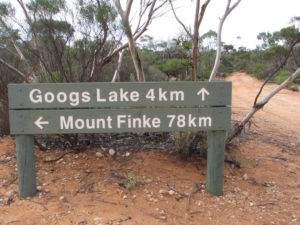
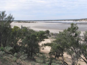
- Googs Lake, four kilometres off the track, has picnic facilities and is well worth the detour.
- Lake Goog
Mount Finke campsite is picked clean of firewood.
- Mount Finke from the campground.
Mount Finke is an inselberg or monadnock which is an isolated hill or small mountain that rises abruptly from a surrounding plain (literally ‘island mountain’). Presumably its name is derived from the same as that for the Finke River. The Finke River was named by Johm McDoual Stuart in 1860 during his fourth attempt to cross the Australian continent from south to north. Stuart named the Finke River “after my sincere friend William Finke, Esq. of Adelaide, South Australia – one of the liberal promoters of the different expeditions I have had the honor to lead.”
- Mount Finke.
- Saltpan on Googs Track.
- The Track can get wet.
The appearance of the Trans Australia Railway signals the end (or beginning) of Googs Track.
The Track is much hyped but a bit of a doddle really. If the uneducated could be educated to lower tyre pressures the offset ‘holes/ruts’ on the approach to sand dunes would be eliminated and one could confidently complete the Track in a 2WD – although that, of course, would exacerbate the problem of holes, ruts and corrugations. Any halfway competent driver with adequate vision and a vehicle with a 4WD button/stick could drive this track with ease.
For details of other, lesser-known tracks, go to the Wells and Tracks website.
© Kim Epton 2016-2024
667 words, 10 photographs.
Feel free to use any part of this document but please do the right thing and give attribution to adventures.net.au. It will enhance the SEO of your website/blog and Adventures.
See Terms of Use.


