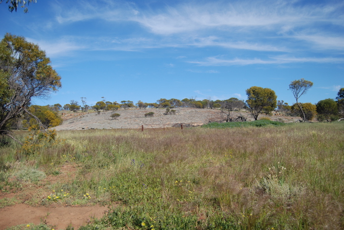
C.C. Hunt (1832-1868) used the native name Dodolokine for the rocks that are about five kilometres NNW of the current town of Doodlakine. Clarkson, Lukin and Harper were in the field looking for pastoral land at the same as Hunt and spelt it Dudulukine. Alexander Forrest (1849-1901) spelt it as Dodlakine and surveyor H.S. King (1862-1930) spelt it variously as Doolekine, Doodlakin and Doodlekine.
When the road to the Yilgarn goldfields was opened in 1894 the town was gazetted as Doodlakine. In 1908 it was proposed as the capital of Australia.
- Doodlakine Rock
From Hunt’s ‘List of Reserves and Stopping Places’:
Situated near the eastern base of rock of the same name. Recommended that 100 acres be reserved. The well to form a point (5) chains within the southern boundary line at equal distance from the corners of the southern line – the greatest length (east & west).
Marked tree about (60) yards east from the well.
Hunt was engaged in reconnoitring the country ahead for suitable sites while his party constructed the well:
10 February 1865. Friday. 11h 30m a.m. halt at Dodolakine Spring, …. some of party engaged, sinking well, collecting stone …
11 February 1865. Saturday… party engaged about the well, carting poles and stone for the same.
Hunt did not record any details of the well’s completion. The next day was a Sunday – a day that was firmly observed as a day of rest and Hunt and his party moved on to Metchering on the Monday, leaving behind an injured pensioner guard named Hyland man and a prisoner to care for him, both of whom were to return to York via the returning resupply cart. This did not leave much time for the well to be completed although if the current day well approximates that built by Hunt it could quite conceivably have been constructed in the period the main party was at Doodlakine.
The current Doodlakine Well is about a metre deep, very small and lined with stone.
It is more than likely not the work of Hunt’s parties, probably being stoned up during the gold rush of the 1890s. It may be that the original collapsed well is located nearby or that the current well was built over Hunt’s well.
5 chains = 330 feet = 110 yards ~100m
The reports of the various trips, tours and travels on the Adventures website have a lot of information about place names – their naming and features – toponymy. More information.
© Kim Epton 2016-2024
431 words, one photograph.
Feel free to use any part of this document but please do the right thing and give attribution to adventures.net.au. It will enhance the SEO of your website/blog and Adventures.
See Terms of Use.

