The Yilgarn Craton in Western Australia is one of the most ancient landscapes preserved anywhere on Earth. It is where most of our trips take place.
The Yilgarn Plateau or Craton is one of the original masses of rock that rose out of the sea in the Late Archaean, about 2700 mya to form the original landmass of Australia.
The Yilgarn Craton is geologically known as Yilgarnia
The ~650,000 km2 of the Yilgarn Craton (as a country it would be the size of Afghanistan) lies in the southern part of Western Australia, with its north-west corner just east of Shark Bay. It runs further east to Meekatharra and Wiluna across to Yamarna/Cosmo Newberry. South toward Balladonia/ Caiguna in the south-east. The approximate extent of the craton follows the south coast to just short of the south-west corner of the continent around Pemberton. The Darling Scarp forms a clear-cut line that separates it from the much younger Swan Coastal Plain along its western edge. The Darling Scarp is the edge of the rift formed at the beginning of the separation of India from Australia, which preceded the separation of Australia from the present continent of Antarctica about 45 million years ago during the break up of Gondwana.
The Yilgarn Block has not been submerged since it rose out of the sea. It was one of the blocks of crust, cratons, which were later joined together to form the present continent of Australia, at a much later date.
-
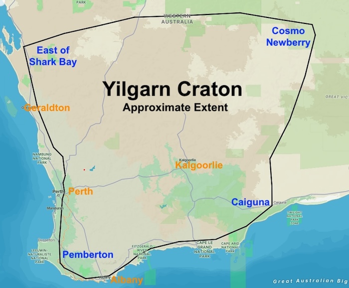
- Yilgarn Craton (approximate extent)
Further reading:
http://austhrutime.com/yilgarn_craton.htm
© Kim Epton 2016-2026
289 words, one image.
Feel free to use any part of this document but please do the right thing and give attribution to adventures.net.au. It will enhance the SEO of your website/blog and Adventures.
See Terms of Use.