
Preamble
In the 1890s renowned bushman Gus Luck pushed through a track from Southern Cross to the 90 Mile, as Goongarrie was known at the time, to supply prospectors and miners at this early gold find. Today’s re-constructed track, with a few small re-alignments, is known as the Gus Luck Track.
This journey was along the full length of the Gus Luck Track (GLT), from Goongarrie to Yelolwdine.
Between Goongarrie and Coonmine Well only some sections of the Track can be driven, however, there are alternative routes to connect these driveable sections.
-

- Routes shown in yellow are the original GLT.
At its start/finish the Track has totally disappeared between Southern Cross and Duladgin and, in any case, following it would be extremely problematic owing to the existence of a sturdy, north-south vermin proof fence that completely excludes access to the area.
For convenience, the Track today starts at Yellowdine and heads north to Weowanie, the first location on Luck’s original track. Weowanie is also part of the earlier Hunt Track, pushed through in 1865-66.
However, our journey started at Goongarrie.
To Lower Goongarrie
The upper part of the track – between Goongarrie and the boundary of the station at Lower Goongarrie – crosses many creeks and is difficult to follow at these locations. Several times I had to search around on foot to pick up the track, however, there were no problems in crossing them.
-

- Kim and Tassy in their Patrol, out of the creek.


The track from Goongarrie brought us out to a service track for a pipeline and powerline connecting two mines – the ‘Pipeline Track’. We had to head south and then take the Davyhurst Road north to Wangine to get back to the Gus Luck Track.

Wangine
After lunch at Wangine we explored the breakaway, a fine example of one of the most notable features of inland Western Australia.
-

- White coloured intrusions among the laterite.
Wangine was an important staging post on the Gus Luck Track. In 1902, the Wangine Hotel that had catered for travellers and teams on the Southern Cross to Goongarrie Track (Gus Luck Track) for many years was shifted 15 kilometres south-east to the now-abandoned gold mining town of Siberia.
-

- Wangine Breakaway
-

- Wangine Breakaway
-

- Wangine Breakaway
The original Gus Luck Track is difficult to follow between Wangine and Coonmine. In some places where the the track is known it is overgrown and not able to be driven. In other places the route can only be extrapolated and other tracks must be used to get to the various original sections that can be driven.
-

- UPPER GUS LUCK TRACK – the Blue Line can be driven. The Yellow Line is the historical track that cannot be driven.
After travelling from Wangine to Point C on the map above, via Davyhurst Road, we stopped to search for any sign of the historical track east to Wangine. A Lands & Surveys bench mark (see photo below) was located at the point where the historical track crosses the more recent north-south track that we were on.
-

- An overgrown, barely discernible section of the historic GLT extends from this benchmark to Wangine.
Locating the Historic Track
A short walk east along the supposed historic track turned up some artefacts (rusted cans and horse shoes), confirming that it was indeed the original Gus Luck Track.
-

- Kim with a rusty can, one of the numerous pieces of detritus found along the barely discernible track.
We continued on Gus Luck Track to Coolgardie North Road. From this point (actually Split Rock Dam a kilometre further on) the historical track is not accessible so we continued south along Coolgardie North Road, turned west on the Coonmine Well track and found a campsite among the Goldfields Blackbutts.
Continue on the Gus Luck Track
First stop was Coonmine Rockhole, also known as Frost Soak.
-

- Coonmine Rockhole, also known as Frost Soak.
Turturdine
-

- Turturdine Rock
-

- Plaque commemorating Gus Luck at Turturdine Rock, installed by some of his descendants.
-

- Covered soak at Turturdine.
Next stop was Urdardanging Rock where there is a covered soak with plenty of water and a grave, most likely for a dog, 100 metres distant. This rock and Turturdine were often confused in official records. Urdardanging was also known as Dookie Rock.
-

- Tassy and Jo at Urdardanging Waterhole.
-

- Greg and Andrew at Urdardanging Waterhole.
For many years the GLT east of the Mount Walton haul road diverted away from the original Track. Some agency (most likely DPaW or Ag Dept) has improved a nine kilometre section of the track, bypassing a long washaway and realigning it with the historic route. Perhaps the engineer responsible for planning the route or the plant operator creating the change was aware of the historical inaccuracy as reported on this website here and here.
71 Mile Rock and Well
The short track into this rock is narrow and overgrown.
-

- Well at 71 Mile Rock.
-

- Kim at 71 Mile Rock.
The track improvements continued for some kilometres south-west of 71 Mile Rock. Though the GLT was never a 4WD ‘challenge’ this work has made it even less so.
Wallangie/Ives Rock
For many years Wallangie was known as Deadmans Soak, because of a nearby grave of an unknown pioneer. Government Dogger Roly Dimer, who had worked the region from 1957, supplied the name.
Until 2005 Ives Rock was known as Ive Rock. Investigative work by Ian Elliot, noted bush historian, author of a number of books, developer of the Hann Track and long time contributor to Western 4WDriver caused the name to be corrected to Ives, the surname of the two men who buried the unknown man in the grave 200 metres to the west of the Rock.
-

- Jo and Andrew at grave of unknown pioneer.
Wallangie was a large and important water point on Juardi Station.
-

- Wallangie Soak
-

- Wallangie Dam
We had lunch, walked up the rock, found some 130 year old graffiti and then continued our drive.
-

- View from Ives Rock.
-

- J. Roberts thought it necessary to peck out his name in 1895. Graffiti or historical work?
Ullambay Well
-
- Ullambay Well
-
- Ullambay Well
Blazed Desert Kurrajong Tree
This tree is reasonably easy to spot about six kilometres before/after the railway depending on direction of travel. Desert Kurrajongs have leaves that are generally brighter green than surrounding vegetation, making them stand out.
-

- It is difficult to discern what has been blazed into the tree and it is not known who blazed it.
Darrine
Two and half kilometres after crossing the Trans Australian Railway we arrived at Darrine Waterhole.
-

- Gary and Andrew at Darrine.
The cover of the rockhole at Darrine has names scribbled all over it, dating back many years.
-

- The “I was here” style of graffiti has achieved a historical significance.
Eva Lake
Fortunately, this potential ‘track blocker/trip stopper’ presented no issues. There was only a few millimetres of waters in the lake at the point where the Track crosses it.
Weowanie Rock
We arrived at Weowanie, walked to the summit and had a look at a number of water catchments.
-

- A wonderful example of how holoclasty had affected this rock.
-

- Cairn at the summit of Weowanie.
-

- Hunt’s Tank at Weowanie.
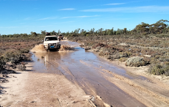
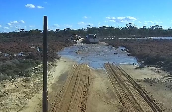
The track after Weowanie can be very sandy and, because it crosses the southern extension of Lake Deborah, it can sometimes be impassable.
-

- Sputhern extension of Lake Seabrook.
-

- Greg on the Weowanie-Duladgin Track
-
- Andrew and Jo through the mud hole.
-
- Southern end of an arm of Lake Seabrook.
-

- Gary takes his Pajero through a mud hole on Weowanie Track.
Duladgin
The track from here back towards Weowanie is the start of the authentic, driveable Gus Luck Track.
At Duladgin is the grave of a pioneer who died in tragic circumstances – often repeated in those desperate days of privations, loneliness and sometimes despair. Locating Thomas Davidson’s grave here after he blew his brains out with a firearm in 1895 ensured a visitation that it would otherwise never get.
-

- Grave of Thomas Davidson.
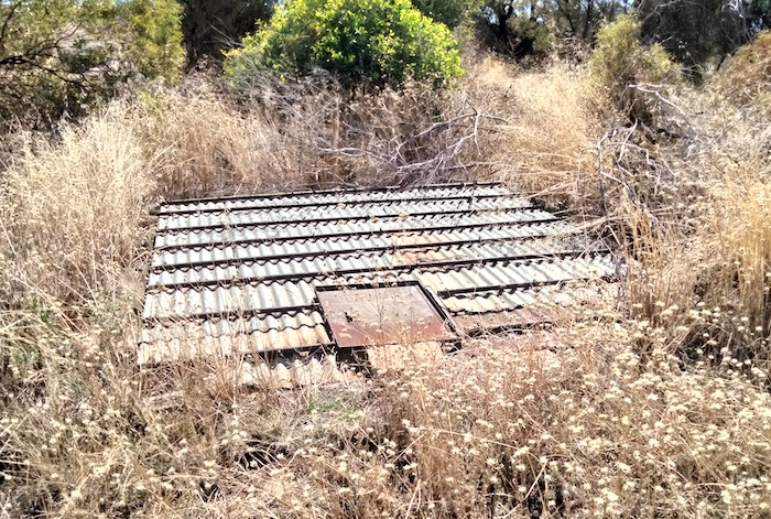
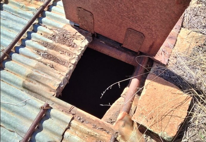
The well at Duladgin has been noticeably deteriorating over the years.
-

- The well at Duladgin is in poor condition as of 2023.
Yellowdine
Yellowdine is effectively the end of the accessible Gus Luck Track and the start of our homeward journey.
See three other Gus Luck Track trips.
© Kim Epton 2023-2025
1399 words, 98 photographs, 7 images.
Photographs
Kim Epton
Tassy Epton
Gary Arcus
Zeljko Zagorac
Feel free to use any part of this document but please do the right thing and give attribution to adventures.net.au. It will enhance the SEO of your website/blog and Adventures.
See Terms of Use.