The road to Cave Hill east off Victoria Rock Road is a big, wide, open, unmaintained dirt road that can be difficult to negotiate after rain. There are generally ‘chicken tracks’ around numerous, enormous bogholes.
Cave Hill was named by surveyor/explorer C.C. Hunt in 1864, obviously after its distinguishing feature. Hunt’s team used it as a depot on subsequent expeditions to the area in following years.
Hunt noted red ochre aboriginal hand prints when he named the hill. When he questioned local aborigines about them he was told the prints were made before they arrived in the area. Terra nullius?
Woodlines
Cave Hill was the main camp for woodline operators of the goldfields. From the time of the first gold rush in 1893 wood was in great demand on the goldfields. It was used as fuel for the steam driven winders that hauled ore to the surface, the generators that provided electricity, the pumps that brought essential water from Mundaring (and prior to that as fuel to heat contenders that ‘made’ water), and to support the hundreds of kilometres of shafts and stopes in the underground mines.
Before long the area within a 15 kilometre radius of the mines was cut out. From 1903 railways were utilised to bring in the wood. These were known as ‘woodlines’.
Cave Hill woodline was in operation until 1938. The area around Victoria Rock was cut out around 1921. At their peak, the timber companies employed 1500 men and supplied over 500,000 tonnes of firewood and mining timber each year. In the early 1950s the switch to coal-powered boilers and diesel-powered generators greatly reduced the demand for wood. New underground techniques of leaving rock columns to support the stopes also drastically reduced the demand for structural timber. Woodlines continued to the south and east of Kalgoorlie until 1965 when they ceased operation.
The Cave at Cave Hill
Cave Hill has a huge tafone. Kings Cave at Elachbutting Rock is another equally impressive exemplar of a tafone. Kata Tjuta and Uluru are two of the best known rocks with tafoni.
The cave/tafone at Cave Hill is supposedly unsafe and it is imminent danger of collapse. Imminent in human terms is just the Department of Parks and Wildlife (DPaW) covering their collective bureaucratic backside. Imminent in geological terms could be a few million years.
-
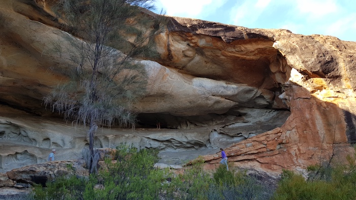
- The ‘cave’ at Cave Hill is a magnificent example of a tafone.
Numerous campsites on opposites sides of the outcrop give options that allow protection from wind.
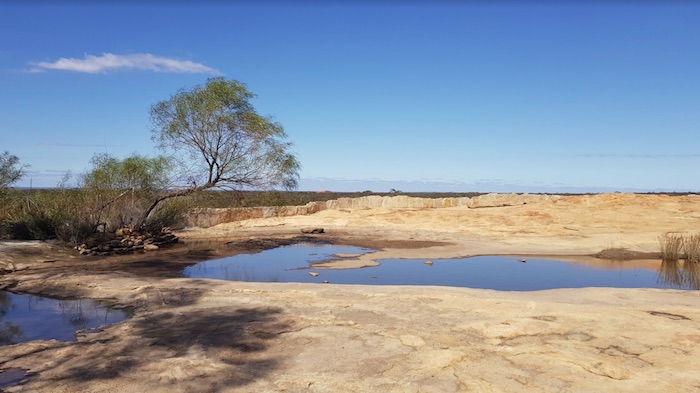
Cave Hill has three water supply reservoirs. These supplied water for the steam locomotives used on the extensive woodlines and, of course, for the workers’ camps.
-

- First dam at Cave Hill.
-
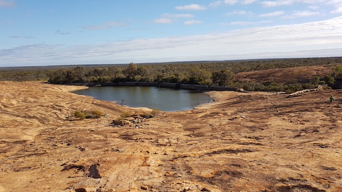
- The second dam at Cave Hill is quite full.
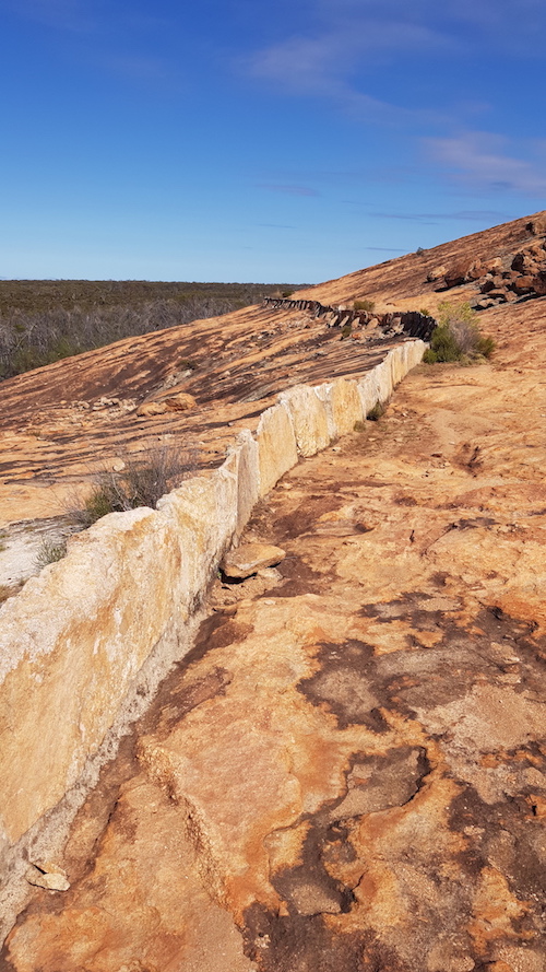
An extensive network of harvest walls were built to channel the runoff into various dams, as required.
Fences were built to keep animals out of the water supply.
-

- The fence at Cave Hill was to keep animals away from the water supply.
Quartz interstices are common in granite rock outcrops in south-west Australia. They are formed when disparate liquid rocks cool at different rates. This one was of interest because it is unusually wide.
-
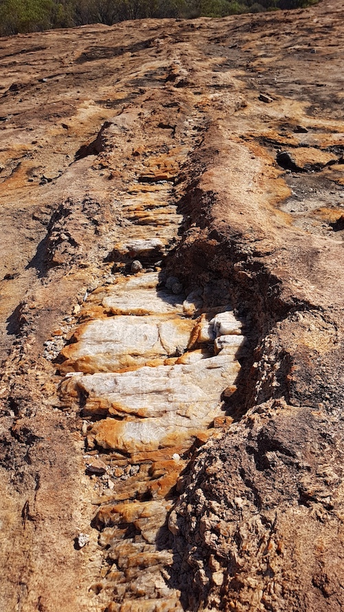
- Quarts interstice in the granite at Cave Hill.
The lonely, derelict fence posts are a sad reminder of times past.
-
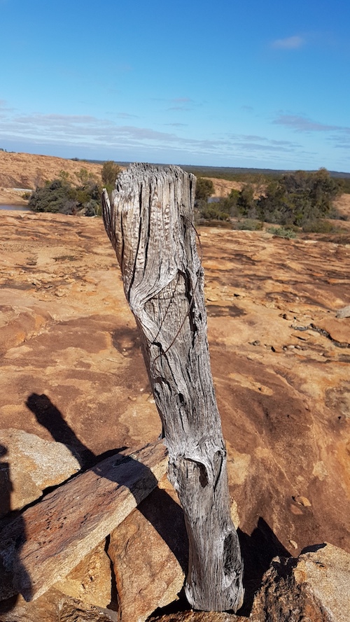
- Fence post, Cave Hill.
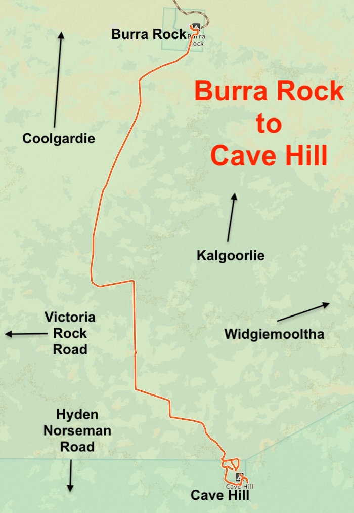
Burra Rock is 41 kilometres north of Cave Hill by road (30 km direct line). This track is a poorly engineered road with at least four bends that ‘tighten’ as one negotiates them (instead of ‘loosening’) and one ‘reverse-camber’ bend. A trap for the unwary. The surface of the road is, however, ok. [Time sensitive information].
-
- On top of Burra Rock.
-
- A harvest wall at Burra Rock.
-

- View from Burra Rock.
Surveyor N.M.. Brazier named this granite outcrop as Champion Rock in 1893. However, in 1899 the Department of Mines applied for Burra Rock Reserve to be declared around the rock, and it has been shown by that name on all subsequent plans.
Widgiemooltha is 38 kilometres to the north-east of Cave Hill and the track out can present challenges at any time of year.
© Kim Epton 2018-2026
714 words, 11 photographs, one image.
Feel free to use any part of this document but please do the right thing and give attribution to adventures.net.au. It will enhance the SEO of your website/blog and Adventures.
See Terms of Use.
