Our ‘get out of town’ campsite on Thursday night of the 2018 easter break was at North Hyden. The Caravan Park at Hyden was full – clearly lots of people were intending to travel the Holland Track.
Wood was in short supply at our campsite so we radioed Tim to collect some on his way.
-

- Tim, Mushy and Kim at campfire.
-
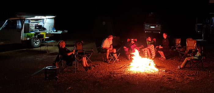
- Our ‘get to know you’ campsite, North Hyden.
Next morning it wasn’t far to Mulkas Cave.
-

- Penny, Lucy and Abbey inside Mulkas Cave.
-
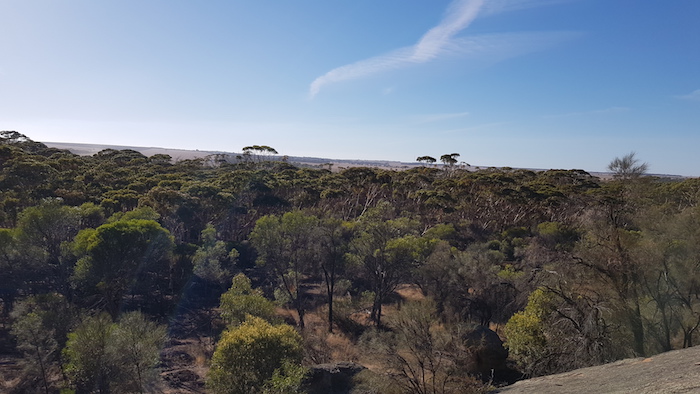
- The view from top of Mulkas Cave.
And then it was a short run down the bitumen to Hyden. Google Maps showed ‘heavy traffic’.
-

- At Hippos Yawn.
-
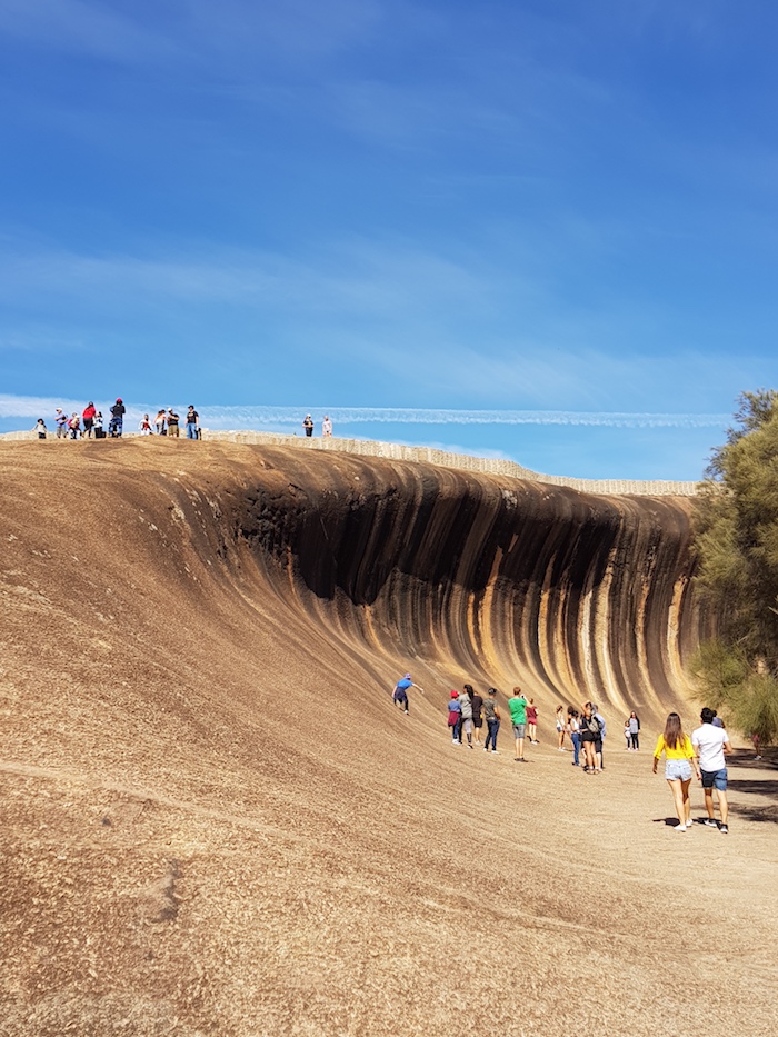
- At Wave Rock.
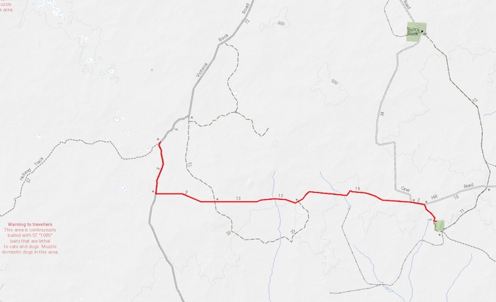
We chose to start the Holland Track from where it intersects the Lake King Road. From Dragon Rocks (from where it is termed ‘Holland Track’) to this point is a fairly uninteresting 2WD bush track.
-

- Our trek started at the Hyden-Lake King Road intersection.
There was a bit of a traffic jam at Lake Carmody so we chose not to stop. The lake was named by Holland in 1893 after John Carmody, a member of his party, who turned 21 years of age on the day they arrived at the lake. An enduring birthday present.
A short distance along the track is Emu Rock.
-

- Bicentennial plaque at Emu Rock.
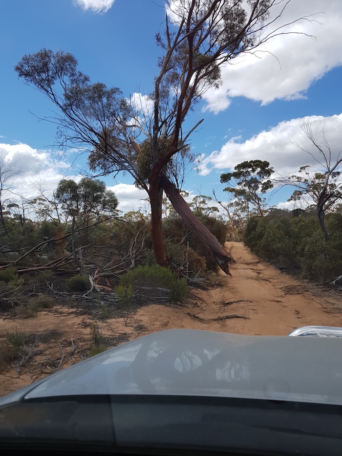
As we arrived four vehicles were making their way up the rock and around the scrub at the side of the track. We were soon to see why.
-
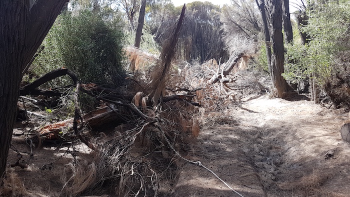
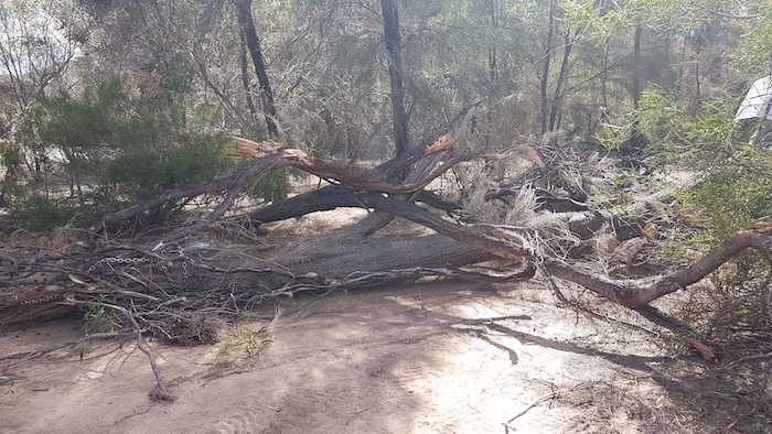
- The fallen tree totally blocked the Track.
A fallen tree had completely blocked the Track. I was insistent that we have a crack at removing it – which was easy for me to say because I wasn’t going to be doing anything physical.
-

- Tim was ready with his chain.
Tim had his chain out in seconds. It was the work of only a few minutes to attach it to Mushy’s winch.
-

- The removal started.
After the initial pull a quick repositioning of the chain ensured that the tree was removed with ease.
-
- Dragging the tree off the Track.
-

- Dragging the tree away from the Track.
-
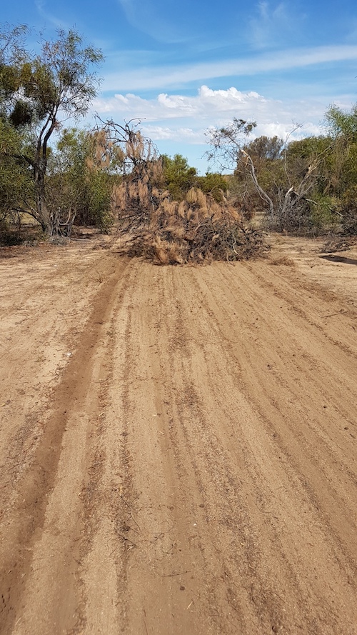
- Parked out of the way. Our good deed for the 4WD community today is completed.
The Holland Track was now obstacle free!
Only a few hundred metres from Emu Rocks is the Vermin Proof Fence. Previously known as the Rabbit Proof Fence, it was part of Western Australia’s desperate attempt to stop rabbits from invading the state. Eventually biological control methods (myxomatosis 1950s, calicivirus 1980s) were used to control rabbit populations. For much of its southern length, the No 1 Fence delineates the sharp boundary between the Great Western Woodlands and the Wheatbelt.
Today the fence is maintained by the State Government against the impact of wild dogs on pastoral and agricultural properties.
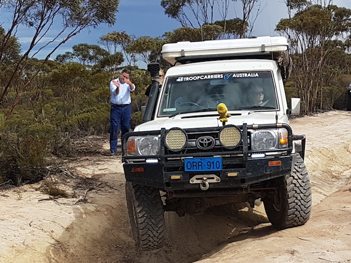
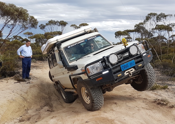
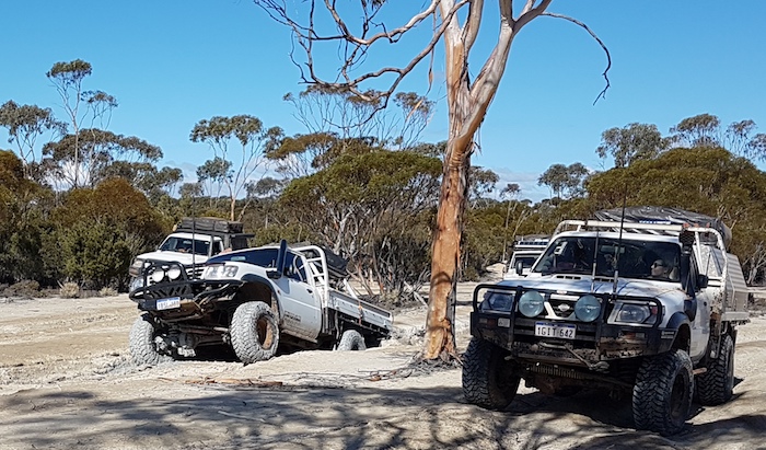
Easter is clearly the busiest time to ‘do’ the Track. There were a number of traffic jams/slower vehicles. The first serious show stopper was at a gutter where vehicles were getting hung up. The chicken track was the route of choice for most but Mushy, Aeron and Aaron decided to ‘give it a go’.
-

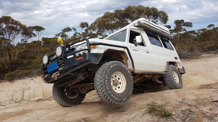
- Mushy attempting to take his Troopy across a ditch.
-
- Just not long enough.
-

- Across the ditch.
-
- Not enough wheels on the ground.
-
- Worried about the weight on the roof.
Aeron’s turn.
-
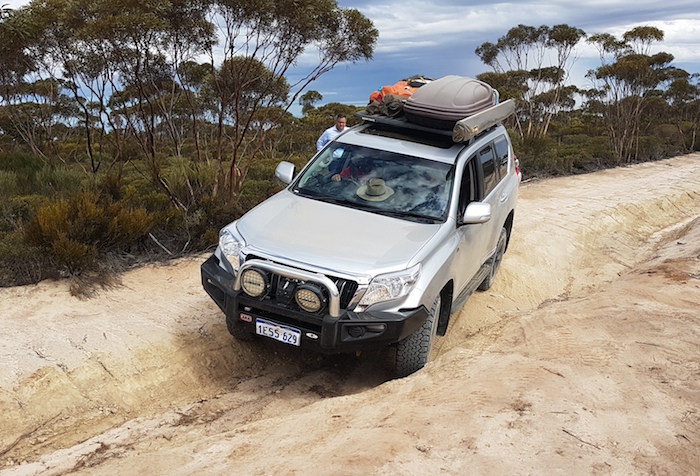
- Prado crossing ditch.
Plenty more excitement to come.
-
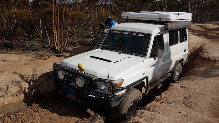
- Troopy in deep gutter.
-

- Troopy in deep gutter ready to be retrieved by Patrol.
The Track had ruts, gutters and holes for the rest of the day. A great drive. As the afternoon wore on we were not sure if we had sufficient time to reach Mount Holland. When we did arrive we decided it was too exposed, too denuded of wood, too busy, and was going to get busier.
I knew of a a potentially good campsite 30 minutes or so further on so we kept moving.
The campsite I wanted was occupied so we continued on. A few minutes later I saw a break in the trees to the west and found a great campsite.
Storms with lightning, thunder and rain struck with vengeance just after dark. Everyone knew it was coming and we were well prepared. The guys were bemused when I got out the soap and had a shower. The wind chill factor made it slightly uncomfortable.
-

- At camp before the storm hit.
-

- A good campfire on the first night on the Holland Track resisted the blitzkrieg storm that hit us twice.
We were concerned about the condition of the Track after so much rain but it had penetrated only about 20mm.
-
- Suspended tree near Sandalwood Rocks.
-

- Thorny Devil (Moloch horridus).
-

- Near the Banker-Mt Day Road.
-

- Lineup of vehicles at Krakouer Rocks.
-
- Powering out of a bog hole.
We didn’t take the option to Thursday Rock but instead took the easily-driveable part of the Track to its end at Victoria Rock Road and headed for Cave Hill.
At this time Mushy was driving an unfamiliar vehicle (my Patrol) behind his Troopy being driven by Nicole (her first time driving such a large vehicle). He said he wasn’t nervous. Or even uncomfortable. Or concerned. As a matter of fact he said he was quite relaxed.
-
- CAVE HILL ROAD
The Cave Hill Road is a big, wide, open, reasonably well-maintained, dirt road although it can be difficult to negotiate after rain. After a false start on arrival at Cave Hill we found a great campsite, although not very sheltered from the howling wind.
-
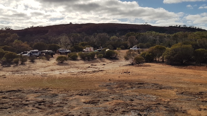
- Our campsite at Cave Hill.
-

- Kim’s Patrol at Cave Hill.
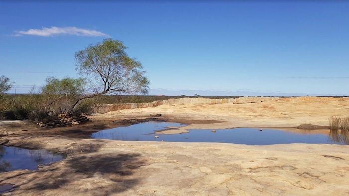
The threatening weather had blown over by morning and we set off to climb the rock, see the ‘cave’ and find the three water supply reservoirs.
-
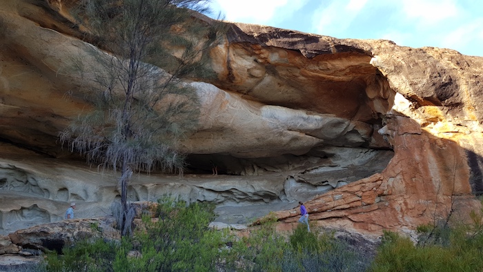
- The ‘cave’ at Cave Hill is a magnificent example of a tafone.
Cave Hill has a huge tafone. Kings Cave at Elachbutting Rock is another equally impressive exemplar of a tafone. Kata Tjuta and Uluru are two of the best known rocks with tafoni.
The cave/tafone at Cave Hill is supposedly unsafe and it is imminent danger of collapse. Imminent in manmade terms is just the Department of Parks and Wildlife (DPaW) covering their collective bureaucratic backside. Imminent in geological terms could be a few million years.
Time to find the three dams.
-

- First dam at Cave Hill.
-
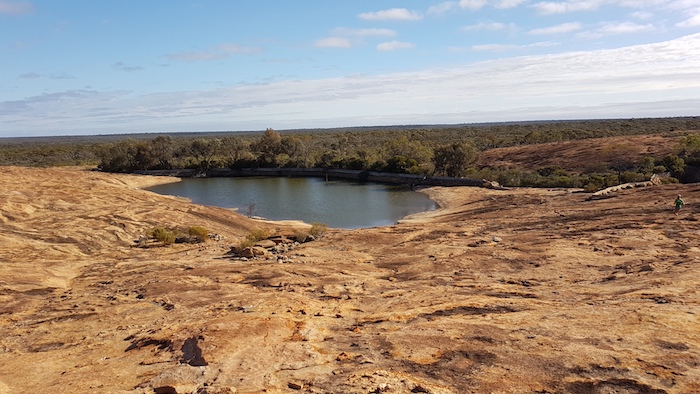
- The second dam at Cave Hill is quite full.
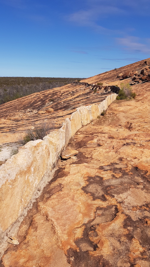
An extensive network of harvest walls were built to channel the runoff into various dams, as required.
Fences were built to keep animals out of the water supply.
-

- The fence at Cave Hill was to keep animals away from the water supply.
On my way down the rock I found a quartz interstice, common in granite rock outcrops in south-west Australia. They are formed when disparate liquid rocks cool at different rates. This one was of interest because of its unusual width.
-
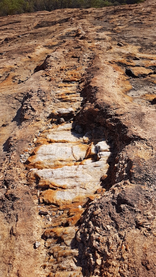
- Quarts interstice in the granite at Cave Hill.
The lonely, derelict fenceposts are a sad reminder of times past.
-
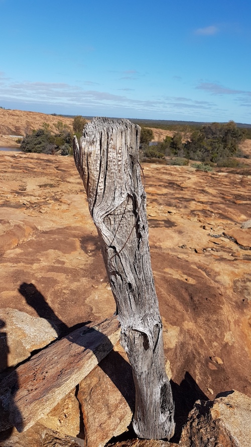
- Fence post, Cave Hill.
Leaving Cave Hill we took the track north to Burra Rock. This track is a poorly engineered road with at least four bends that ‘tighten’ as one negotiates them (instead of ‘loosening’) and one ‘reverse-camber’ bend. A trap for the unwary. The surface of the road is, however, ok.
-
- On top of Burra Rock.
-
- A harvest wall at Burra Rock.
-

- View from Burra Rock.
After a counter lunch in Coolgardie we visited the Pioneer Cemetery where R.J. Holland’s grave is located.
-

- Pioneer Cemetery Coolgardie
Onward to our overnight camp which as a result of some arrogant, short-sighted capriciousness had to be be changed from Koorarawalyee to Karalee.
-
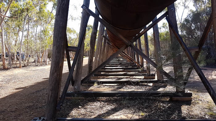
- Massive jarrah supports for the Karalee viaduct.
-

- The remarkable flume/viaduct at Karalee is used to carry the diverted water from the Rock to the reservoir.
-

- Flume supports at Karalee
On arrival at Karalee I located a couple of great campsites but Santokh suggested that, as there was still plenty of daylight, we should keep going to the Mount Palmer goldfields. And so it was.
We took the dirt track from Karalee to Yellowdine, stopping at Morlining Well along the way.
-
- Morlining Well
Across Great Eastern Highway and south to the abandoned Mount Palmer goldfields.
-

- Our campsite at Palmers Find.
There are any number of great campsites in the open woodland around the old townsite of Mount Palmer.
-

- The archway is the only remaining standing part of the derelict hotel at Palmers Find.
-

- Fantastic information board recording the details of the Mount Palmer Hotel. More information like this is needed at all our heritage sites.
Rather than return on our inward path to the Great Eastern Highway we determined to travel to Marvel Loch – a place none of us had previously visited.
-
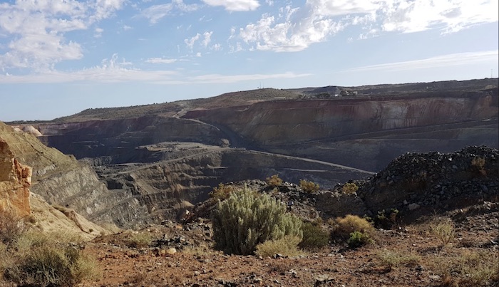
- Marvel Loch Superpit
The open cut mine at Marvel Loch was sold by Hanking Australia (a Chinese backed company) to a company owned by the chairman of Minjar Gold (another Chinese-backed company) for $330 million in February 2017. It produces 130,000 oz of gold annually which is a turnover of about $225,000,000 at the time of writing.
Our return route to Perth was via Goldfields Road – more interesting than the Great Eastern Highway.
-
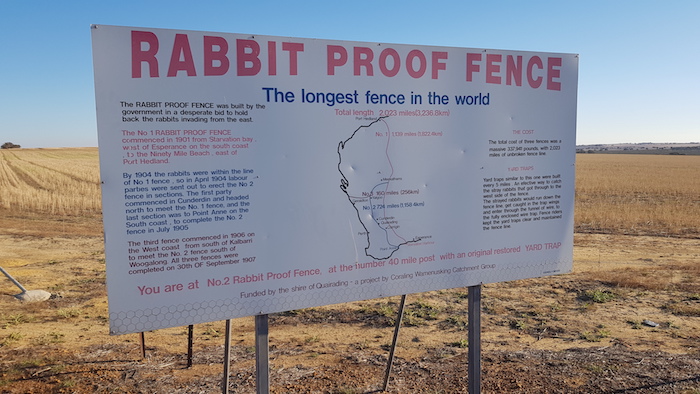
- The longest fence in the world.
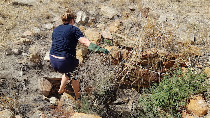
Not far up the road we stopped at Burracoppin Well and Nicole was quick to jump in and start removing weeds.
-
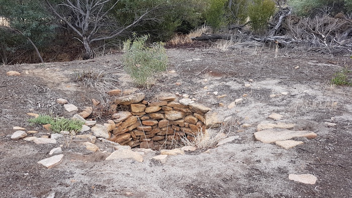
- Burracoppin Well April 2018
-

- Nicole removing weeds at Burracoppin Well.
We then turned south to see the Collgar Windfarm. With 111 turbines it is the largest single stage wind farm in the Southern Hemisphere.
-

- Collgar Windfarm
Lunch was at the popular bakery at Merredin.
The Goldfields Road took us to Doodlakine Well where once again Nicole was quick to jump in a clear out the well.
-
- Nicole clearing Doodlakine Well.
Next stop was Happy Dolphin Rock – also described as Shark Mouth Rock. More like Moray Eel Rock or Goanna Rock! How does one get ‘shark mouth’ from that?
-

- At Shark Mouth Rock, Kellerberrin. More like a dolphin.
From York I had planned a route through the bush to Karagullen and Brookton Highway. Shorter and simpler, I thought.
Once into the forest it was slow, technical and difficult. Eventually we came out onto Dale Road. Ball bearing gravel, loved by rally drivers, is the bane of 4WDrivers.
-

- Driving into a setting sun through dust on a ball bearing gravel road on a bend and the result is not good.
-

- Landrover Discovery vs rock.
We extricated Tim’s vehicle, got it functional and headed home.
© Kim Epton 2018-2025
1778 words, 59 photographs.
Photos by Kim Epton, Michael Orr, Veronica Rowe.
Feel free to use any part of this document but please do the right thing and give attribution to adventures.net.au. It will enhance the SEO of your website/blog and Adventures.
See Terms of Use.
