While we were not even close to being the first to explore this result of a cosmic interaction – the existence of Shoemaker as an impact crater was determined in 1974 – we were the first to determine its exact centre, on the ground.
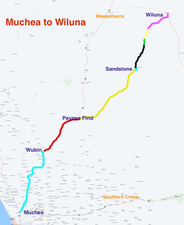
Shoemaker Crater is 105 kilometres north-east of Wiluna. We travelled via Wubin, Paynes Find, Youanmi, Sandstone and Montague.
And why do those in the know call it the ‘Man in the Moon’ Crater? Read on to find the answer.
Muchea to Wubin
Our Road Trip started on Friday 19 August 2022 at the BP Muchea Roadhouse.
- ROUTE FROM MUCHEA TO WILUNA
- The Road Trip started at Muchea.
The Northlink Project rerouted the Great Northern Highway around New Norcia, however, in the process, a lookout was created. The great views over New Norcia with its Benedictine Abbey in the distance was a great photo opportunity.
The country was green and lush after the plentiful winter rains. Sweeping paddocks of bright yellow canola were opposed by fields of green wheat, framed by rows of tall trees.
Further north we took the Miling North Road past Tim’s childhood farm and were then treated to his detailed description of the countryside and farm operations back in the 60s/70s.
Just short of Wubin, Des and Kay made an ominous radio call that they had to pull over. Scott stayed with them and the convoy continued to the Wubin Wheatbin Museum – an attraction that we had been trying to visit for nearly two years. Covid!
News came through from Scott that the situation did not look good. The gear lever in the Ford Ranger went from Park to Drive and back again with no effect of the vehicle. A known Ford Ranger gearbox problem, even acknowledged by Ford.
Scott continued to Wubin and, with Andrew, arranged recovery of the hapless vehicle and a very disappointed Kay and Des. They stayed the night at Dalwallinu and their vehicle was recovered to Perth.
- Tayla in an old Ford.
- Wubin Museum
- Wubin Museum
After refuelling, our convoy continued to the overnight stop at Wubin Rocks, seven kilometres east of the town. We found a good campsite with a reasonable availability of firewood. For such a large area there are precious few campsites with enough area for groups. It was a cold night with a heavy dew.
Wubin to Montague
The first morning of a 10 day Road Trip is all about getting into gear, working out procedures, and being ready to leave by 8.00 a.m.
- Early morning at Wubin Rocks campsite.
It was a 152 kilometre run up the Great Northern Highway to Paynes Find, an early gold mining area that is still producing.
- Wide loads were common on. the highway.
- The battery at Paynes Find is still capable of operating.
- Leaving Paynes Find battery.
Past Paynes Find the cemetery at the abandoned, historic townsite of Youanmi is worth a visit. The number of burial sites related to mining accidents gives pause for thought:
“BANTOW Thomas Henry, 53yrs, d 24 Feb 1920, at the Youanmi GM, Youanmi, Occ: Miner, Cause: While cleaning under the cracker conveyor belt, he was caught by a bucket and dragged under the pulley, Born: Sebastopol Victoria in 1867, …”
- Youanmi Cemetery
The Heritage Loop at Sandstone is a quality tourist attraction. Compact, interesting, different. An Aldi advert? First up was a clever, innovative, goldfields brewery that is the epitome of the ’necessity is the mother of invention’ adage. Basic physics was used to cool the beverages.
- Historic brewery at Sandstone.
- Enttrance to the historic brewery.
- This shaft convected air from underground to the surface.
Only a short distance further along the Loop is an Outback Icon – London Bridge. This geological oddity has been a popular picnic spot for locals and tourists alike for well over a century.
- London Bridge at Sandstone.
Next up is the State Battery – a well preserved piece of our State’s heritage and one that has an important tale to tell of the pioneering gold getting era.
- Manager’s house at Sandstone Battery.
- Scott at old workings near the Sandstone Battery.
The Heritage Loop turns back towards Sandstone via the Menzies Road past Contradiction Well, a vitally important construction that provided water for survival in a desert environment.
- Contradiction Well, south of Sandstone.
Fuel is available at Sandstone. Card operated, 24/7/365. But not intuitive.
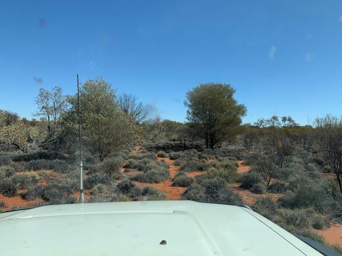
The expedition was now in pastoral country. Along the shoulder of the red dirt road wildflowers softened the harshness of the land.
The seemingly endless winter rain that was the signature of 2022 in Perth is finally a thing of the past as the convoy moved into station country.
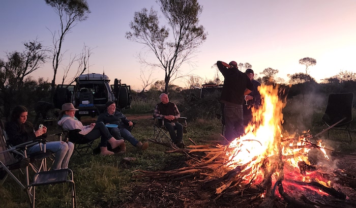
We camped a few kilometres north-west of Montague Well and Mine.
- Campfire at Montague
- Jeff and Scott at Montague camp.
Montague to Wiluna
On our way north we stopped at an old Government Well. There is water in the well still, confirmed by the small stone dropped by Micaela. I wonder by how much the depth of wells such as this have been raised over the years by the thousands of stones thrown in by tourists.
- Tayla at the old government well 25 kilometres north of our camp.
The skinny-gutted track eventually took us past the Joyner Find Mine and then onto the Goldfields Highway. It was then only 12 kilometres into Wiluna, a service town for travellers attempting the Canning Stock Route or the Gunbarrel Highway, and surrounding mines and pastoral stations.
- Centre of Wiluna.
- Steel sculptures at Wiluna.
Fortunate happenstance meant that we witnessed a camel train come through town, nearing the end of an epic fundraising journey.
- Camel train in the main street of Wiluna.
- Wonder if they get reduced rego.
- Camels at the Police Station.
- ROUTE FROM WILUNA TO SHOEMAKER CRATER
Wiluna to Gold Mining Lease
We were to meet with Scott Wilson, well known Kalgoorlie gold prospector and Eastern Goldfields Historical Society immediate past president. With Scotty will be licensed surveyor Steve Leipold, Principal of Lone Star Surveys, a mining survey company based in Kalgoorlie. Apart from enjoying a few days out in the bush with our group, Steve will be the authority for determining the centre of Shoemaker Crater.
Despite prior planning and preparation by Scott Overstone many weeks before our arrival at Jundee Mine (on what was once Jundee Pastoral Station 50 kilometres north-east of Wiluna) it seems that the operators of the mine are totally unaware of who we are and what our intentions are (simple transit through the station). Coupled with our unfortunate timing of arriving at lunchtime we experienced a considerable delay. Once ‘someone’ was aware of our presence we proceeded to the Admin Centre where once again we were totally ignored. Transiting visitors is way down on the list of priorities when there is gold to be dug up. After establishing face to face contact with humans it seems that they were concerned our vehicle(s) could catch fire while traversing tracks on their station and they would then be responsible for our retrieval. Aah, from such fanciful imaginings worksafe empires are built!
- Passing through Jundee Operations.
While we were waiting at the mine one of the geos brought a few samples of gold.
- That’s quite a few dollars worth of gold Scott is holding.
Once through the mine we met with Scotty and Steve at the Jundee Station Homestead. The delay at the mine allowed Scotty and Steve to check out the tracks I had planned to traverse between the Station Homestead and Scotty’s lease 30 kilometres to the north and in this respect the delay at the mine was perversely fortunate. While passable, Scotty pronounced the intended tracks as difficult and potentially damaging to vehicles. He had devised a new, much easier route for us.
- Scotty and Steve were able to find an alternative to this ‘track’ around Bejink Bore.
We arrived at Scotty’s temporary camp at the area known as Coralie Jean, where he was going to mark out a Mining Lease. It was time to meet Maria, Louise and Donna.
Not many people ever get to mark out a Mining Lease – way less than would ever mark out an Exploration Lease which, in turn, would be way less than those who casually pick up a metal detector for a two week sojourn in the goldfields seeking their fortune. It is such experiences that we try to incorporate into our Trips. Banal for some but a unique happening for virtually everyone involved.
- Under a magnificent Gidgee tree Scotty took the group through the procedure of how to stake a claim of land for mining.
There is more to prospecting than buying a metal detector and searching anywhere on the red earth of outback Australia for the glint of gold – or a rusty nail. The search for gold and other precious metals is highly regulated.
Scotty had determined that his Exploration Lease was worthy of conversion to a Mining Lease and in casual conversation some weeks before the Road Trip we decided that the marking of the Lease would be a unique activity in which the group could participate.
Such an important undertaking needs the attendance of a surveyor. Scotty has engaged Steve Liepold of Lone Star Surveys to confirm his Mining Lease boundaries (apart from the commercial arrangements with Scotty, Steve, Louise and Donna were a part of the Road Trip) and we were fortunate enough to be part of that process.
- Scotty demonstrates the finer points of marking out a lease to Tracey and Andrew.
- Scotty and Rob on a corner of his Mining Lease.
We joined the process to formalise the pegging of Scotty’s latest claim, splitting into two groups, spades and GPS in hand. Pegs were hammered in, trenches dug and a new Mining Lease was created!
Gold Mining Lease to Shoemaker Crater
Task completed, we headed north along a creek bed to the Christopher Dean track. We intended to stop as soon as we found an acceptable campsite. A couple of ks along the track Scotty pointed out some interesting rock formations to the north. We deviated off the track to investigate.
- Balancing rock at Christopher Dean.
- Unnamed rock formation.
- Steve, Louise and Donna enjoying the view.
Our planned track towards Shoemaker Crater was unknowingly missed and after a kilometre or so of travel in the wrong direction we stopped and camped for the night. There would be plenty of time in the morning to pick up the correct route.
- The Christopher Dean campsite.
Today we would reach the Centre of Shoemaker Crater.
- Steve delivers the daily briefing.
The Shoemake Crater, with an outer rim diameter of 30 kilometres, is one of the largest impact craters in Western Australia. It is a large bowl-shaped flat structure, arid and contains a few salt lakes. The inner rim is more easily discerned as a crater.
After a bit of challenging navigation and some cross country travel we arrived at what we believed to be the centre of the crater.
- The centre of the crater was on the other side of this sand dune.
- Rob and Steve get some elevation inside Shoemaker Crater.
Surveyor Steve got to work and showed that our ‘carpark’ was only about 50 metres from the exact centre of the Crater. This data was derived from a geolocation package, after Hawke 2003.
With a few minutes work Steve determined the location of the centre of the crater. This significant point was duly marked with that quintessential Australian indicator – a star picket.
- Steve determines the centre point of the crater
- Steve explained some techinical details on how he derived the centre of the crater.
- Scotty marked the star picket”We Were Here”.
- Micaela nd Kim.
- Scotty, Steve and Kim
- At the Centre of the Shoemaker Crater.
- At the centre of Shoemaker Crater.
- At the centre of Shoemaker Crater.
And why is it known as the ‘Man in the Moon’ Crater?
The crater was named after Eugene Shoemaker (1928-1997) a renowned US planetary geologist who was killed in a vehicle crash on the Tanami Track in the Northern Territory. His ashes were on the Lunar Prospector when it was deliberately crashed into Mawson Crater near the South Pole of the moon in July 1999. The International Astronomical Union then renamed the crater as Shoemaker Crater.
We moved on to Granite Peak Station and Glen-Ayle Station to Journey to the Centre of Western Australia.
© 2022-2024 Kim Epton
2124 words, 51 photographs, three images.
Photographs
Micaela Anderson
Kim Epton
James Hay
Tayla Skewes
Feel free to use any part of this document but please do the right thing and give attribution to adventures.net.au. It will enhance the SEO of your website/blog and Adventures.
See Terms of Use.


