
This trip to the Fitzgerald River National Park was designed as a recce for our annual Australia Day Road Trip where we regularly have 10-13 vehicles and somewhere between 18 and 25 people.
It was indeed fortunate that we made this recce because the plan to take 10 vehicles and 18 people to the Fitzgerald River National Park would not have worked!! The layout of the camping areas is not suitable for groups (even small ones), access to (limited) attractions is tedious, and the appeal of Park is more towards walkers and flora enthusiasts. Dieback has caused the closure of numerous tracks, limiting the opportunities for four wheel drivers.
The Parks and Wildlife Service are remiss in not advising potential visitors to the Park of the very real limitations. Big thumbs down.
We made the most of what was on offer and devised an alternative plan for our 2018 Australia Day sojourn.
Pumphreys Bridge
Pumphreys Bridge 155 kilometres south-east of Perth near Wandering was our ‘get out of town’ destination on the way to the Stirling Ranges.
This is a fine campsite on the banks of the Hotham River, with plenty of room and flat, grassed ground, free of ants and pests. The adjoining recreation oval would accommodate hundreds of campers if the need arose.
-

- Entry to Pumphreys Bridge.
-
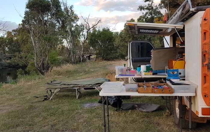
- Pumphreys Bridge camp.
-
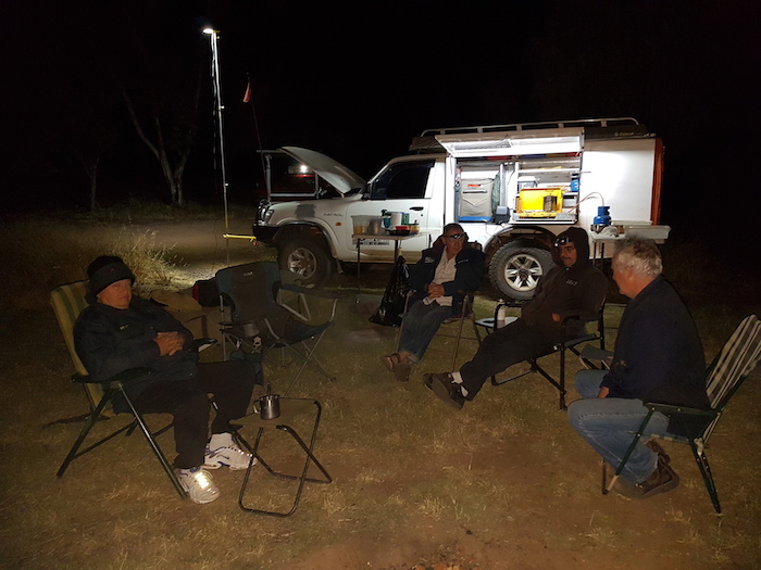
- Socialising at Pumphreys Bridge.
-

- Moon at Pumphreys Bridge.
The ‘Bridge’ in the name refers to a now-derelict wooden bridge across the Hotham River. Across the river from where we camped is the historical homestead settled by John and Isabella Pumphrey in 1888.
On the Banks of the Hotham River
Waking up on the banks of a river is always very pleasant. The first day of December 2017.
-
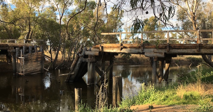
- Derelict bridge at Pumphreys Bridge camp area.
-

- The old bridge no longer spans the river.
-

- The replacement bridge over the Hotham River.
-
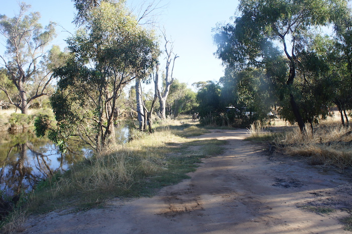
- Pumphreys Bridge camp area on the Hotham River.
-

- Rarely seen maypole swing at Pumphreys Bridge.
Wickepin
Scott, Adi, Phil, Dan and I met Kerry at Cuballing and continued on to Wickepin. This small Wheatbelt town is notable, among other things, for the restored house where renowned author Albert Facey lived until the Depression.
-
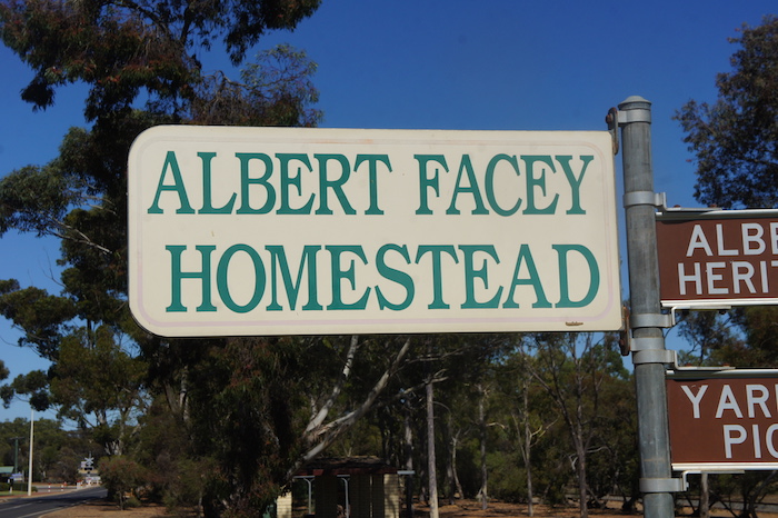
- Albert Facey Homestead sign.
-

- Albert Facey Homestead
-
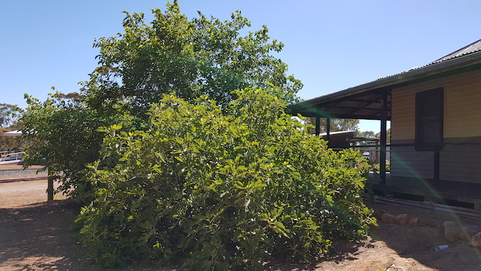
- We had a delicious feed of mulberries from these trees with a full crop of fruit at Albert Facey Homestead in Wickepin.
Albert Facey wrote A Fortunate Life, an autobiography chronicling his early life in Western Australia, his experiences during the Gallipoli campaign of World War I and his return to civilian life after the war. It also documents his extraordinary life of hardship, loss, friendship and love.
It has become a classic piece of Australian literature and is one of Australia’s most beloved books. It has sold over 800,000 copies and has become a primary account of the Australian experience during World War I. It is required reading for young adults in many Australian schools.
-

- Interesting artwork at the Wickepin Park.
-

- Wickepin Bird Park
Lake Toolibin
South of Wickepin is Lake Toolibin, one of the last remaining inland freshwater lakes in the south-west of Australia. But more than that, it is wonderful exemplar of how the issue of salinity can be tackled. The lake is internationally classified as a wetland of international importance. It is home to many kinds of plants and animals including waterbirds – an impressive 41 species have been recorded there.
-

- Unseasonal inflows made the lake look very healthy.
Toolibin is one of only half a dozen wetlands of its type remaining. This type of wetland used to be common throughout the Wheatbelt but most have now become saline. Fauna monitoring, revegetation, fencing, weed control and water monitoring are all part of the strategy that assisted in the recovery of Lake Toolibin.
-

- Lake Toolibin is looking beautiful now.
Fortunately for us, unseasonal inflows presented the lake in a magnificent state at a time when it would normally be dry or very nearly so.
We continued along the dirt roads around farms, through Tincurrin, more dirt roads and into the small wheatbelt town of Dumbleyung.
-
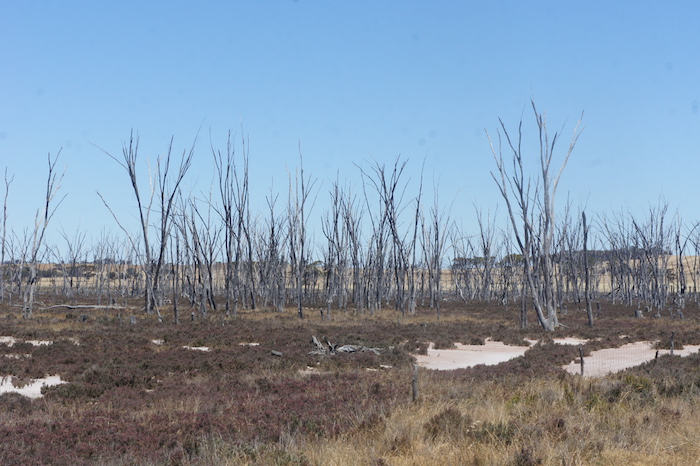
- Dead trees on salt pan.
Dumbleyung
-

- A different style of directional signage.
So many towns in regional Western Australia ‘hang their hat’ on some thing or some event. In Dumbleyung’s case it is Donald Campbell’s world water speed record set on Lake Dumbleyung in 1964 in a boat named Bluebird. Most people alive today would not be aware of the event but I certainly recall it as a massive event that brought worldwide attention to this tiny Wheatbelt town. Learn more about Dumbleyung’s time on the world stage.
-
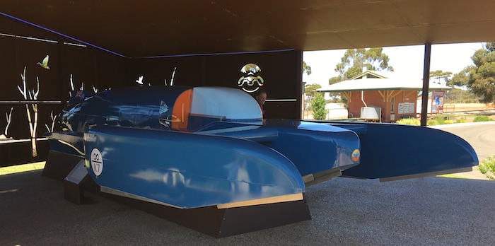
- Bluebird replica at Dumbleyung.
Fortunately for us, Lake Dumbleyung was full for the first time in many years. It overflowed in February of this year – the only other times in the past 100 years that water has flowed out of the lake have been in 1983, 1964 and 1955. When full the lake is 13 km long and more than two metres deep.
-
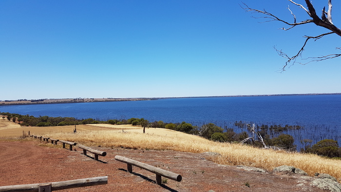
- Dumbleyung Lake is impressive.
-
- Lunch at the Lake.
We had lunch on the boat ramp watching the wind whipped waves and listening to the local birds.
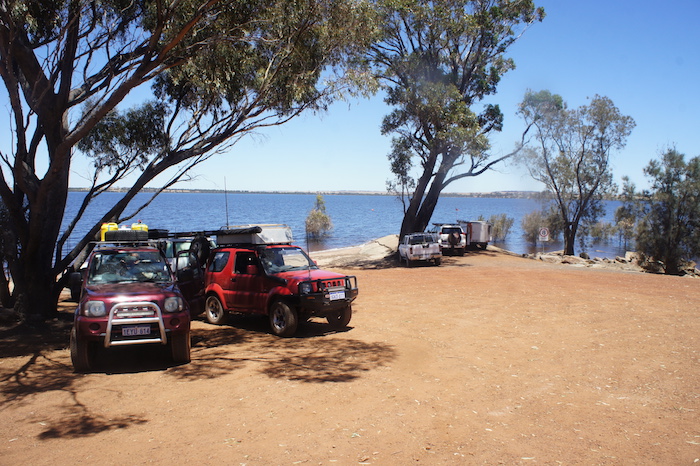
South of Dumbleyung and 20 kilometres east of Katanning is Lake Ewlyamartup. In 2010 Lake Ewlyamartup was a hyper-saline, yellow, smelly lake. Volunteers from the Katanning district transformed this 100 Ha, abandoned body of water into a great community resource.
-
- Lake Ewlyamartup
More than 150,000 trees were planted, 40 kilometres of fencing erected and 20,000m3 of nutrient rich black sludge removed to turn the lake into a popular picnic spot that is now used regularly for kayaking, swimming and water skiing.
-

- Road to Lake Ewlyamartup.
Stirling Range National Park
We continued to wind our way south through the back roads of the Wheatbelt and Great Southern region, past Gnowangerup and eventually arrived at the western entrance of the Stirling Range National Park.
-

- Western entrance to Stirling Range National Park.
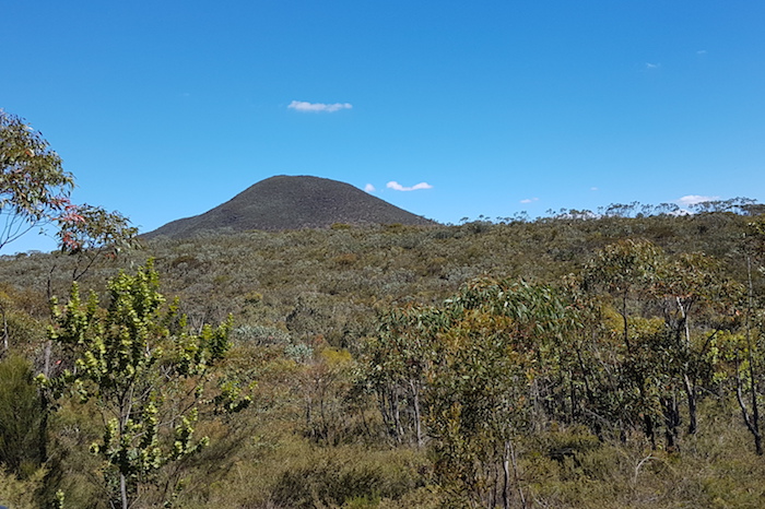
Species-rich Stirling Range National Park encompasses the only major mountain range in the southern half of Western Australia. It is recognised internationally for biodiversity and in 2006 was added to the National Heritage List, in recognition of this outstanding biodiversity.
-

- Heading into Stirling Range National Park along the very beautiful Stirling Range Drive.
-

- The three peaks are, from left, Mt Magog Talyuberup Peak and Mount Gog.
Dieback, the plant pathogen Phytophthora cinnamomi, is devastating the forests of this National Park, as it is doing to many forests throughout the south-west of Australia. This scourge was to impact our trip on future days.
-

- Stirling Drive, western side of National Park.
-
- High vegetation obscured many peaks.
-

- Along Stirling Range Drive.
Stirling Range Drive weaves its way 40 kilometres west-east through the centre of the Park, along the way providing great views of many of the rugged peaks. The drive terminates at Chester Pass Road, an important arterial road deceptively busy with local traffic, tourists, and road trains hauling wheat to the port at Albany – a task that has been pretty much non stop for the past two years as a result of record harvests.
It was a cool evening at Stirling Range Retreat. There was a total fire ban.
-

- Enjoying Banana Flambe prepared by Phil.
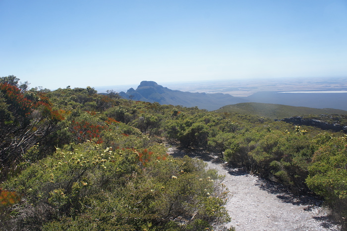
Bluff Knoll
With my recovery from a knee replacement being incomplete and Adi’s ankle condition still unresolved we were never going to climb Bluff Knoll. However, once we had driven to the Bluff Knoll carpark Scott, Dan, Phil and Kerry started the climb of this famous peak – the highest mountain in WA outside of the Pilbara (in actuality, outside of a group of mountains around Tom Price).
-

- Bluff Knoll as seen on the road in.
-

- Important information
-

- You would need to run to complete the walk in less time.
-

- Our vehicles in the Bluff Knoll carpark.
-

- Bluff Knoll as seen from start of walk.
-

- Looking at the peak from a few hundred metres into the start of the walk.
-

- In case you don’t know where you are.
-
- Pathway to the top.
-

- View of farmland.
-

- View of farmland.
-

- From summit.
-
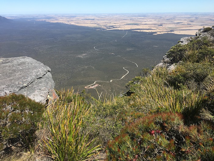
- Carpark as seen from the summit.
-

- Dan and Scott at the summit.
-

- Phil at the summit
-

- Rocks at the top.
-

- Rocks at the top.
-
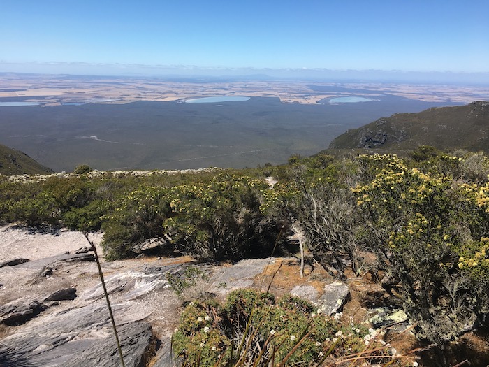
- View from the top of Bluff Knoll.
-
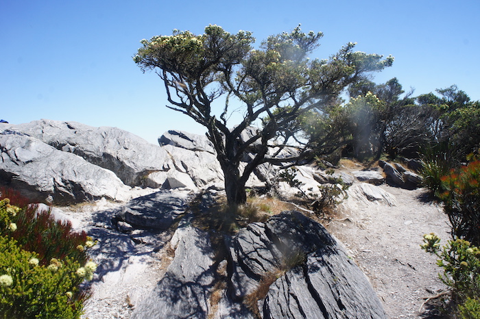
- Gnarly tree on the top of Bluff Knoll.
Adi and I refuelled and then made our way back to the carpark to wait for the walkers’ return. It was close to midday before they all returned and we left the carpark to start the drive to Bremer Bay and Gordon Inlet.
© Kim Epton 2017-2024
1286 words, 48 photographs.
Feel free to use any part of this document but please do the right thing and give attribution to adventures.net.au. It will enhance the SEO of your website/blog and Adventures.
See Terms of Use.