Silent Grove
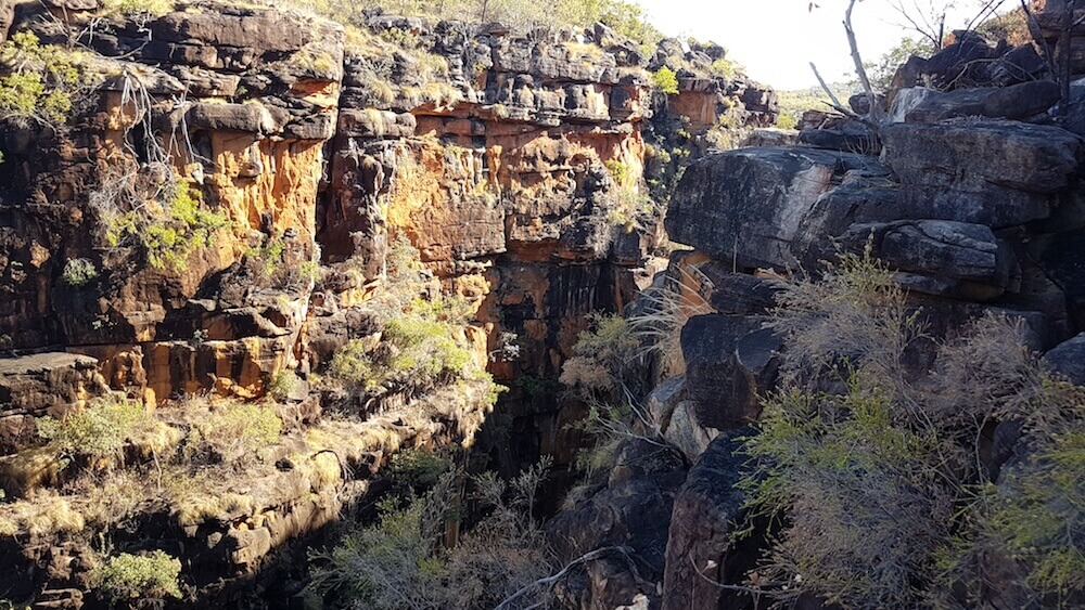
Windjana Gorge is formed by the Lennard River carving its way through the Napier Range – part of the ancient Devonian Reef.
Access to this wondrous example of nature’s work is easy and only a few metres from the campground – unlike most of DPaW’s campgrounds and carparks that are generally located a kilometre or more from the actual attraction. Sure, distant parking encourages everyone to ‘commune with nature’ and get a healthy dose of exercise in the great outdoors – but it can be a struggle and a challenge for the disabled, partly disabled or temporarily disabled.
- The Lennard River has carved its way though the Napier Range to form Windjana Gorge.
By 10.00 a.m. it was time to leave Windjana and re-acquaint ourselves with the Gibb corrugations. The section from Windjana to the Silent Grove turnoff did not disappoint.
- Sandy drives her Explorer through the Lennard River.
- Nick and Carrie in their Jeep Wrangler through the Lennard River.
- Jeff and Micaela in their Prado.
- Mike and Sue in their Nissan Patrol exit the river.
It was very hot at Lennard Gorge and, as a result of recent fires, there was no shade while having lunch.
The track into Silent Grove contrasts markedly with the Gibb. This track is maintained by DPaW – a State government agency that seems to have more funding for road maintenance than Main Roads WA – the agency responsible for maintenance of the Gibb River Road.
Baofeng UHF Radios
Arriving mid-afternoon allowed time to chill and sort out the frequencies on the handheld UHF radios.
We have been using Baofeng UV5R 5 watt radios for some time now (daily basis) and they are excellent value at $40. Some people may scoff at them as being ‘cheap junk’, however, our experience has been that they have the range, the clarity and are just as robust as more well-known brands that cost 10 x as much. (and have less functionality).
The downside is lack of documentation on setting frequencies. But even that is easy enough once fathomed. Techies tell us that their lack of tuning precision allows them to splatter across neighbouring frequencies. Hhmm.
Bells Gorge
We chose to go to Bells Gorge early. It is about a 15 minute drive from the Silent Grove campsite to the carpark, short of the gorge, along a twisting, turning, dusty track. Nick and Carrie decided to run to the gorge and, very fortuitously for them, I arrived at the creek crossing just as they did – saving them getting their runners wet!
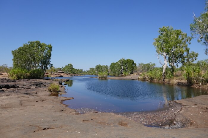
- Placid pool above the Bells Gorge Falls.
It is easy enough to rock hop across the creek at the pool above the falls and take the walk track to pool below. Most of the water was in shade and very cold. That didn’t deter Micaela, Jeff and Mike and Nick from taking a dip.
- The waterfall at Bell Gorge.
The Gorge extends about 10 kilometres to the north and Bell Creek joins the Isdell River a few kilometres further on.
- Swimming below the Bells Gorge Falls.
Mount Barnett
We departed Bells and drove out to the Gibb River Road, arriving at Mt Barnett Roadhouse around lunchtime. The road was in reasonable condition. It would seem the grader had been over it recently and taken the top off the corrugations. While refuelling I noticed a bulge in the sidewall of the right rear tyre. Luckily there was a level, shaded spot only metres away where everyone helped me change the wheel. On return to Perth I was credited 50% on a new tyre.
Kalumburu Road
The Gibb continues to the north-east from Mt Barnett. The corrugations were no better when we turned onto the Kalumburu Road, 110 kilometres from Mt Barnett. An oncoming fuel tanker road train was slogging its way south at an excruciatingly slow pace. As we continued north I could see its wheel tracks deviating from one side of the road to the other as the driver searched for relief from the bone jarring corrugations. His journey from Drysdale River Station to the Gibb would have taken in excess of two hours to cover the 60 kilometres. It is indeed fortunate for travellers that fuel is ONLY $2.05/litre.
Drysdale River Station
Drysdale River Station is clean, neat and tidy and appears to be a well run campground. We all know that there are some thoughtless, selfish, rude/obnoxious travellers out there making it difficult for the rest of us, however, from the preponderance of ‘Don’t’ and “No’ signs around the complex, it would seem that the great majority of those uncaring people have descended on Drysdale River Station at some time in the not too distant past – or perhaps management is a bit jaded dealing with people. Rest assured nobody drove above ‘dust raising pace’, on pain of being banished!
We had a pleasant night around the campfire.
King Edward River
The Point Warrender Road turnoff is 100 kilometres north of Drysdale. The Kalumburu Road in this section was in good condition. The road continues north for another 105 kilometres to the Kalumburu community. The road was put through in 1954 to service the Benedictine Mission that was initially established at Drysdale in 1908 and then moved to Kalumburu in 1937.
But our destination was the Mitchell Falls, 88 kilometres to the west along the Port Warrender Road (more often referred to as the Mitchell Falls Track).
- At the Port Warrender Road turnoff.
The King Edward River crossing is six kilometres in. The turnoff to the Camping and Day Use areas is another two kilometres further on. Time for a swim.
- Greg at the King Edward River.
- King Edward River
- Mike and Sue at the King Edward River waterfall.
Aboriginal Paintings
Three kilometres further along we stopped at the Munurru aboriginal cultural and burial site. The carpark for this attraction is at 14°52’49.72″S 126°10’15.15″E. This an extensive Wandjina art site – extending about 500 metres north-south and 100+ metres in breadth.
- Avenue de Rock Art
- Sheltered from the elements.
- Emu or brolga.
- This Munurru rock art site is a ‘must see’ for tour groups.
- The gallery of rock art covers an extensive area.
Mitchell Fall Campground
Just after passing the airstrip road we turned off the Port Warrender Road onto Mitchell Falls Campground Road. It is a rough, 16 km, unmaintained track.
Immediately on selecting our campsite we walked over to helicopter booking office and made arrangements for our return from Mitchell Falls tomorrow. And got directions to the favoured swimming hole, Little Merton Falls. The pathway down to the water is not easy to spot.
Mertens Creek
Mertens Creek on which the Little Mertens and Big Mertens Falls are located was named after the water goanna Varanus mertensi. This in turn was named after Robert Mertens (1894-1975), a German herpetologist who was responsible for much of the work on Australian goannas.
Swimming and climbing up under the waterfall filled the rest of the afternoon.
The nights were cool enough for us to appreciate a campfire – our time in collecting firewood on the way in was well spent.
Mitchell Falls
Next day was to be the highlight of our visit to the Mitchell Plateau – a walk to the Mitchell Falls along a five kilometre track, followed by a helicopter flight back to camp. To beat the heat we started the walk just after seven o’clock.
- Big Merton Falls
- Pool at the head of Big Merton Falls.
- Rugged Kimberley sandstone.
- When walking along the access track to Mitchell Falls it is difficult to realise that Big Merton Falls gorge is parallel to and close to the more famous feature.
- Lily Pool
The attractive Lily Pool was a welcome break part way along the track.
- Mitchell River at the crossing point above the Falls.
- Mitchell River above the Falls.
- Mitchell Falls
- Kim at the Mitchell Falls.
Chopper Ride
At $150 per person the chopper ride back to the campground wasn’t cheap, however, it was not just a beeline to the landing pad. The pilot identified many features, enabling us to get a better understanding of the ‘lie of the land’, and oriented the helicopter to provide lots of photo opportunities. Good value.
- Big Merton Falls are on the left and Mitchell Falls on the right. In time the two will merge but will still be fed by two different watercourses.
Surveyors Pool
Later in the day we drove to Surveyors Pool. Swimming is not permitted in the main pool. The upper pool was too shallow for a proper swim but we were still able to cool off. We arrived back early evening having witnessed an incredible ‘over land’ sunset.
- The main Surveyors Pool.
- The shallow top pool above the main Surveyors Pool.
- Relaxing at Surveyors Pool.
- An awesome sunset on the return journey from Surveyors Pool.
The road into the Mitchell Falls Campground didn’t get any easier.
© Kim Epton 2018-2024
1491 words, 31 photographs.
Feel free to use any part of this document but please do the right thing and give attribution. It will enhance the SEO of your website/blog and Adventures.
See Terms of Use.


