
A 198 kilometre Day Trip to the north of Khon Kaen.
Ku Kaew Arogayasala Khmer Ruin
-
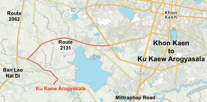
- ROUTE TO KU KAEW, KHON KAEN.
The ruins of the ancient Khmer arogayasala (hospital temple) Ku Kaew are 12 kilometres south-west of Khon Kaen.
-
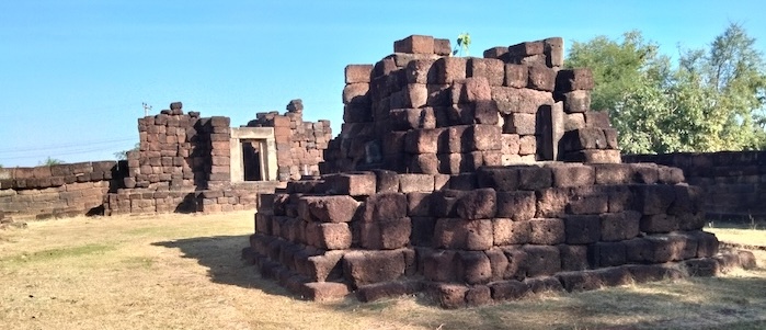
- Aragayasala Ku Kaew, Khon Kaen.
Hin Chang Si Lookout
-
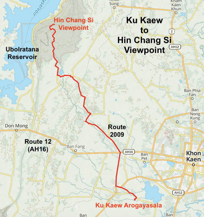
- MAP OF ROUTE FROM KU KAEW AROGAYASALA TO HIN CHANG SI VIEWPOINT.OF
The Hin Chang Si Viewpoint, in the Nam Phong National Park, offer great views over the huge Ubolratana Reservoir.
-
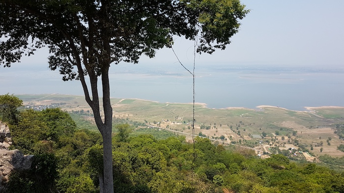
- View over lake from the summit at Nam Phong National Park.
-

- At Nam Phong National Park.
Phasalasod Viewpoint, Lan Nub Dao Visitor Centre, Ubolratana
Phasalasod Viewpoint is 13 kilometres along Route 2063 – the Rural Road that runs along the eastern edge of Ubolratana Reservoir. The Lookout has a good size parking area, a substantial ‘Roadside Shelter’ and provides great views of the reservoir.
-
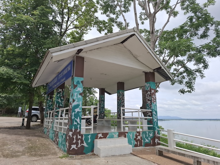
- Phasalasod Roadside Shelter at the Viewpoint overlooking Ubolratana Reservoir.
Only 700 metres further north is Lan Nub Dao Visitor Centre. Viewpoint, camping, toilets, cafe.
Ubolratana Reservoir, Dam, and Municipality
[IMAGE LOOKOUT TO UBOL]
-

- Fishing village on Ubolratana Reservoir.
The Dam
Ubolratana Dam is the first hydroelectric power project built in the Isaan region. It impounds the Nam Phong River, which flows into the Chi River and then the Mun River, a tributary of the Mekong. It is an earth-core rockfill dam, 885 m long and 32 m high.
The dam was built for flood control, irrigation and electricity generation. Its construction created fishery, transport and tourism industries.
The Reservoir
Ubolratana Dam’s catchment area spans 12,000 km². The countries of Qatar, Jamaica and Lebanon are each about this size. Around 30,000 people were resettled to create the reservoir.
With a storage capacity of about 2.4 billion cubic metres it is the largest irrigation reservoir in Thailand’s Northeast.
In 2024, a 24 MW floating solar array numbering about 48,000 panels was installed, so daytime power generation now often relies on solar while hydropower is reserved more for nighttime.
The reservoir water levels fluctuate significantly with the seasons and droughts.
Tourism
The dam and reservoir area is one of Khon Kaen’s iconic landmarks making it a premium tourist destination
Thee are numerous restaurants along edge of the reservoir on the drive north to Ubolratana. Depending of timing/schedule it may be too early for lunch on arrival at the restaurant precinct making it advisable to continue to Ubolratana Dam and Phu Aen Skywalk and return here afterwards.
Phu Aen Skywalk
-
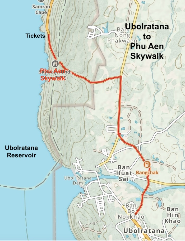
- MAP OF ROUTE UBOLRATANA TO PHU AEN SKYWALK
There is a perfectly adequate carpark from which to access the Skywalk at the structure itself but, this being Thailand, parking is not allowed, the Ticket Office is non-functioning, and all things relating to accessing the Skywalk are conducted at a location one kilometre down the hill. This arrangement provides employment for the locals and admittedly takes away traffic pressure from a difficult uphill/downhill bend in the road.
-
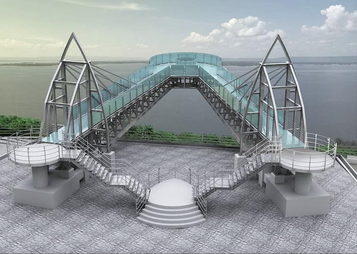
- Phu Aen Skywalk
If the option of visiting Ubolratana and the Skywalk prior to lunch was exercised then it is necessary to return to the city and find a restaurant or continue a few kilometres further south to the Ban Saen Restaurant Precinct.
Ban Saen Restaurants
[IMAGE SKYWALK TO FRESTAURANTS]
[PHOTO]
[TEXT]
King Cobra Snake Show
[IMAGE FLOATING RESTAURANTS TO SNAKE SHOW]
The King Cobra Snake Show is a free (make a donation), skilful demonstration of snake dancing, taunting/dodging/mesmerising, and handling. Members of the audience can be photographed with snakes, if they wish.
Ku Prapha Chai Khmer Ruin
Ku Prapha Chai is a small Khmer ruin that (as is usual with Khmer constructions) faces east. No roofing survives, but the gopura‘s walls, doorways, and three small side rooms are fairly intact. More detail is available on the information-rich Tim’s Thailand website.
-
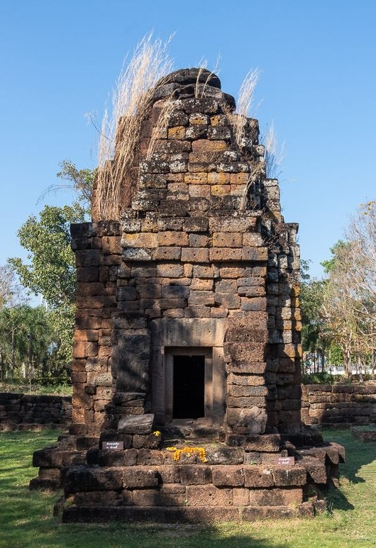
- Prang at Ku Prapha Chai. Photo courtesy Tim’s Thailand.
- Coordinates: 16.6118, 102.9300
- Address: JW6J+P2J, Bua Yai, Nam Phong District, Khon Kaen 40140, Thailand
To Khon Kaen
-
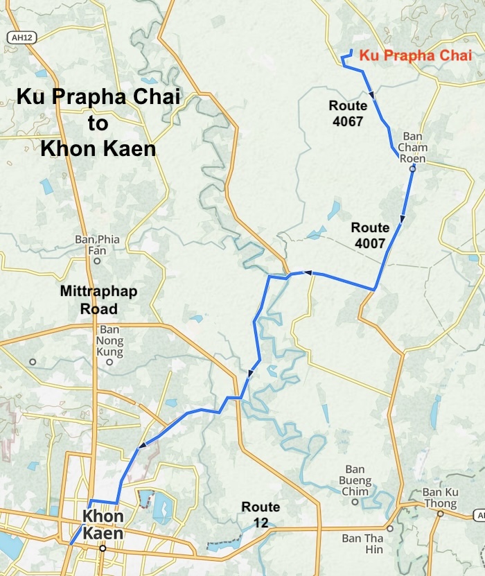
- MAP OF ROUTE KU PHRAP CHAI TO KHON KAEN
From the Ku Prapha Chai Khmer ruin it is only a 32 kilometre, 45 minute drive back to Khon Kaen.
© Kim Epton 2026
703 words, 10 photographs, 7 images.
Feel free to use any part of this document but please do the right thing and give attribution to adventures.net.au. It will enhance the SEO of your website/blog and Adventures.
See Terms of Use.