This reconnaissaince trip was made during the sesquicentenary of the Hunt Track – the oldest inland track in Western Australia.
We aimed to visit 20 explorers’ wells in the eastern wheatbelt/goldfields and ascertain their condition (with a view to refurbishing them in the future) as part of the Explorers’ Wells and Tracks Project.
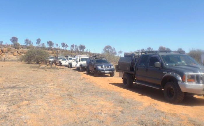
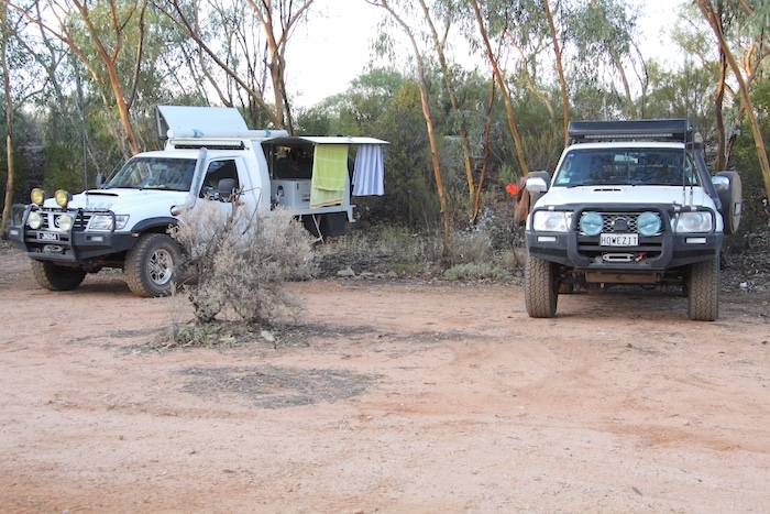
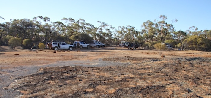
Ten people in seven vehicles got away on time from The Lakes and, after a stop at Northam for dinner, arrived at Boodallin Soak on the Westonia Common after 9.00 p.m.
Boodallin Soak
The hot, dry easterly was blowing strongly, a precursor to a warm tomorrow.
There was no chance of lighting a fire so we sat around a torch that I placed in the centre of the circle of chairs. With a little bit of imagination …..
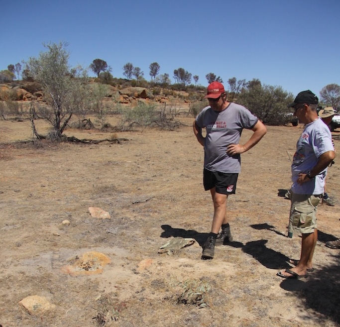
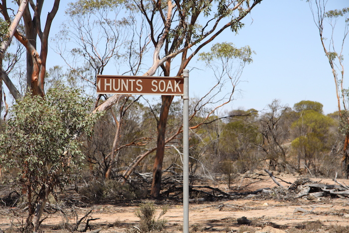
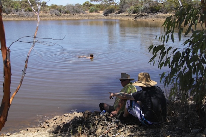
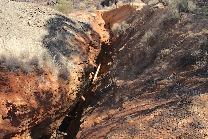
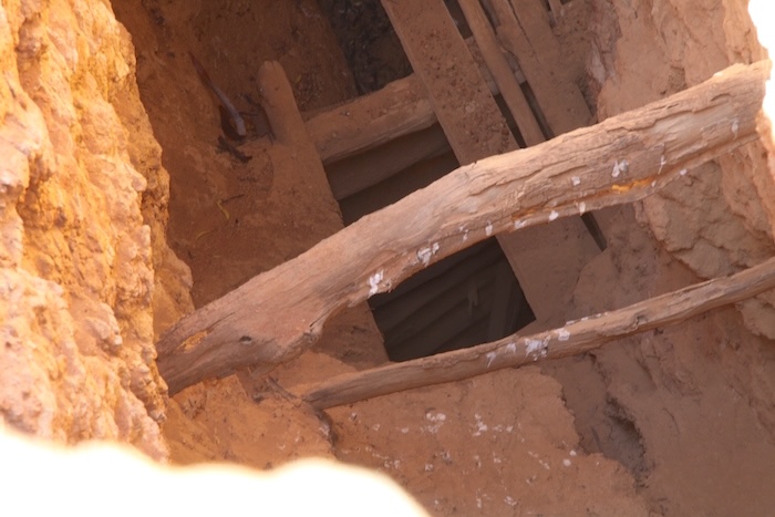
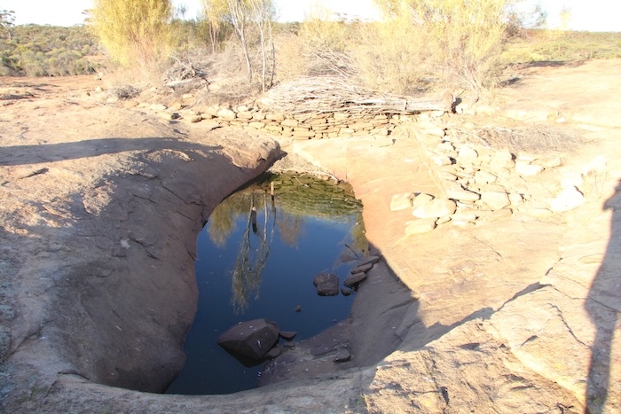
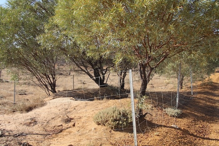
We were camped only metres from Boodallin Soak, the first well on our list.
-
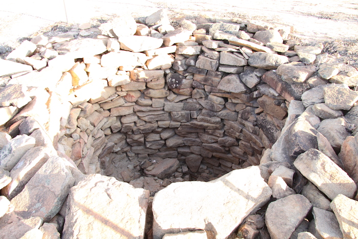
- Boodallin Soak. Phoo Rob Wilson.
-
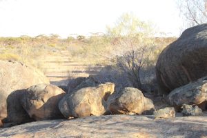
- Boodallin Rocks
-
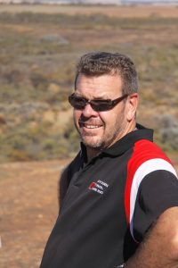
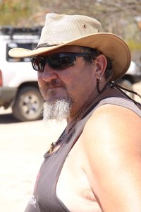
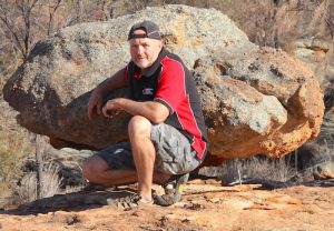
- Rob at Boodallin.
-
- Joe at Boodallin.
-
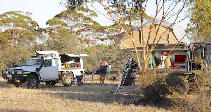
- Boodallin Camp.
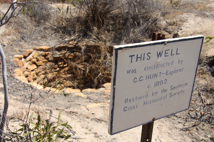
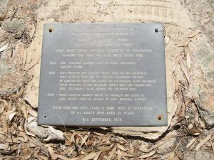
Explorer/surveyor C.C. Hunt travelled through this area on his March 1864 Koolyanobbing Expedition and located this native well. Later that year, during his Exploration Eastward of York, he again visited the soak to water his horses.
In March 1865 his team opened out the native well but were unable to build the stone well until logistical issues were resolved. Boodallin Soak was where the notorious bushranger and escape artist Moondyne Joe was captured in 1866.
Edna May Mine
On the way to Sandford Rocks we visited the working Edna May Mine, immediately to the north of Westonia.
-
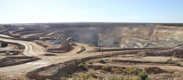
- Edna May Mine was re-opened in 2010, the centenerary of the discovery of gold at Westonia. It is expected that the mine will be in operation for at least nine years and produce 100,000 ounces of gold per annum.
-
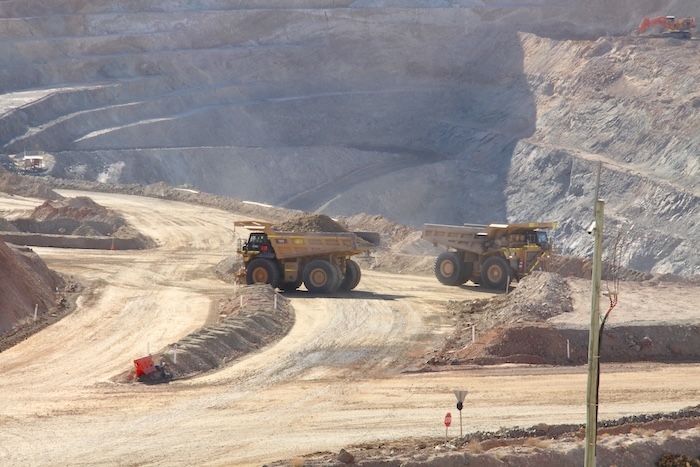
- Haulpacks at the Edna May mine.
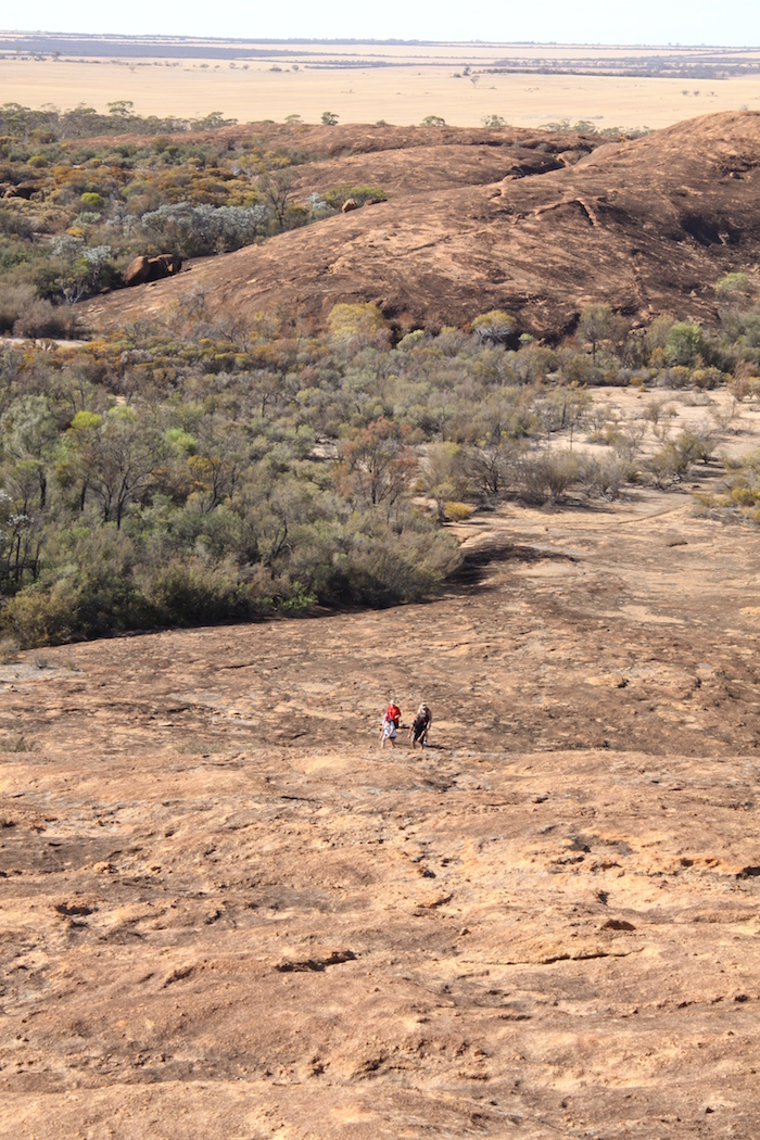
Sandford Rocks
Although Hunt developed a well at Sandford Rocks (he called it Yorkarakine) its location is not known and we did not search for it, opting instead to climb to the summit.
-
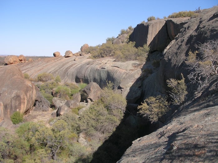
- Sandford Rocks.
-
- Climbing up Sandford Rock.
-
- A gnamma on Sandford Rock.
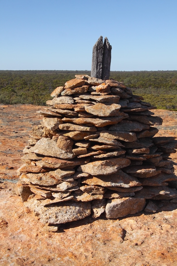
-
- Cairn on the top of Sandford Rock.
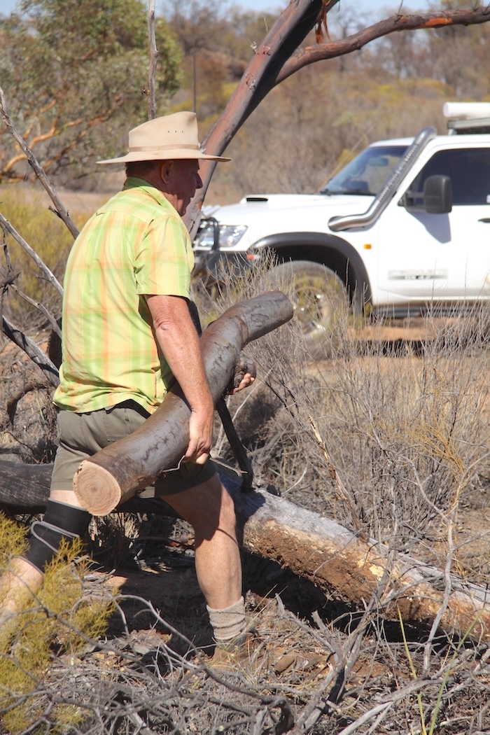
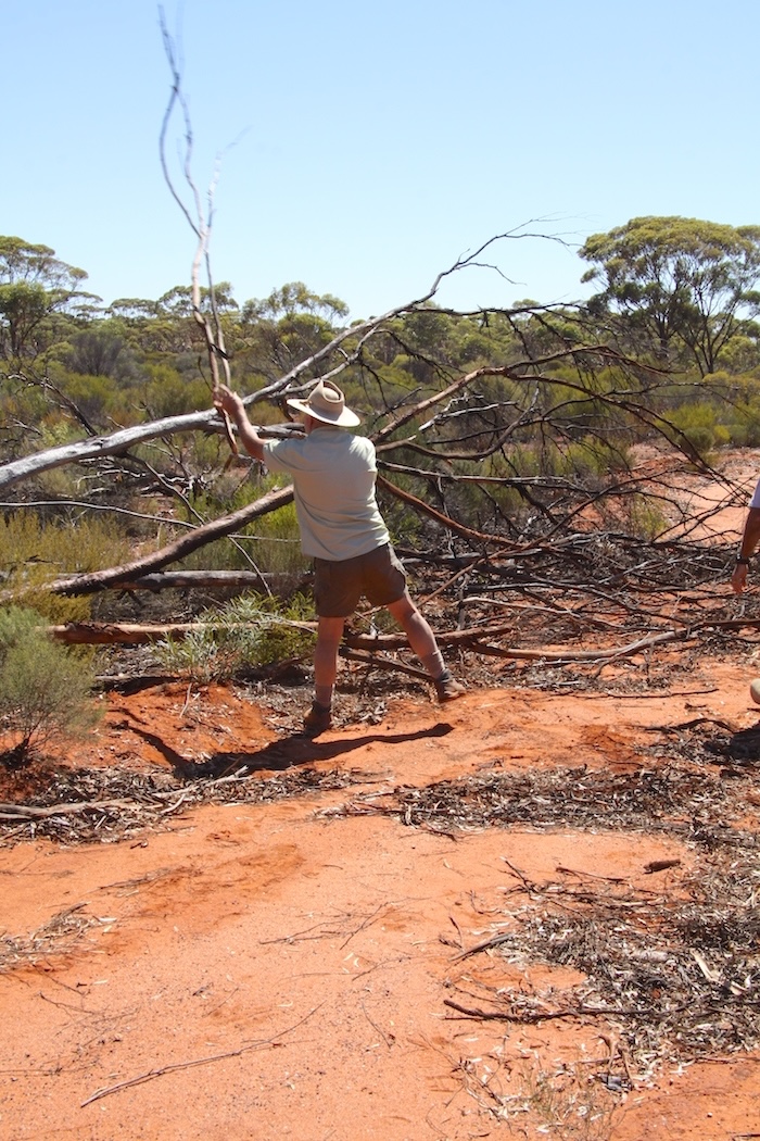
After working off some early morning energy climbing up and down the rock we sought out a track that showed up on Google Earth during my pre-planning as a shortcut back to Boodorockin Road.
-
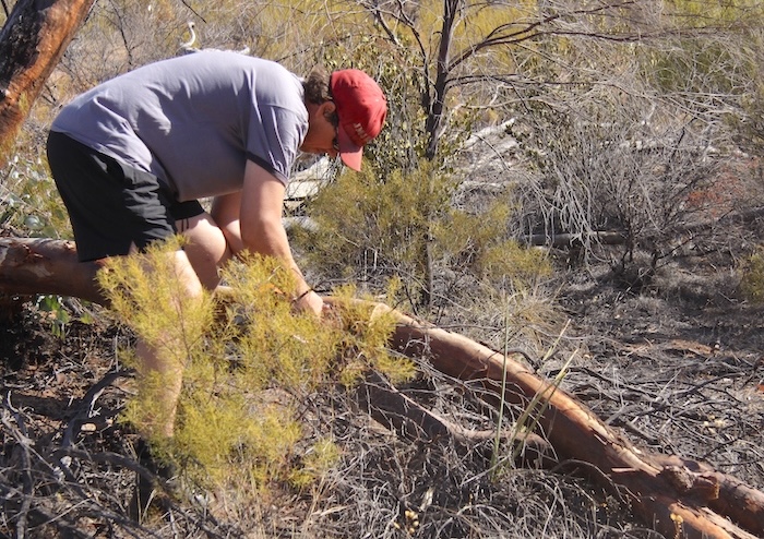
- Matt cutting a log blocking the track.
-
- Kim removing a log.
-
- Craig and Tracey on the dead end track.
-
- No through road.
Despite Matt’s work with the chainsaw, we deemed the track impassable. We turned around and took the more normal way to Keokanie Rock, our next destination.
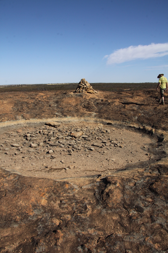
Keokanie Rock
Forty five minutes of searching for Keokanie Well all around the rock produced no result and we drove away along the access track towards Bodallin North Road. Lloyd drove over the well. Success, well number two found!
-
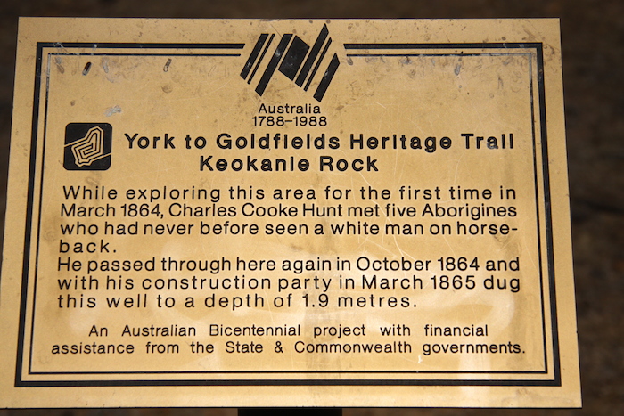
- Bicentennial Plaque at Keokanie Rock.
-
- Matt and Joe and Keokanie Rock.
-
- Leaving Keokanie Rock.
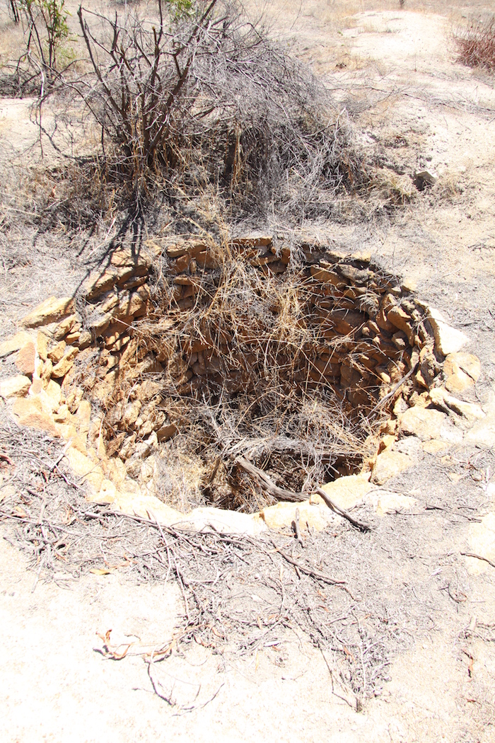
On the way to Southern Cross we stopped at Moorine Rock Well and Kodjerning Rock Well and found both to be in reasonable condition.
Moorine Rock Well
-
- Moorine Rock Soak.
-
- Moorine Rock Soak
-
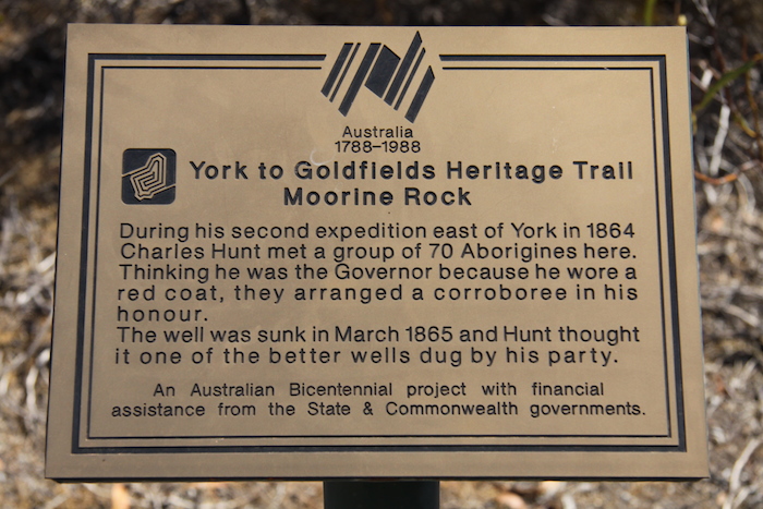
- Bicentennial Plaque at Moorine.
-
- Moorine Rock Soak.
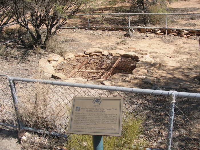
Kodjerning Well
-
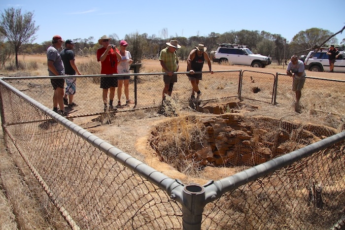
- Even though Kodjerning Well is protected by a fence it still needs extensive restoration work.
-
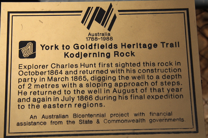
- Bicentennial Plaque at Kodjerning WEll.
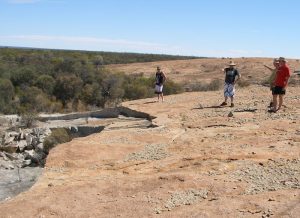
After a quick refuel at The Cross we passed Yellowdine and stopped at Boorabbin Rock for lunch and a swim in the dam.
-
- Swimming at Boorabbin.
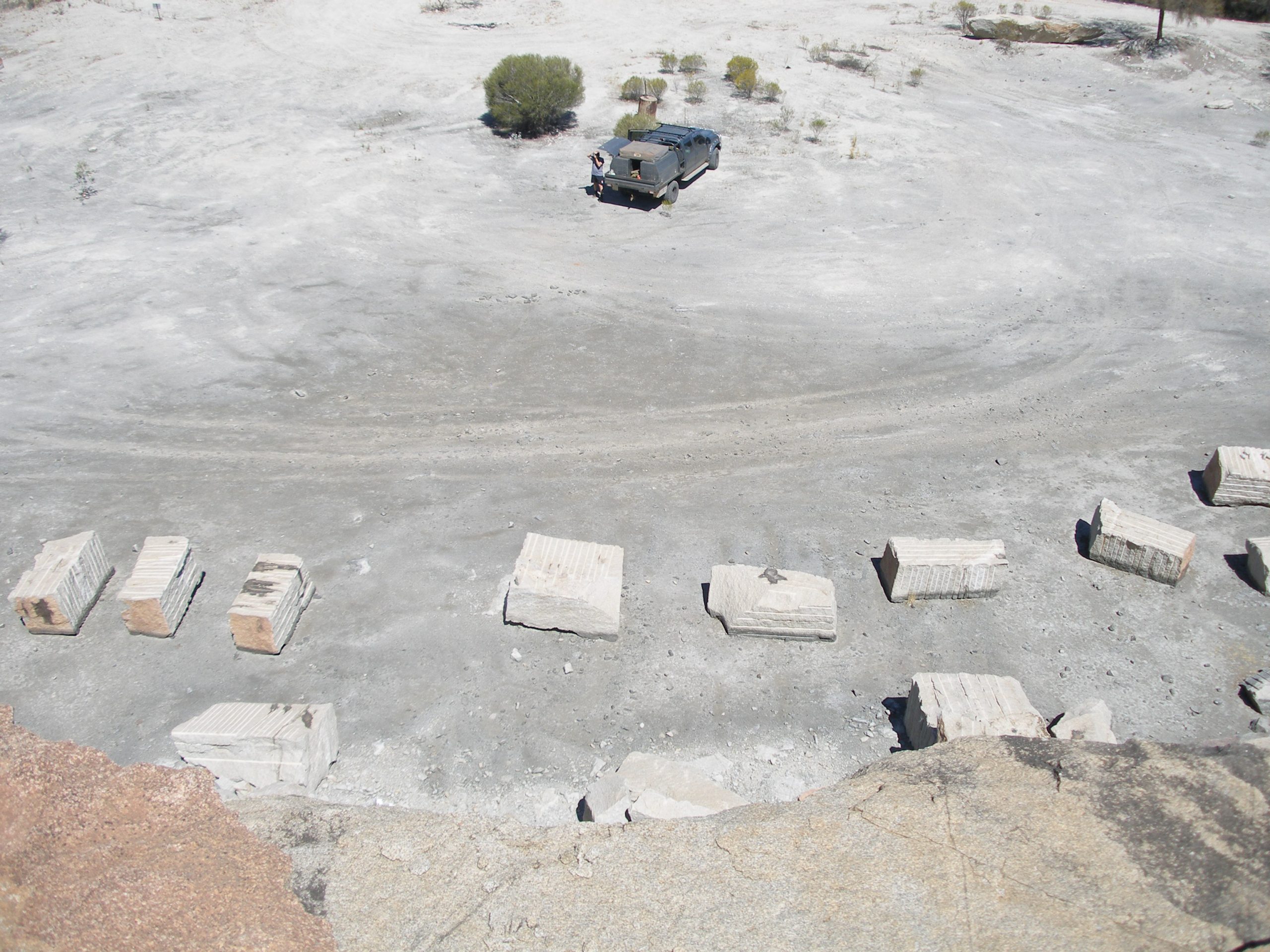
The day was heating up. Before heading back to the highway we detoured to the quarry.
-
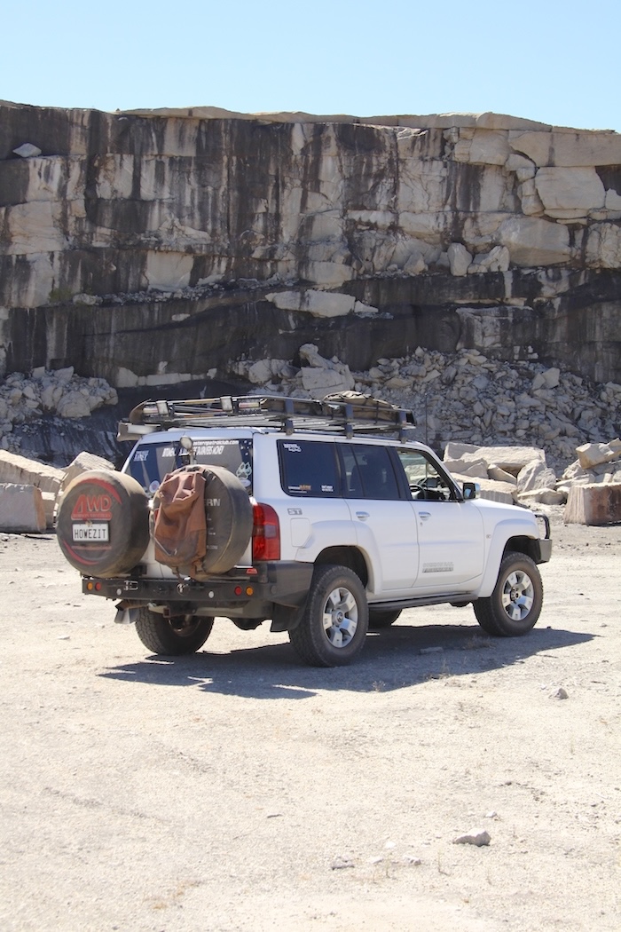
- Graham’s Patrol at Boorabbin Quarry.
-
- F250 at Boorabbin Quarry.
-
- Quarry face at Boorabbin.
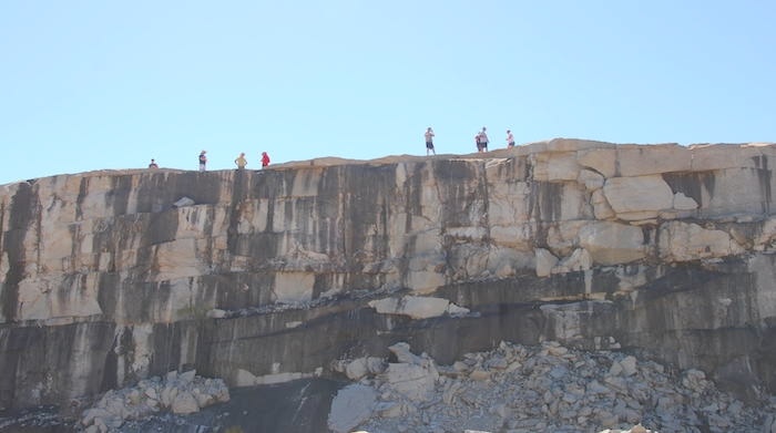
-
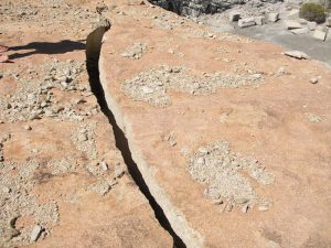
- Crack near edge of cliff.
-
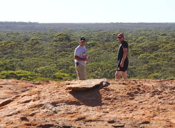
- Alan, Paul Kim and Rob at the top of Boorabbin Quarry.
The convoy arrived at Boondi Rock and Dam just before 1500. After another swim and noting the facilities (a popular DPaW site), the crew mutinied and it was decided to camp here rather than push on to the planned overnight stop at Yerdanie.
-
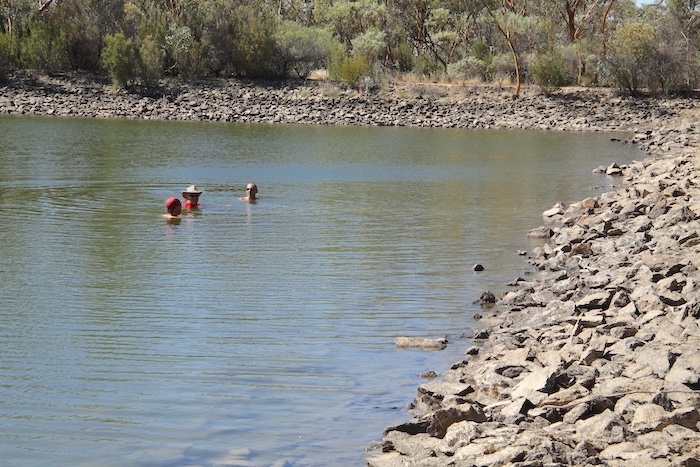
- Swimming at Boondi.
-
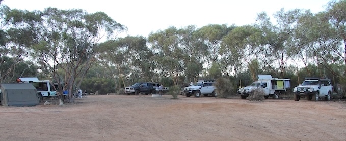
- Camp at Boondi.
-
- Boondi Camp.
A few other travellers arrived later in the day in search of a comfortable camp so we turned our caps sideways and played the bogan music louder.
-
- Craig Roper
-
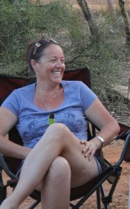
- Tracy Beckwith
-
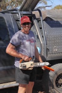
- Matt Hall
-
- Lloyd Bloomfield
The trade off for stopping short of the previous day’s run was an early start for Yerdanie on Saturday. Away by 0710.
We turned off the Great Eastern Highway near Woolgangie negotiating a little used track for seven kilometres to Yerdanie Rock. I missed the turn into the Rock but fortunately Rob was on the ball, radioed the error through to me and it was only a short run back to the destination.
-
- Cairn at Yerdanie Rock.
-
- Joe and Matt at Yerdanie.
This was the well I intended to open out. I had written permission from DPaW to remove vegetation, as required. After half an hour of searching on foot, we abandoned the quest, cognisant that this was only a recce.
The track to our next destination, Gnarlbine Soak, was uncertain so I determined to head back out to the highway, drive a few kilometres further east and then head back through the woodlands towards Gnarlbine.
Along the way we stopped at the Prince of Wales Mine, a small, private digging that has been abandoned.
-
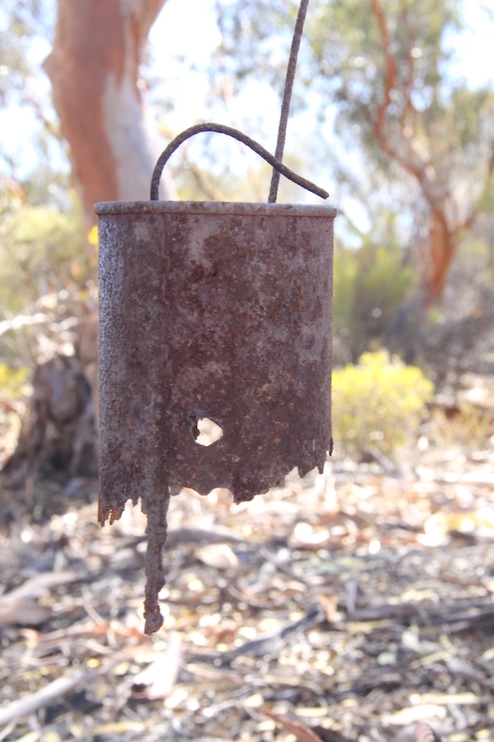
- Used as a billy before being used as a target.
-
- Stoping at the Prince of Wales mine.
-
- Shaft at the Prince of Wales mine.
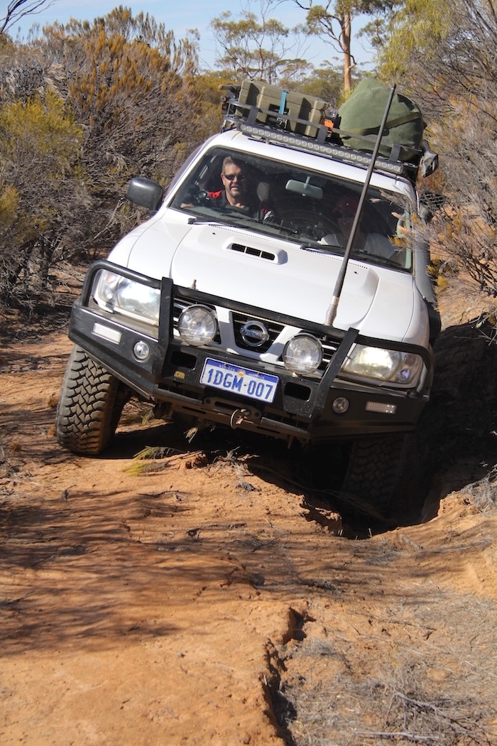
The track had only a few obstacles and we eventually arrived at Victoria Rock Road, a few hundred metres north of Gnarlbine Rock.
-
- Kim clearing fallen trees from the track.
-
- Paul Marriner
-
- Graham Howe
-
- Rob Wilson
Gnarlbine Soak was a very important water source for aboriginal people. It became an important stopping place for explorers and prospectors, including R.J. Holland when he and his team put through what today is known as the Holland Track.
-
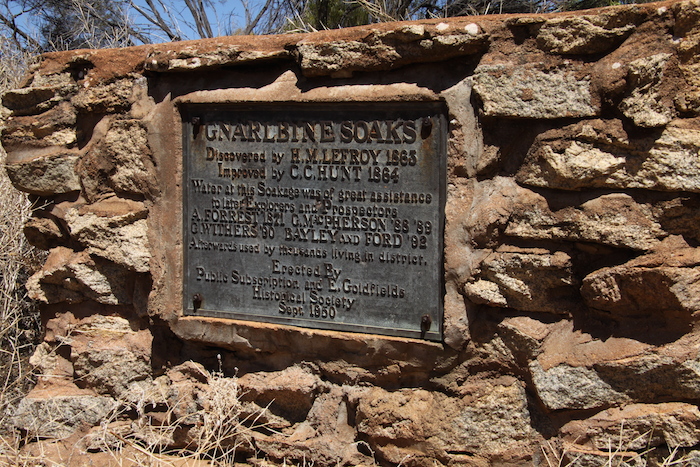
- Eastern Goldfields Historical Society plaque at Gnarlbine.
-
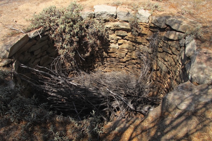
- Gnarlbine Well
-
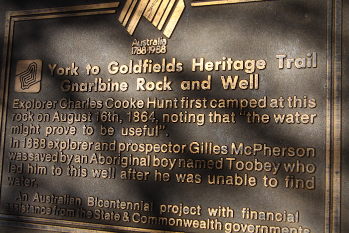
- Bicentennial Plaque at Gnarlbine
Gnarlbine Rock has some excellent examples of gnammas.
Matt and I went looking for a second well 200+ metres to the south-east without success. [This well was located in 2019 and again in 2020].
We arrived at Coolgardie at 1130 and visited the Pioneer Cemetery, the final resting place of R.J. Holland of Holland Track fame.
-
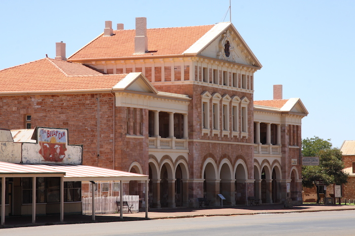
- Coolgardie Town Hall.
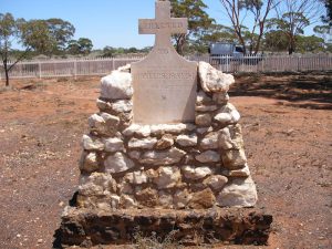
After lunch at Coolgardie we headed out of town to the Coolgardie Cemetery, resting place of many pioneers including explorer Ernest Giles.
-
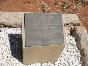
- R.J. Holland’s plaque at the Pioneer Cemetery
-
- Memorial to the pioneers of Coolgardie.
-
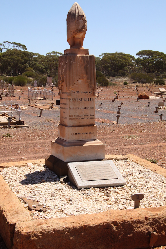
- Ernest Giles’ tombstone.
Leaving Coolgardie was a major undertaking. Roadworks extended past Bullabulling and we were delayed for an hour.
We arrived at Karalee Rock and Dam mid afternoon.
-
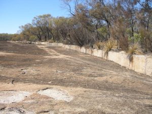
- Harvest wall at Karalee.
-
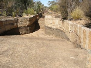
- Diverting water from the rock to the aquaduct.
-
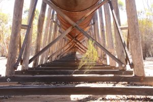
- The supports of the Karalee aquaduct.
-
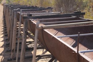
- Aquadect.
-
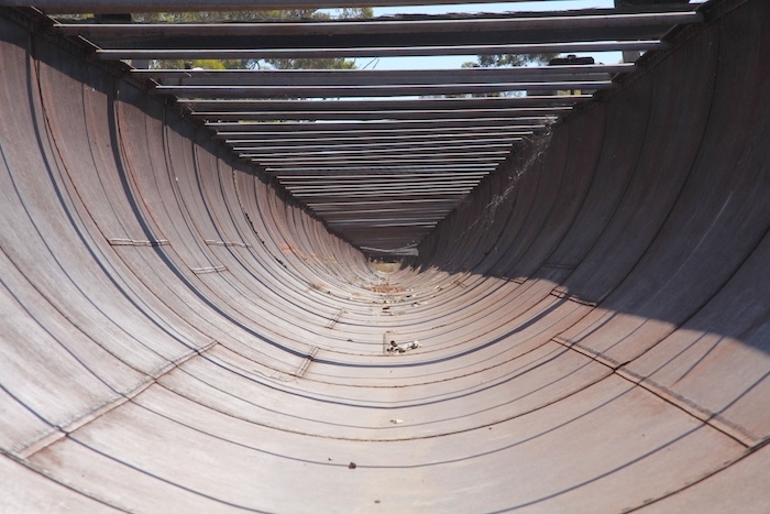
- The Karalee aquaduct or flume.
-
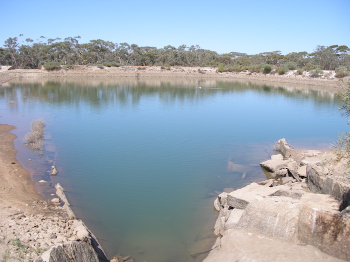
- The reservoir at Karalee.
Another attempted mutiny to stay at Karalee to swim in the dam was put down and we headed out towards Weowanie Rock. I had checked this track with the local dogger and he assured me that it was open, an easy track, and that none of his traps were placed along the track.
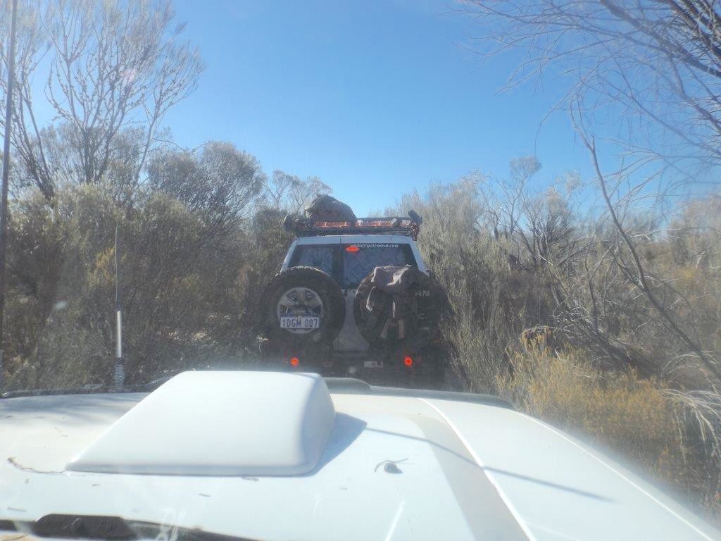
It took us two hours to travel the 16 kilometres to Weowanie. As I’m sure all the drivers who pushed their way through that track will attest, it was a bad experience. The hard, sharp branches of the acacias scratched the vehicles non stop for four kilometres. There was no turning back, there was no way to turn around. Reversing wasn’t an option. Eventually the acacias gave way to eucalypts and the track opened out to woodland. One of the worst – if not THE worst – track I have ever negotiated. Thanks to the bum steer from the dogger!
-
- Track to Weowanie.
Since Boorabbin, through to Boondi, Yerdanie, Gnarlbine Coolgardie, back to Yellowdine and Southern Cross and onto Weowanie we had been in the Great Western Woodlands, the largest remaining area of intact Mediterranean climate woodland left on Earth.
After arrival at Weowanie most people climbed the Rock to photograph the Tank and then went to the top to watch the sunset.
-
- Weowanie Tank.
-
- Vehicles at Weowanie.
-
- Graham’s camp setup.
-
- Sunset at Weowanie
Everyone had noticed the signs at Karalee that declared the fire ban ended on 31 January. We had a modest fire, not for warmth but to add to the ‘ambience’.
I had scheduled departure each morning for 0800 but we were getting away an hour early.
-
- Old well at Weowanie.
-
- Second well at Weowanie. These wells were put in much later than Hunt’s. They were more than likely developed by the Public Works Department to provide water for prospectors and others travelling to the goldfields.
On the way out of Weowanie on Sunday morning we stopped at the lonely grave of Thomas Davidson, a Scottish woodcutter. Davidson blew his brains out in May 1895. Isolation, loneliness and alcohol accounted for many old timers in the bush.
-
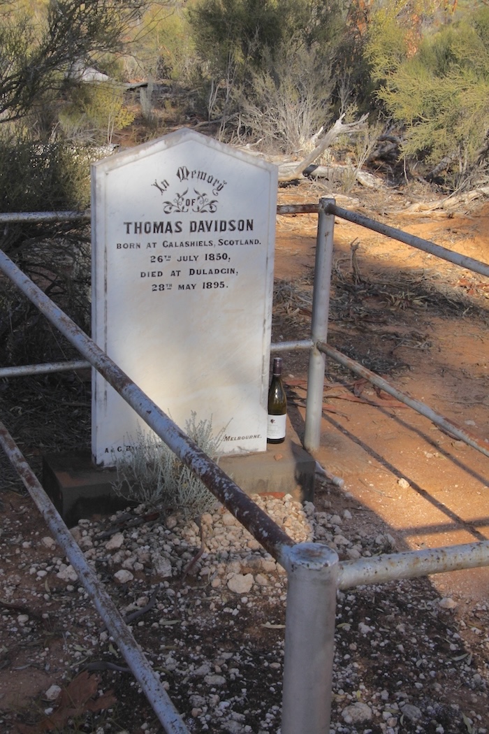
- Thomas Davidson’s grave at Duladgin.
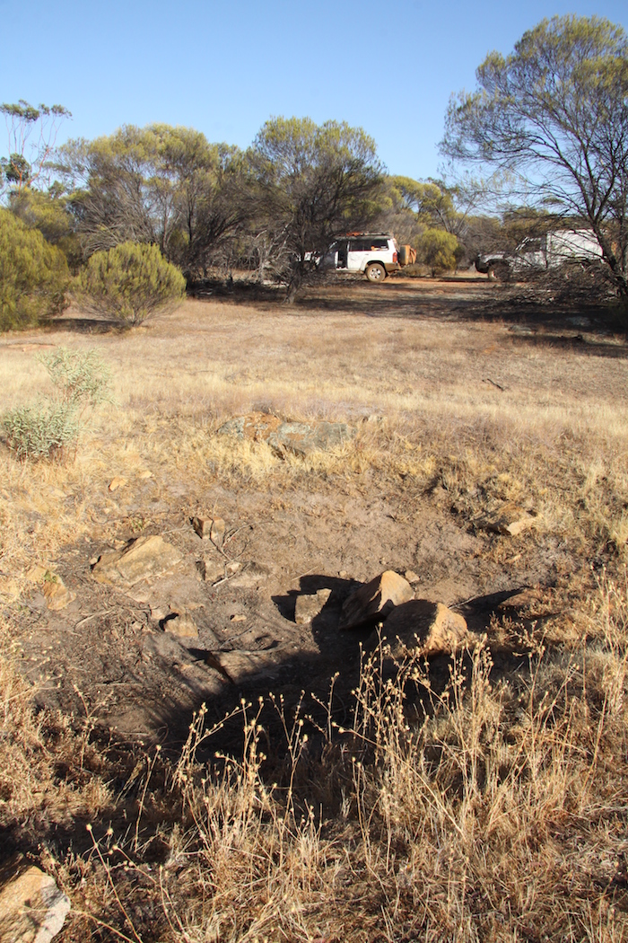
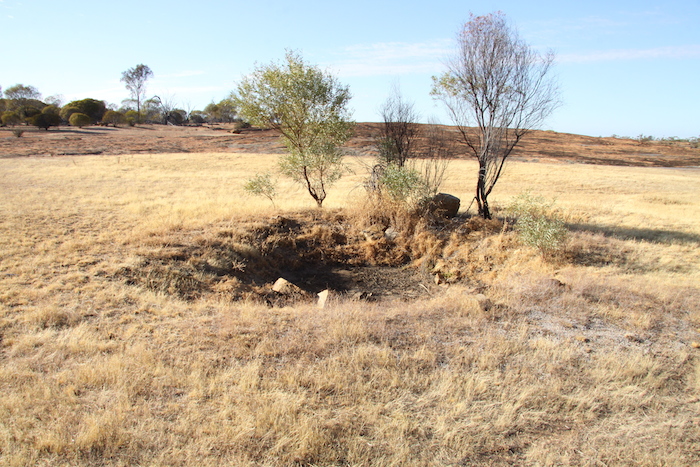
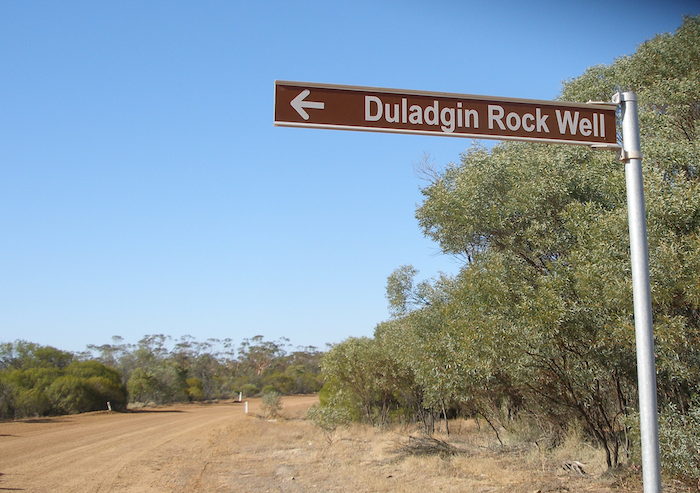
Ten minutes later we stopped at Duladgin Well for photographs. This is not one of Hunt’s wells. It was built by the Public Works Department in the late 1890s.
-
- Duladgin Well across the road.
-
- Duladgin Well
-
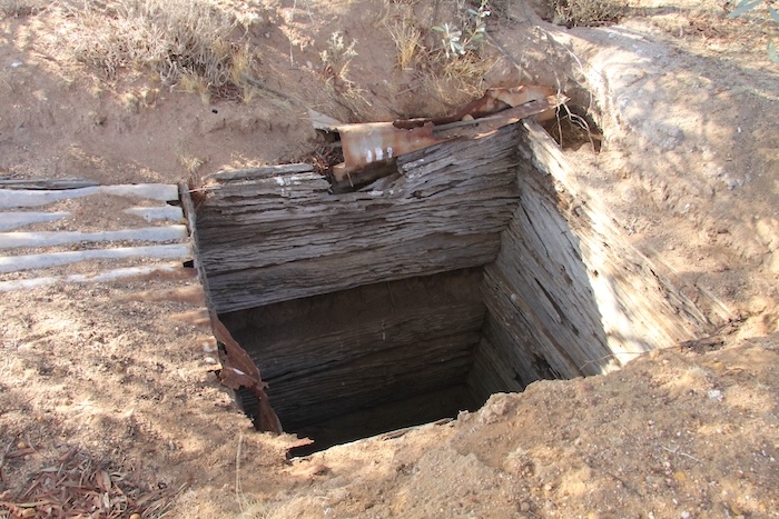
- Reasonable condition for a wood-lined well.
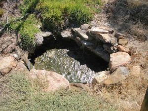
We then headed south to Yellowdine on the Great Eastern Highway. It was then west along the blacktop to Southern Cross where we stopped for 20 minutes to refuel, before heading north out of town to Koorkoordine Well, one of the best preserved of Hunt’s Wells. It has a grand vista, overlooking the dry Lake Koorkoordine.
-
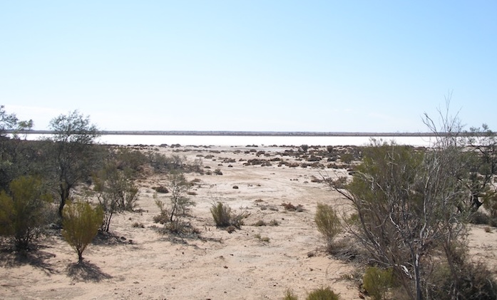
- Lake Koorkoordine.
-
- Bicentennial Plaque at Hunt’s Well at Lake Koorkoordine.
-
- Kim and Paul at Koorkoordine Well.
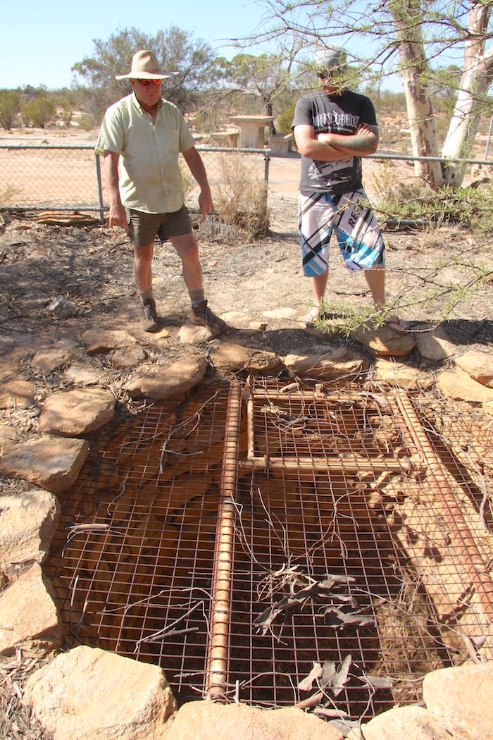
Next stop was Burracoppin, a mid-morning disappointment. We were unable to find the well here despite an extensive foot search. A possibility was noted with no great degree of confidence.
-
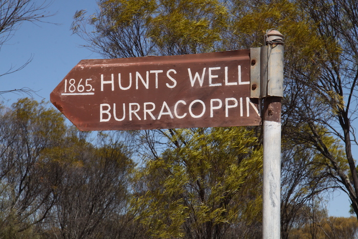
- There is no well where the sign is pointing.
-
- Merely a depression.
-
- Another possibility.
[ Note: We located the well only in 2016. The area near the carpark (signposted ‘Hunts Well 1865’) is a motocross track and after two previous unsuccessful searches we were starting to believe that the well had been destroyed with the construction of the track. While onsite at the carpark I contacted former champion race car driver and now outback explorer, Stuart Kostera, who has a keen interest in pioneer wells. He told me that he had spent the best part of a day searching for the well and had eventually located it some distance from the signposted location. Following his directions, I was able to quickly find it.]
We pushed on along Goldfields Road to Merredin and then headed south on the Bruce Rock Road to Totadgin Rock and Well
-
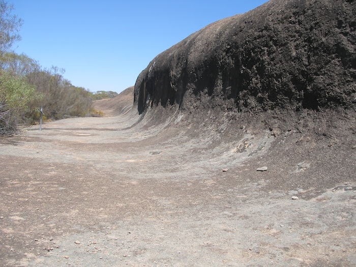
- The ‘wave’ at Totadgin Rock.
The well at Totadgin is in reasonably good condition. After walking to the summit and checking out the ‘wave’ on the eastern side of the rock we had lunch.
-
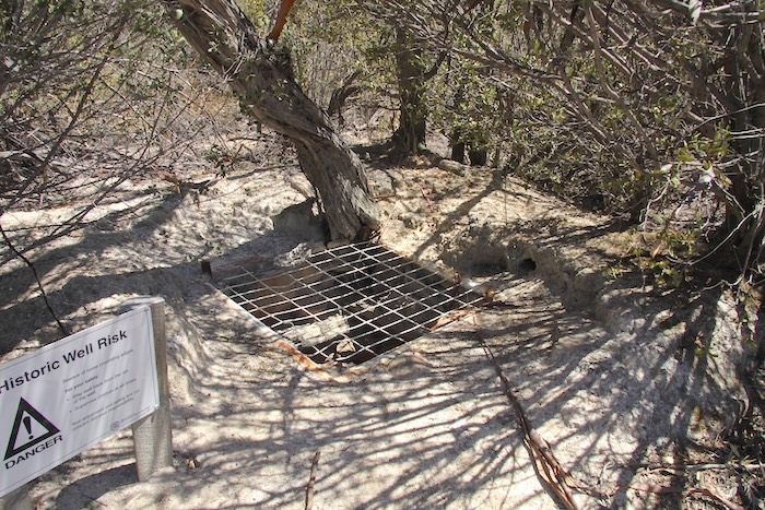
- Totadgin Well after refurbishment.
-
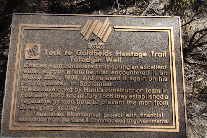
- Bicentennial Plaque at Totadgin.
-
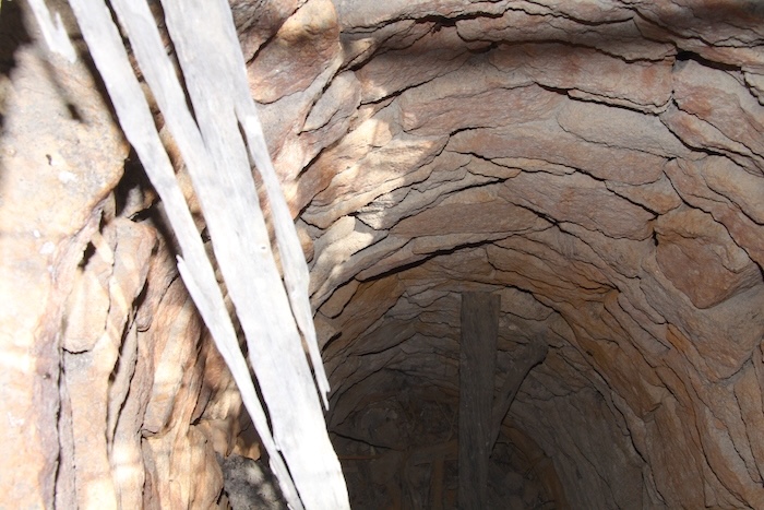
- Totadgin Well.
Weaving our way along gravel roads of the wheatbelt we arrived at Doodlakine. Four kilometres north of the town is Old Doodlakine and Hunt’s Well.
-
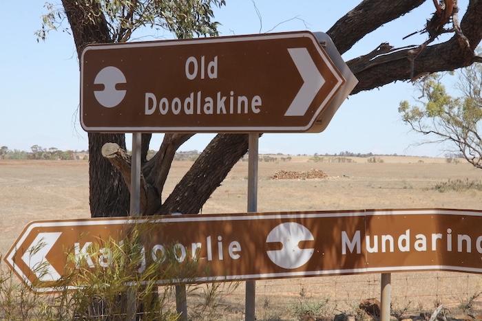
- A self nominated, early 20th century candidate for Australia’s capital.city.
-
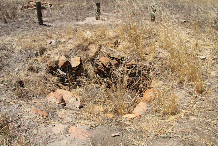
- Doodlakine Well February 2015.
-
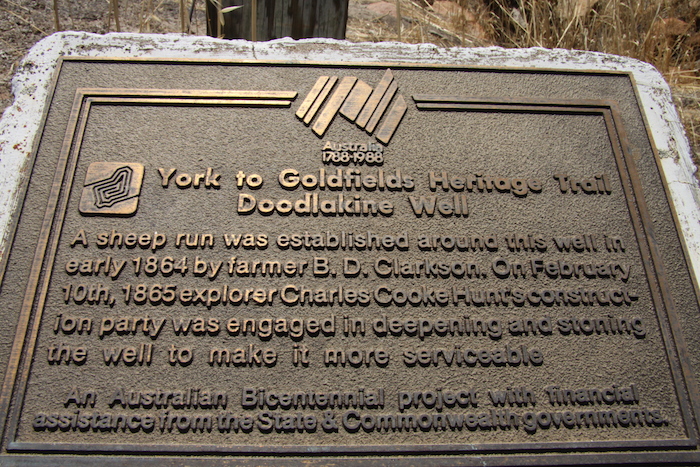
- Bicentennial Plaque at Doodlakine Well.
After a short stop we were back on the Goldfields Road heading west. Fifteen minutes later we arrived at Happy Dolphin Rock, an unusually shaped granite outcrop that looks nothing a shark’s mouth that is advertised as.
-
- Shark Mouth Rock.
A few hundred metres along the road is Marranobbing Well. It has recently been dug out.
-
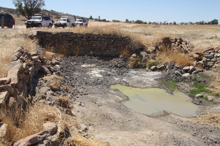
- Marranobbing Well.
-
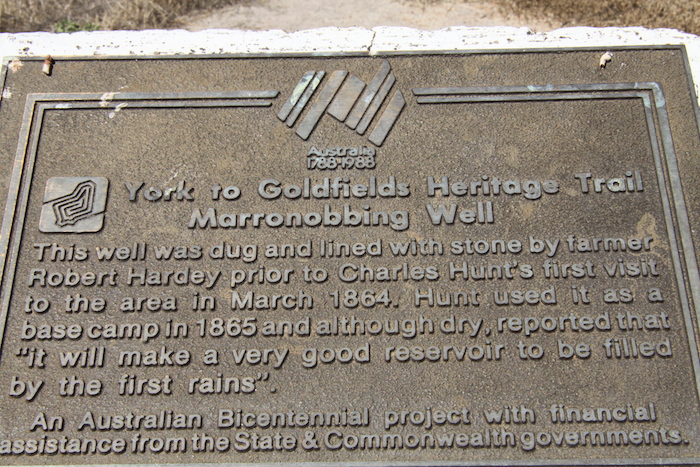
- Bicentennial Plaque at Marranobbing.
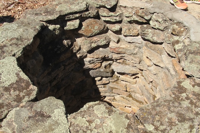
We took photographs and continued west on Goldfields Road to Hunt’s Well at Tammin Rock.
-
- Tammin Well.
-
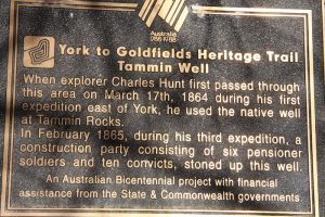
- Bicentennial Plaque at Tammin Well.
-
- Plaque at Tammin Well.
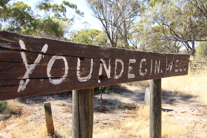
Our route took us through historic Youndegin.
-
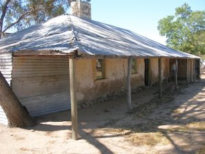
- Old Police Station at Youndegin.
-
- Hunt’s Well at Youndegin 2025.
Goldfields Road was now bitumen through to York. The Explorers’ Wells Recce ended at The Lakes at 1715.
This Road Trip took place between 19-22 February 2015.
Vehicles
My Patrol had been written off in a crash (idiot came through a red light and T-boned me) a few weeks earlier so I was with Matt Hall in his F250 ute,
Paul Marriner was in a Nissan Navara ute,.
Rob Wilson was driving his GU Patrol Wagon and doing the ‘sweep’ duties.
Graham Howe joined the recce in his GU Patrol Wagon.
Craig Roper and Tracey Beckwith came along in a GU Patrol Wagon.
Lloyd and Alan Bloomfield were in a GU Patrol Ute.
Joe Natoli was in his stolen GU Patrol Ute.
© Kim Epton 2015-2025
2116 words, 94 photographs.
Feel free to use any part of this document but please do the right thing and give attribution to adventures.net.au. It will enhance the SEO of your website/blog and Adventures.
See Terms of Use.
