Larapinta Drive
Just before departing the caravan park at Alice Springs I phoned Kings Creek Station and booked us in – fortunately. We got the last sites.
The drive west from Alice Springs along Larapinta Drive is a tourist’s dream. So many easily accessible attractions in a relatively short distance.
Just out of town is the memorial to John Flynn, founder of the Royal Flying Doctor Service.
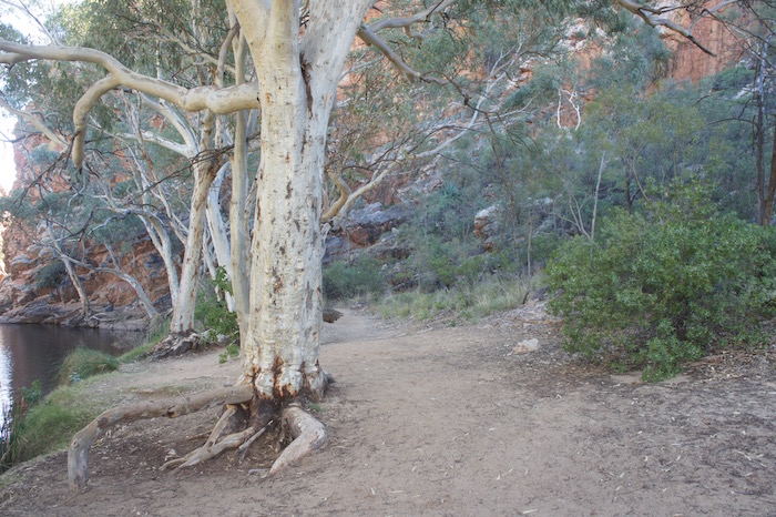
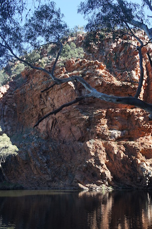
Simpsons Gap
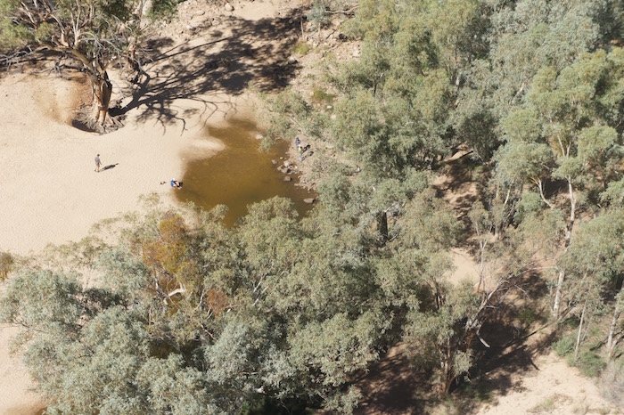
Simpsons Gap is a stunning gorge carved out of the West MacDonnell Ranges by Roe Creek. It has the same derivation as the Simpson Desert – A.A. Simpson, President of the South Australian branch of the Royal Geographical Society. A borefield on Roe Creek fifteen kilometres south of the town is the water source for Alice Springs.
-

- Simpsons Gap.
-

- Roe creek, the watercourse that created Simpson Gap.
-

- Waterhole at Simpsons Gap.
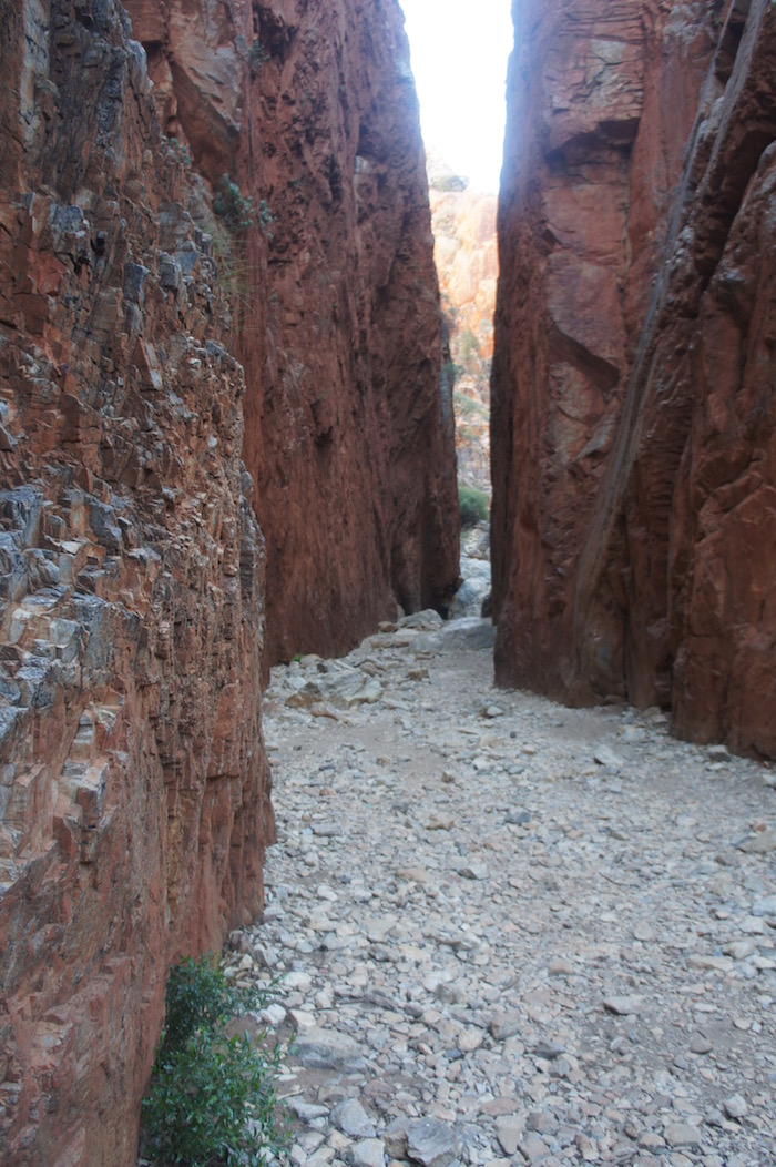
Standley Chasm
There was a definite chill in the air as we alighted from our vehicles at Standley Chasm. Time for a coffee before we headed for the Chasm. The gorge is said to be named after Mrs. Ida Standley, who came to Alice Springs in 1914 as the first Government school teacher and taught there for fifteen years. She is reputed to have been the first white woman to walk through the Chasm. The walls of the chasm extend to a height of eighty metres.
-
- Standley Chasm.
-

- The walk into Standley Chasm.
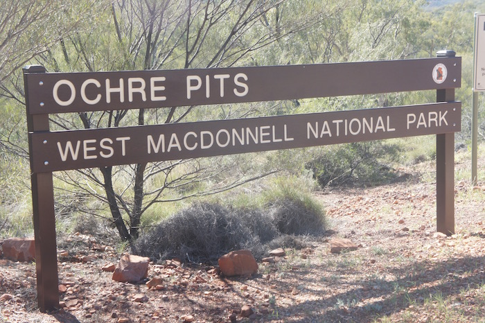
Ochre Pits
-

- Yellow and red ochre.
-

- Ochre was a tradeable commodity.
-

- Ochre Pit.
-
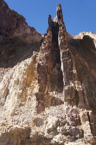
- White ochre.
Ochre was traditionally used by Indigenous Australians in ceremonies and was traded with neighbouring clans across the continent.
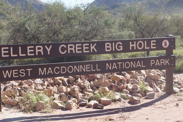
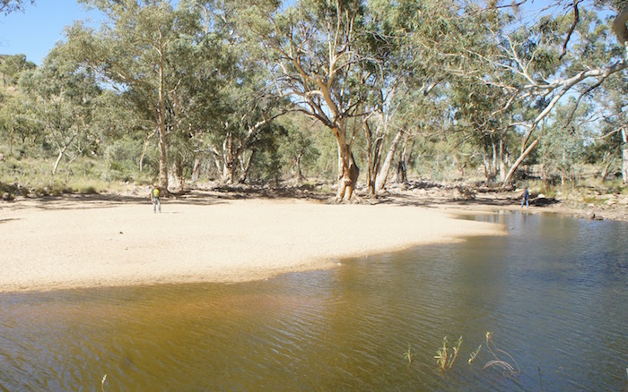
Ellery Creek Big Hole
-

- Ellery Creek Big Hole.
-
- Lots of shade.
-
- Ellery Creek Waterhole.
-

- Lots of water.
-
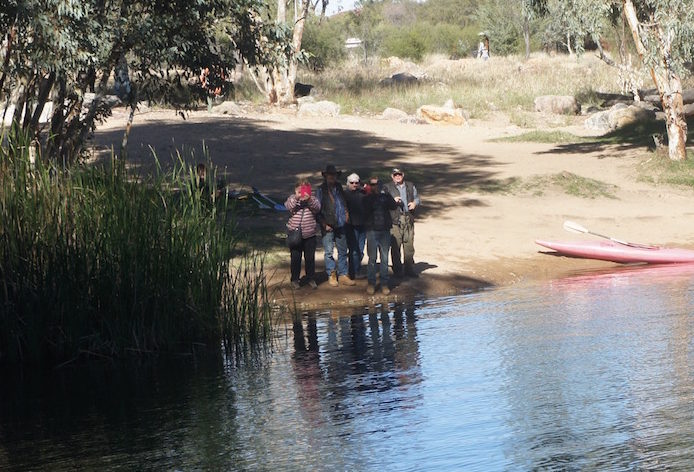
- Estela, Ken, Leslie, Dan and John.
-

- Tranquil.
Ormiston Gorge
Next stop was Ormiston Gorge, probably named by pioneer pastoralist J. Arthur Macartney after his Queensland property.
-

- Ormiston Gorge.
-
- Kim and Ken at Ormiston Gorge waterhole.
-
- Dan, Ken and Kim.
The Mereenie Loop
After Glen Helen we passed Mount Zeil, the NT’s highest peak, and continued on Namatjira Drive till its intersection with Larapinta Drive. From here we turned right to do the ‘Mereenie Loop’ (now promoted as the Red Centre Way). This dirt road allows tourists to access Kings Canyon without returning to Alice Springs.
-

- Stand of desert oaks on Namitjira Road.
-
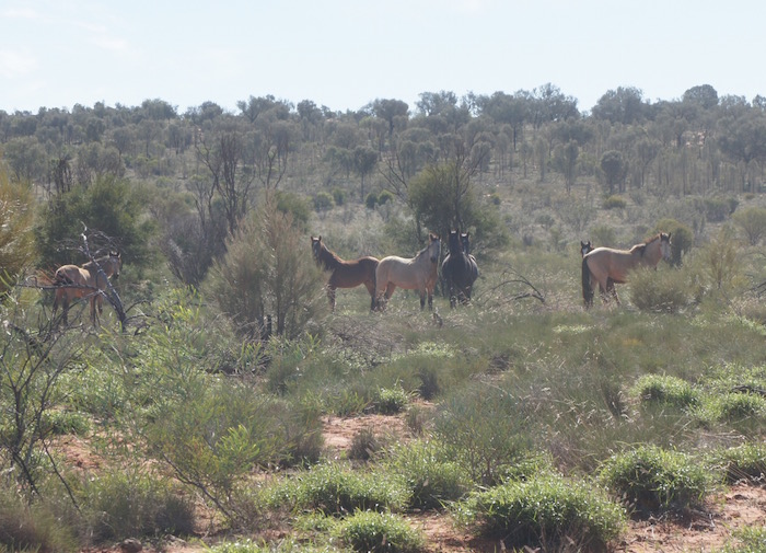
- Wild horses.
-

- The brumbies didn’t hand around to find out what was going on.
-

- Iconic piece of outback advice. The drum has been replaced numerous times.
-
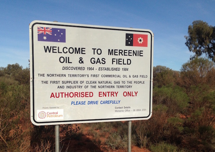
- Mereenie Oil and Gas.
While stopped at the turnoff to the Mereenie gas operations a worker from the plant arrived in a 4WD and stopped to chat.
There are two main fields from which oil and gas are produced – the West Mereenie and East Mereenie. Gas is compressed and sent via a 1628 kilometre pipeline to Darwin. Oil and condensate is transported to Alice Springs via a 270 kilometres pipeline. From here it is transported to South Australia where it is on-sold.
The plant has been reduced to 15 workers and needs the pipeline to Alice Springs to be upgraded to make it viable. Workers at the gas operation are FIFO, two weeks on, two off. He was heading down the hill to be a lollypop man while a fuel road train drove up the switchback.
-

- Switchback on the Mereenie Loop.
-

- Switchback on Mereenie Loop.
-

- Carmichael Crag in the George Gill Range – approaching Kings Canyon Resort from the west.
Blowout
Just past Kings Canyon I had a blowout, right rear.
-

- Shattered tyre.
Kings Creek Station
We camped at Kings Creek Station. We were initially frustrated at having nowhere to set up camp other than on access roads but one of the older station hands took over from the ‘backpacker’ staff member and allowed us vehicle access on to the lawn. Compared to Alice Springs it was not too cold.
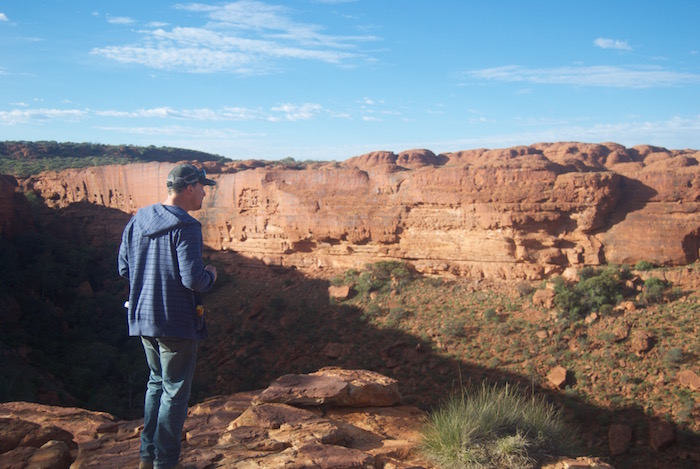
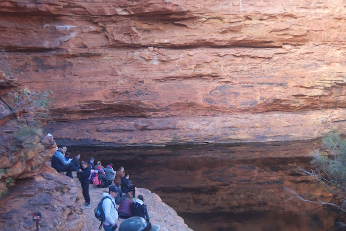
Kings Canyon
Next morning we drove 30 kilometres back to Kings Canyon. An 8.00 a.m. start to do the Rim Walk is fine in June but later in the year one would need to kick off at first light to avoid the heat. We took 2.5 hours start to finish. Many would take three hours or longer.
-

- Canyon near the start of the Rim Walk.
-

- Canyon near start of walk.
-
- Dan at canyon near start.
-

- Dan.
-

- Garden of Eden.
-

- Steps leading to the Garden of Eden.
-

- Garden of Eden.
-

- Pool at Garden of Eden.
-
- Garden of Eden.
-

- Garden of Eden.
-

- Garden of Eden.
-

- Garden of Eden.
-

- Ken in the Garden of Eden.
-

- Lookout to Kings Canyon. Difficult to access.
-
- Garden of Eden.
-

- A view of Kings Canyon most people rarely see. It is difficult and dangerous to get to this vantage point.
-

- Ken at Pool.
-

- Beehives.
-
- Beehives.
-
- End of beehive section.
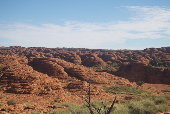
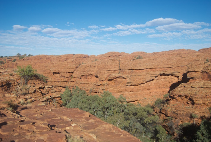
-
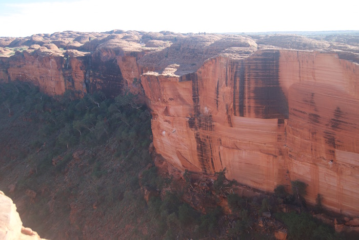
- Kings Canyon.
-
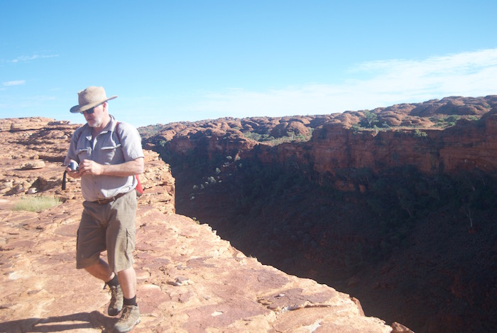
- Scott at the rim of the canyon.
-
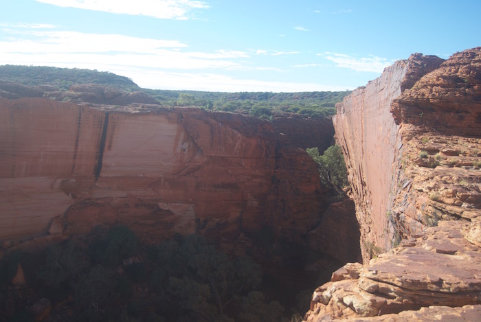
- Kings Canyon.
-

- Kings Canyon.
-
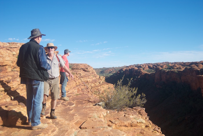
- Ken, Scott and Dan.
To Yulara
Leaving Kings Canyon we took Luritja Highway to the Lasseter Highway and made our way into Yulara.
After a bit of negotiation with Campground staff we secured a fire pit (half a 200L drum) and, once again, had a comfortable camp
At 9.00 a.m. next day we departed for ‘the Rock’.
Ayers Rock/Uluru
-

- Uluru.
On arrival, access to the Rock was closed and I decided to join the Mala Walk. Just as I was about to set off on the walk I noticed the gate being opened – the ‘climb’ had been reopened.
I climbed Uluru, while everyone else did the Mala Walk. It took me 1.25 hours (last time was 0.75 hours). Halfway down from the top I spoke with a bloke who had just travelled the Tjukaruru Road (section of the Great Central Road from WA/NT border to Yulara ) who told me it was in excellent condition. This was surprising news given my experiences of it on a number of occasions since 1996.
-
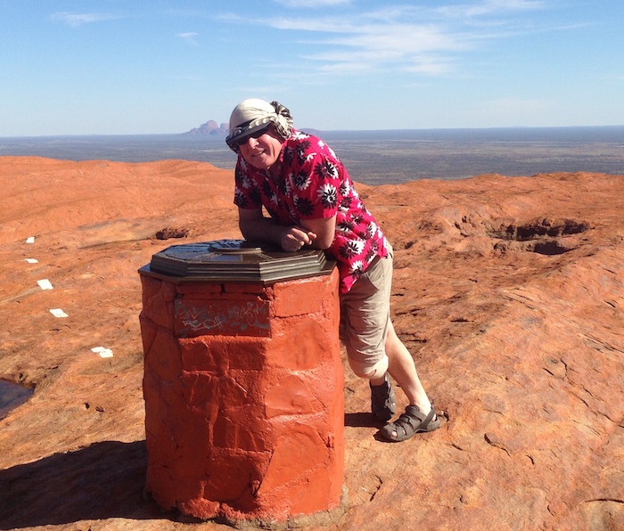
- Kim on top of Uluru.
-

- Topograph at the summit of Uluru.
-

- Uluru tafoni.
-

- Ancient and modern.
Yulara Campground
After lunch at the Interpretative Centre Kerry and I returned to Yulara. Other members of the group returned at various times throughout the afternoon and prepared for the trip home through the desert.
-
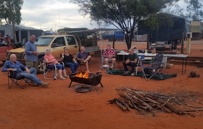
- Campfire at Yulara.
-
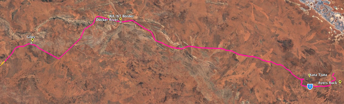
- YULARA TO GILES.
It rained overnight. We departed at 8.00 a.m. for Kata Tjuta / The Olgas.
Kata Tjuta/The OLgas
-

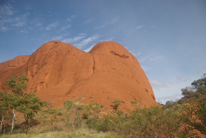
- Kata Tjuta.
-

- Emergency radio point.
-
- Kata Tjuta dome.
-
- Not something you see every day.
-

- Infrequent occurrence.
-

- Into the Valley of the Winds.
-

- Tafoni at Kata Tjuta.
-

- Ken.
-

- Dan.
We walked to top of the Valley of Winds walk. It was busy. Numerous groups were coming and going.
Back to Tarcoola to Alice Springs
Go to Great Central Road
© Kim Epton 2026
1131 words, 69 photographs, two images.
Feel free to use any part of this document but please do the right thing and give attribution to adventures.net.au. It will enhance the SEO of your website/blog and Adventures.
See Terms of Use.
