-
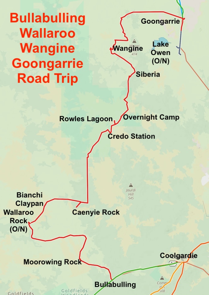
- ROUTE OF BULLABULLING WALLARO WANGINE GOONGARRIE ROAD TRIP
Confirming the Location of Moorowing Rock and Caenyie Rock
One of the aims of this Road Trip was to determine the correct positions of Moorowing Rock and Caenyie Rock. Scott Wilson’s research was in agreement with what Alan McCall had determined a few years previously. If there was any doubt, this ‘on ground’ visit eliminated it. The rationale was to determine that Caenyie Rock shown on modern maps (including Moving Map Software Apps) is actually Moorowing Rock; Caenyie Rock is located at what modern maps show only as ‘Rocky Outcrop’ 20 kilometres east-north-east of Wallaroo Rock; and the Moorowing Rock shown on modern maps five kilometres north of the Trans Line doesn’t exist, is described here.
Depart from Bullabulling
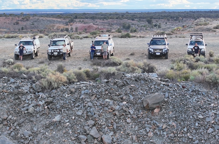
Six people in five vehicles departed Bullabulling Hotel on Great Eastern Highway 30 kilometres west of Coolgardie to check out Bullabulling Reservoir and many other points beyond.
Bullabulling Reservoir
Bullabulling Reservoir was constructed from 1895.
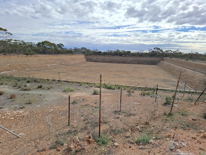
We spent some time trying to determine the purpose of the large, now empty reservoir. Clearly some of the water it held was utilised by the steam trains on the Yilgarn Railway (renamed the Eastern Goldfields Railway in 1899). A phone call to James Hay who worked on the pipeline in a previous career solicited the information that, like other Pumping Stations between Mundaring and Kalgoorlie, it was used for ponding water to be repressurised/pumped to Coolgardie and on to Kalgoorlie.
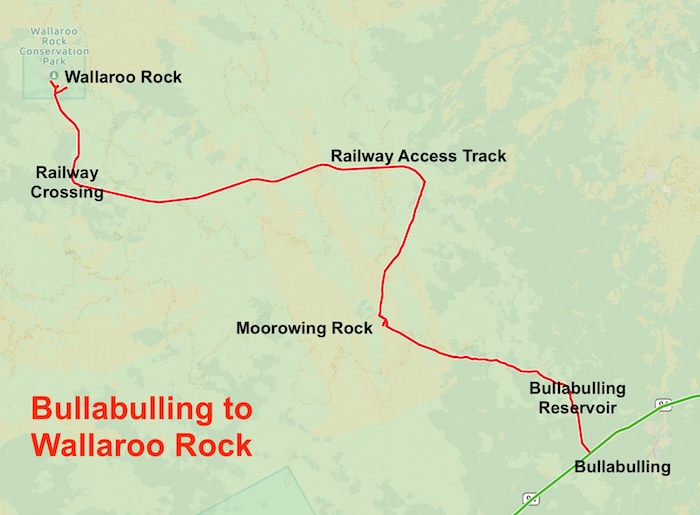
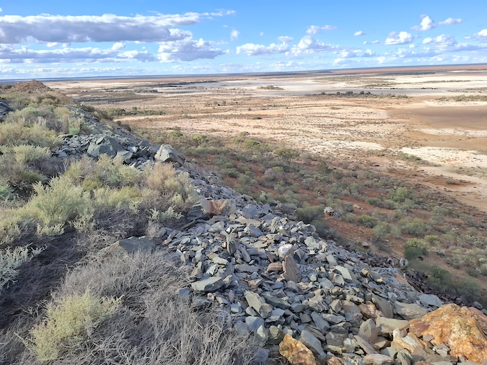
To Moorowing Rock (shown on modern day maps as Caenyie Rock)
Under threatening skies we moved north-west to what modern maps show as Caenyie Rock but is clearly Moorowing Rock. From now referred to as Moorowing Rock.
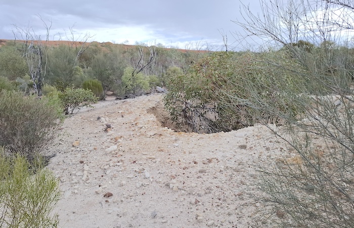
As with most granite outcrops, the thick fringing vegetation at Moorowing encircles the rock in a 15-20 metre band. We searched for, and found, a number of hand dug wells around the base of the rock, as well as the usual detritus common at these pioneer camps such as water tanks, horseshoes and tins.
-
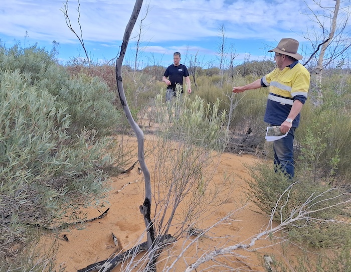
- Dan and Scott searching for wells.
-
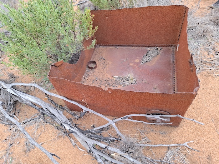
- Shipping container repurposed as a water tank.
-
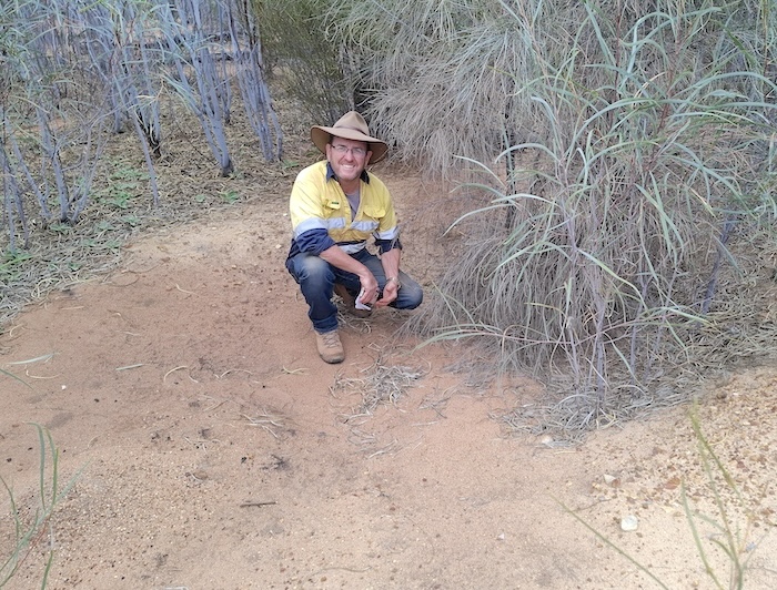
- Scott at what once was a forty foot deep well that, over time, has filled in.
-
- Hand dug well at the base of Moorowing Rock.
We ascended to near the summit and made some interesting finds – modern day petroglyphs.
-
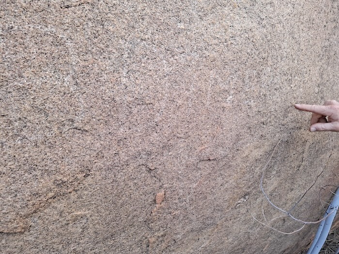
- Faint outline of the petroglyphs (graffiti.
Every time I see these reasonably recent rock carvings I ask – are they grafitti or useful historical records? While these particular engravings are of the “I was here” variety – that is of graffiti character – they are of an age that gives some context to the use of the rock.
-
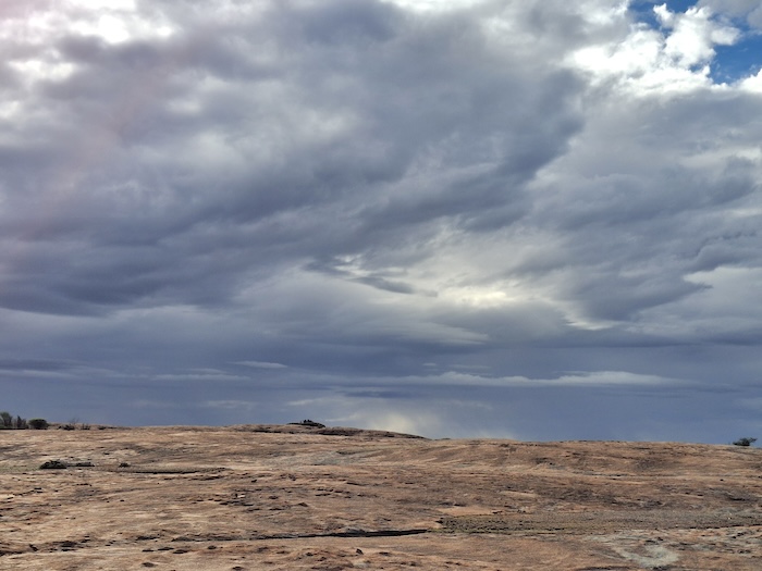
- Storm clouds over Moorowing Rock. Photo Rod Dally.
More photographs of Moorowing Rock.
To Wallaroo Rock
Time to move on to Wallaroo. The track north from Moorowing Rock is unremarkable and leads to the Trans Australia Railway service road that runs from Southern Cross to Kalgoorlie. We turned west and headed towards Wallaroo, passing a number of oncoming railway service vehicles along the way.
The Prospector passenger train passed by only seconds after we turned north across the railway. We continued to Wallaroo Rock.
-
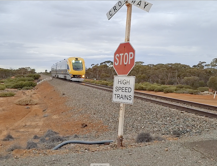
- The Kalgoorlie to Merredin ‘Prospector’ commuter train. Another train in identical livery travels from Merredin to Perth. The schedule of each train is synced to meet at Merredin. Photo Rod Dally.
As with numerous other granite outcrops in the Western Australian Wheatbelt/Goldfields, harvest walls had been constructed to divert water into substantial dams.
-
- Reservoir at Wallaroo.
Alan pointed out that quite often useful historical information was inscribed (unofficially) into the concrete blocks at the extremities of the dams built on these granite outcrops.
-
- Second reservoir at Wallaroo Rock.
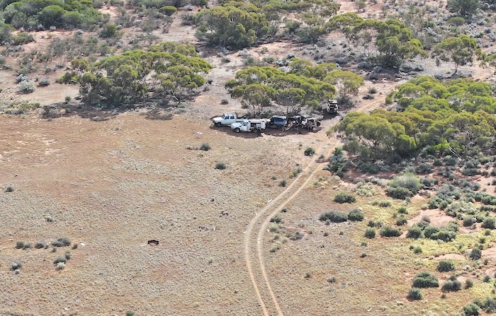
After doing the ‘tourist thing’ at the various dams we moved to a great bush campsite just east of the Rock, selected by Scott who was leading the Road Trip at the time (and, indeed, for most of it).
-
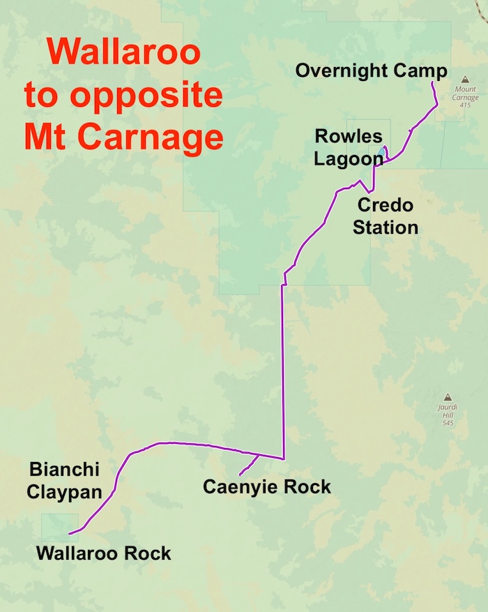
- ROUTE FROM WALLAROO ROCK TO CAMPSITE OPPOSITE MOUNT CARNAGE
Wallaroo Campsite to Bianchi Claypan
Scott’s pre-trip research revealed a small claypan that had a woodline crossing it (unusual occurrence) so we determined to make a track into it and name it after our fellow Road Tripper and renowned author of various books about the woodlines, Phil Bianchi.
-
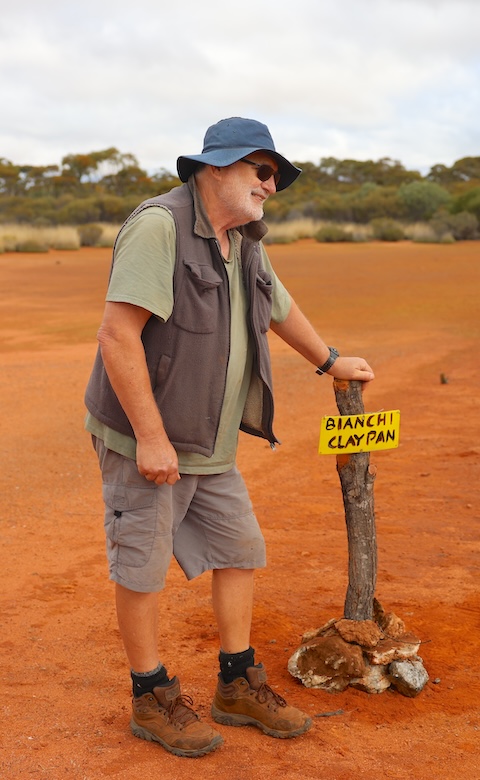
- Phil Bianchi at the newly-named Bianchi Claypan. Photo Alan McCall.
More about the locating and naming of Bianchi Claypan.
Malleefowl Nest
We stopped to inspect a disused trackside malleefowl nest.
-
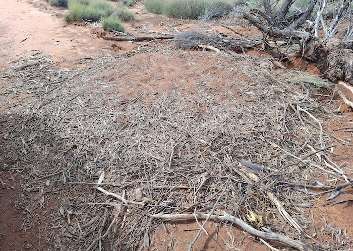
- Disused malleefowl nest east of Wallaroo Rock.
Caenyie Rock
After erecting a sign indicating the track into Bianchi Claypan we continued east along the Juardi Road and turned south to Caenyie Rock. On most modern day maps this is indicated only as ‘Rocky Outcrops’.
-
- Alan at Caenyie Rocks. Photo by Rod Dally.
Caenyie Rock is at -30.7537, 120.69321.
More information and photographs of Caenyie Rock.
To Credo Station and Rowles Lagoon
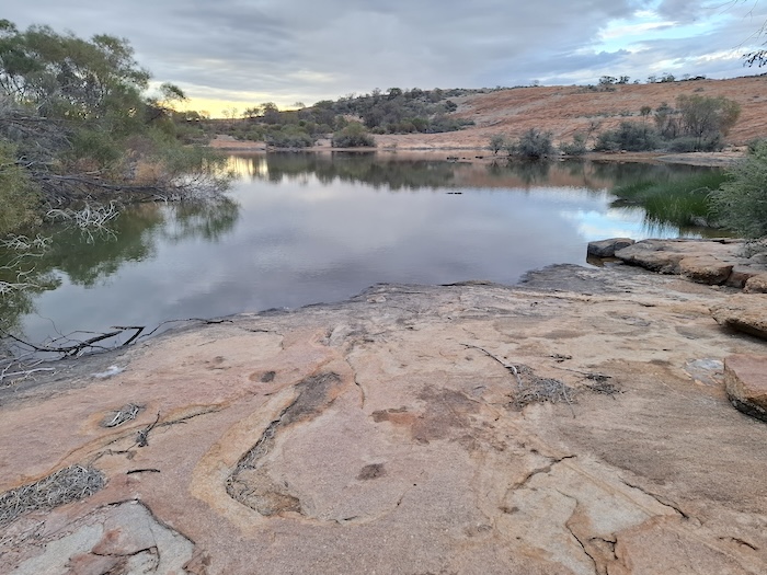
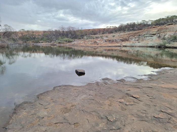
We headed north to Credo Station, another of DPaW’s buybacks to preserve an ecosystem. The was no reason to stop so we continued to Rowles Lagoon.
-
- Rowles Lagoon
We were running out of daylight and after last night’s rain that caused tents and awnings to be packed away wet there was a need to camp a bit earlier than usual.
I abandoned plans to visit Ora Banda and, at Scott’s suggestion, we selected a track west of Mount Carnage that would lead us more directly to Siberia – eventually selecting a dry, level, open overnight campsite with plenty of firewood just off the track.
-
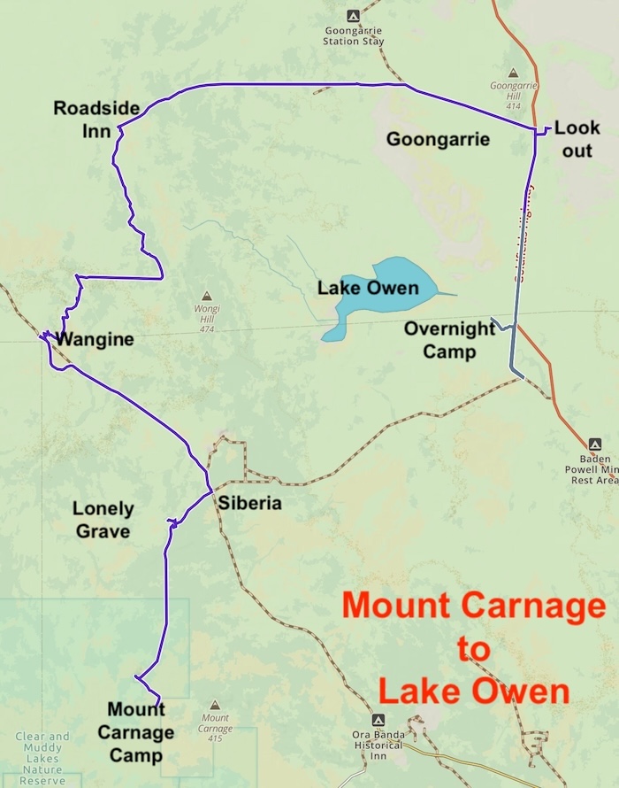
- ROUTE OF MOUNT CARNAGE TO LAKE OWEN
To Siberia
On the way to this iconic goldfields location we visited a ‘lonely grave’ not listed by Outback Grave Markers or recorded in Lonely Graves – although I expect it soon will be.
-
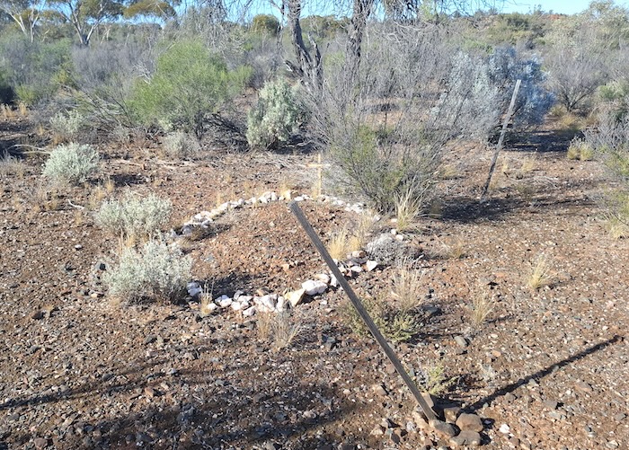
- Lonely grave.
Siberia is more correctly known as Waverley, the scene of a failed rush in 1893.
-
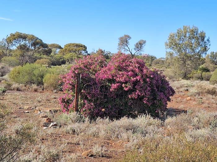
- A bougainvillea bush planted by a grieving mother in memory of her son who perished in the pursuit of the yellow metal. It is kept alive in the harsh goldfields climate by irregular watering by passersby.
We contined north to Wangine.
Wangine
Wangine was a major staging location for Cobb and Co. It was also an important point on what was to became known as the Gus Luck Track.
-
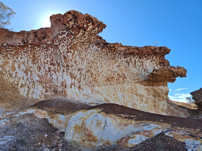
- Spectacular Wangine Breakaway.
-
- View over Wangine.
More photographs of Wangine and its spectacular breakaway.
Wangine to Goongarrie
We navigated around Wangine Lake to emerge onto a mining service road.
Some sketchy mining exploration access tracks took us to the site of historic Roadview Inn – now disappeared.
-
- Site of the now disappeared Roadside Inn. Photo Alan McCall.
Continuing north we got onto the Goongarrie Davyhurst Road that took us to the Goldfields Highway.
-
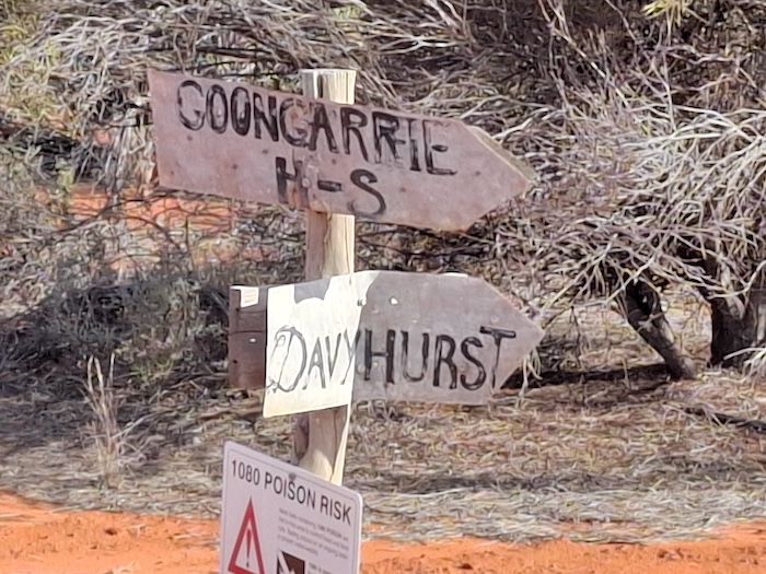
- Signposting in this part of the world is more concerned about function than form.
Goongarrie
The rich gold mining history of Goongarrie – discovered before Kalgoorlie – is still evident if one knows where to look. But Goongarrie itself is a ghost town.
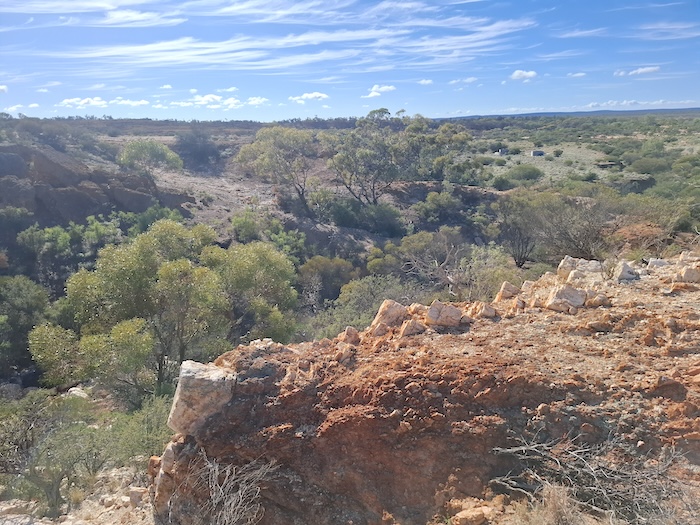
The massive amount of overburden from two open pit gold mines operational in the 1980s was utilised to create a great lookout over Lake Goongarrie. The turnoff from Goldfields Highway to the Lookout is 400 metres south of Goongarrie Road.
-
- The abandoned mine overburden has created a great lookout over Lake Goongarrie.
-
- Our crew at the Goongarrie Lookout. Photo Alan McCall.
More photographs of Lake Goongarrie.
The former Goongarrie Pastoral Station is now a DPaW campground, nine kilometres off the Goldfields Highway.
Goongarrie to creek into Lake Owen
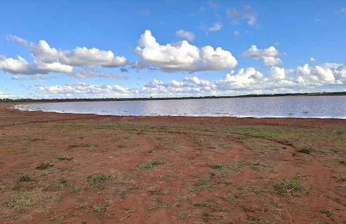
Leaving the lookout we headed south to try to investigate an old condenser reputed to be at Lake Owen.
A bogging in a feeder creek at Lake Owen put paid to the condensor investigation but we did stay overnight in the general vicinity of the lake.
-
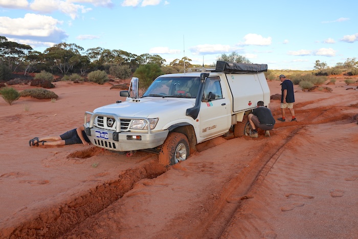
- The Patrol is going nowhere. Photo Alan McCall.
Leaving Lake Owen we transitioned to our Goczel Track Road Trip.
The Bullabulling Wallarooo Wangine Goongarrie Road Trip was from Friday 31 May to Sunday 2 June 2025.
Participants
Phil Bianchi
Rod Dally
Kim Epton
Alan McCall
Dan Wales
Scott Wilson
2130-Bullabulling to Wallaroo GPX file
2130-Wallaroo to Mount Carnage GPX file
2130-Mount Carnage to Lake Owen GPX file
2130-Waypoints for Bullabulling Wallaroo Wangine Goongarie Road Trip
© Kim Epton 2025
1396 words, 23 photographs, four images.
Photographs
Kim Epton
Rod Dally
Alan McCall
Feel free to use any part of this document but please do the right thing and give attribution to adventures.net.au. It will enhance the SEO of your website/blog and Adventures.
See Terms of Use.
