
-
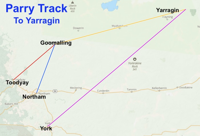
- PARRY TRACK – TO YARRAGIN
Goomalling to Yarragin
Goomalling/Slaters Well
Well No. 01 on the Parry Track – Goomalling to Yarragin
Description – Current Day
Location
Two hundred metres south-east of Goomalling-Wyalkatchem Road at the historic Slater Homestead, three kilometres north-east of Goomalling.
Download GPX file Blimmining Well to Goomalling Well.
Coordinates
31° 16′ 29.06″ S, 116° 50′ 45.43″ E
-31.274738 116.845954
Naming and History
In his 1888 Report Parry stated:
Mr Slater’s homestead Plenty of water in Mr Slater’s wells. Regular baiting [feeding] place for teams. Water could be obtained here by sinking if necessary. This is the function of the Newcastle road.
Unknown Well
Well No. 02 on the Parry Track – Goomalling to Yarragin
Description
Location
Coordinates
Naming and History
No information found.
Nenin Well
Well No. 03 on the Parry Track – Goomalling to Yarragin
Description – Current Day
This location of this well is relatively unknown, unable to be seen from the road and mush be searched for, meaning that it is visited less often than other wells on this Track. It is in reasonable condition.
Nenin Well is situated on, near the fork of two creek lines, 200 metres west off Bradley Road and unable to be seen from Goomalling Wyalkatchem Road or Bradley Road. The well is surrounded by a fence comprising of star pickets and rabbit netting.
It is a four metre diameter stone well infilled to a depth of approximately 5metres. The stone is relatively irregular in size and form. Top stones are dislodged in places.
Location
Nenin Well is in the Shire of Dowerin, on the Goomalling-Wyalkatchem Road, four kilometres west of Namelcatchem Nature Reserve.
Download GPX file Blimmining Well to Nenin Well.
Coordinates
31° 11′ 2.90″ S, 117° 8′ 51.14″ E
-31.18414, 117.14754
Naming and History
Nenin Well was an important water supply for gold seekers heading to the Yilgarn Goldfields in the late 1880s and beyond.
John Forrest recorded that he camped at ‘Neening’ during his 1869 journey to search for the lost Leichhardt expedition. It is possible that the names Neening and Naaning could have been confused, however, Naaning is not shown on public plans until 1906, so it is presumed that this reference to Neening refers to the well now called Nenin.
In 1887, Parry reported:
“Neening, 50 miles [80 km], there is a spring, said to be permanent by some of the settlers, but Mr. Adams informs me that he has seen it nearly dry. The supply might be greatly improved by deepening and enlarging present well. A very likely place for water. A dam could be made in gully to collect the surplus water. This is, however, on private land so I would advise to go on to Namelcatching, 53 miles [85km].”
The Nenin Spring was on the pastoral lease of James Sinclair, of Toodyay. Sinclair applied for freehold title to 40 acres of land around the spring. The survey was carried out by G. W. Leeming on 27 July 1891, and shows the location of the Nenin Well on the land at this time. The Crown Grant for the land was issued on 12 May 1894, at a cost of £20.
-

- Nenin Well, near Dowerin.
Naaning Well
Not an official well on the Parry Track.
Description – Current Day
Location
This well is located 300 metres south of Goomalling-Wyalkatchem Road. Interestingly, it is located part way along a rise rather than at the low point.
The carpark for the well is signposted. Approximately one kilometre west of the Minnivale Road.
Coordinates
31° 10′ 59.63″ S, 117° 10′ 47.86″ E
-31.18323 117.17996
Naming and History
John Forrest recorded the name for this well when he stayed overnight there on 22 April 1869 during his search for missing explorer Ludwig Leichhardt.
As Naaning Well is on private property and only just more than a kilometre from the government well at Namelcatchem Reserve (Namelcatching Well) it was not part of the Parry Track even though it was obviously available as a water supply if needed.
In his 1888 Report Parry stated:
“50 miles, there is a spring, said to be permanent by some of the settlers; but Mr. Adams informs me that has seen it nearly dry. The supply might be greatly improved by deepening and enlarging present well. A very likely place for water, A dam could be made in gully to collect the surplus water. This is, however, on private land so I would advise to go on to Namelcatching, 53 miles, which is on Government land, where I would suggest a well or bore. The settlers all maintain that a good supply could be got here.”
-

- Information sign at Naaning Well.
-
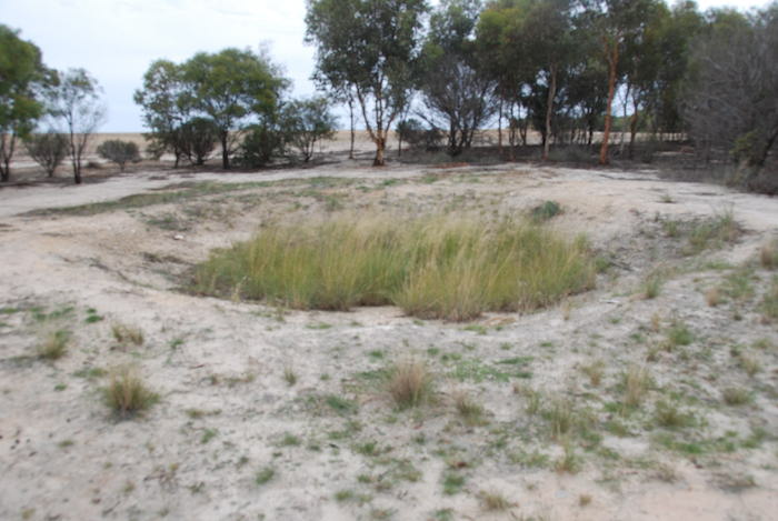
- Naaning Well near Dowerin.
Namelcatching Well
Well No. 04 on the Parry Track – Goomalling to Yarragin
Description – Current Day
This deep, stone lined well is in good condition. It is entirely enclosed in a steel cage.
Location
Namelcatching Well is in the Namelcatchem Nature Reserve on the north-east quadrant of the intersection of Goomalling-Wyalkatchem Road and Cunderdin-Minnivale Road.
Download GPX file Naaning Well to Namelcatching Well.
Coordinates
31° 10′ 55.06″ S, 117° 11′ 30.37″ E
-31.18196, 117.19177
Naming and History
Namelcatching Well was built at the request of Charles Adams, a stonemason for the Toodyay Roads Board. It supplied water for early explorers and prospectors heading to the Yilgarn goldfields. It was an important water source for horses and camels transporting passengers and supplies.
The discovery of gold around Southern Cross led to considerable traffic along the track that ran past this well.
Following the opening of the railway from Dowerin to Korrelocking in 1911, Namelcatching Well became an important water source for horse teams transporting wheat to Minnivale rail siding.
-
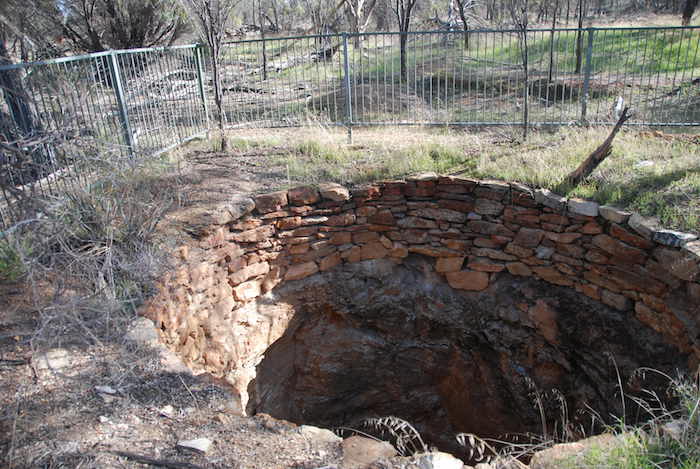
- Namelcatching Well 2017.
-
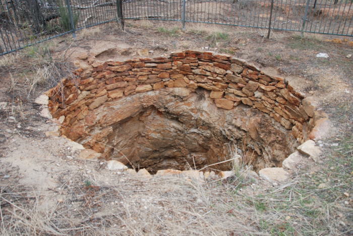
- Namelcatching Well 2015..
-
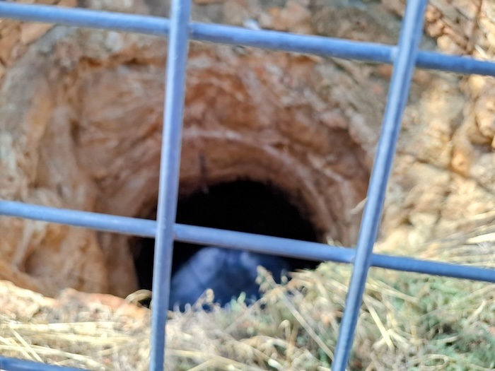
- Namelcatching Well 2026.
Benjabbering Well
Well No. 05 on the Parry Track – Goomalling to Yarragin
Description – Current Day
Location
Located in the south-east quadrant of the Goomalling Wyalkatchem/Davies South Road intersection and 100 metres south-east from it.
Download GPX file Namelcatching Well to Benjabbering Well.
Coordinates
31° 09′ 59.7″ S, 117° 17′ 44.1″ E
-31.16659 117.295576
Naming and History
John Forrest passed through this area in April 1869 and recorded the name Pingerperring. Earlier Surveyor Robert Austin was in this vicinity and recorded the name Benjabbering.
Even earlier Surveyor A.C. Gregory (he of Mount Augustus fame) recorded the name Binjermaring (perm springs) on his exploration plan.
Parry used the name Benjyberring in his 1888 Report.
In 1903 leaseholder J. Sinclair showed it as Benjabbering Spring.
Wyalkatchem Well
Well No. 06 on the Parry Track – Goomalling to Yarragin
Description – Current Day
This roadside well is in the shape of a tank rather than the traditional round well.
Location
On Goldfields Road approximately 200 metres east of the intersection with Wyalkatchem-Koorda Road, and opposite the Wyalkatchem Golf Club.
Download GPX file Benjabbering Well to Wyalkatchem Well.
Coordinates
31°10’13.2″S, 117°23’45″E
50J 537727E 6551454N
Naming and History
Wyalkatchem Well was constructed by John Haywood for the Toodyay Roads Board in 1881.
Originally 69 feet deep, it was also known as Wyalkatchem tank due to its unique rectangular form with sloped granite sides approximately five metres wide and seven to eight metres long. On the north side of the tank extensive sheets of granite adjoin a natural winter creek.
The well was originally gazetted in 1884 as a stopping place for teams of explorers heading inland along the goldfields track and other travellers to the regions such as sandalwood cutters and shepherds.
In 1915 the reserve was vested as a railway water supply and by 1917 the Wyalkatchem Well was closed to prevent travellers and their stock from polluting water running into the railway dam.
In his 1888 Report Parry reported:
“WYALCATCHING, 67 miles. A tank of about 15 feet square, at base of large granite boulder on south side of road. Could only be improved by enlarging tank; too rocky for sinking.”
-
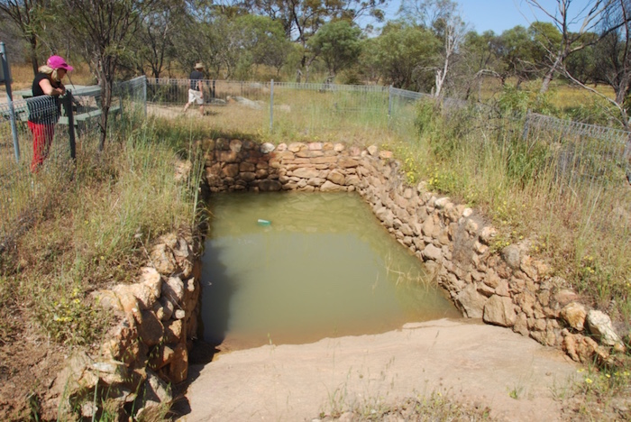
- Wyalkatchem Well/Tank 2015..
-
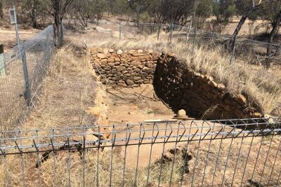
- Wyalkatchem Well/Tank 2024.
Korrelocking Well
Well No. 07 on the Parry Track – Goomalling to Yarragin
Description – Current Day
Location
This well is in the Korrelocking Nature Reserve, south of Goldfields Road and east of Tyler Road.
Download GPX file Wyalkatchem Well to Korrelocking Well.
Coordinates
31° 10′ 26.67″ S, 117° 27′ 14.04″ E
-31.174076 117.453901
Naming and History
In 1888 Parry stated:
“71 miles. A well about 700 yards on south side of road, with bad water and scanty supply. Good tanks could be made at base of enormous mass of granite close to road. Settlers advise sinking, they believe water will be got at from 20 to 25 feet.”
Gabwotting Well
Well No. 08 on the Parry Track – Goomalling to Yarragin
Description – Current Day
Location
Gabwotting Nature Reserve, Korrelocking. The well is in the Nature Reserve, 200 metres north of Goldfields Road.
Download GPX file Korrelocking Well to Gabwotting Well.
Coordinates
31° 10′ 12.4″ S, 117° 29′ 46.3″ E
-31.170123593976623, 117.49618936543176
Naming and History
Also known as Cabowally. This may have been the more correct name
In 1888 Parry noted in his Report:
“GABWOTTING, 74 miles. A small rook hole quite dry. Water might be obtained here by sinking.”
Monembudding Well
Well No. 09 on the Parry Track – Goomalling to Yarragin
Description – Current Day
Location
Moonabudding Well is 300 metres east of McNee Road and 17 kilometres east of Wyalkatchem.
Download GPX file Gabwotting Well to Moonabudding Well.
Coordinates
31° 09′ 15.1″ S, 117° 33′ 23.4″ E
-31.154183, 117.556507
Naming and History
Former names included Moonerbuding, Moonabudding and Monemuding.
In 1888 Parry stated in his Report:
“… 77 miles. Small well, only a soak: not permanent. Is often filled up by thunderstorms. Improved by enlarging.”
Yelbeni Well
Well No. 10 on the Parry Track – Goomalling to Yarragin
Description – Current Day
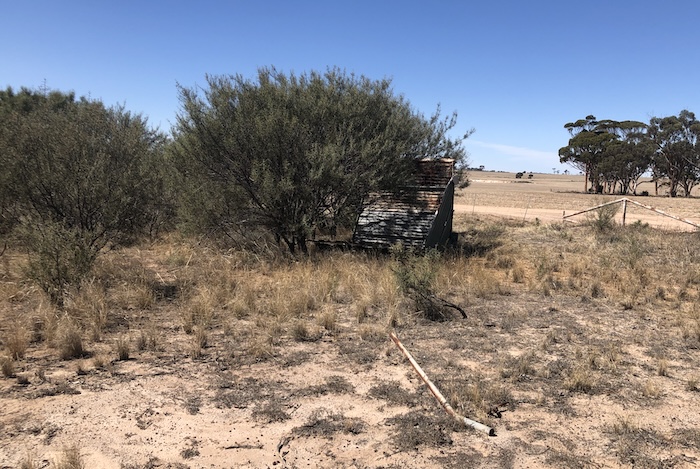
Not known
Location
Located in the Yelbeni Nature Reserve immediately north of the small settlement of Yelbeni.
Download GPX file Moonabudding Well to Yelbeni Well.
Coordinates
31° 09′ 53.4″ S, 117° 39′ 46.6″ E
-31.16482, 117.66294
Naming and History
Other former names were Yellbene and Yelburning.
Parry stated in his 1888 Report:
“… 83 miles. Well 25 feet deep. About two feet of water, but not very good. I would suggest, deepen this.”
Swamp Well
Well No. 11 on the Parry Track – Goomalling to Yarragin
Description – Current Day
The well is located on the perimeter of an extensive flat clay area. There are two perimeter fences around the well.
The five metre diameter well is constructed of stones of consistent shape and size. There is extensive erosion of the earth around the well and subsequent loss of perimeter stones particularly evident on the south side of the well although the well still holds water.
Location
This well is about 180 metres south of Goldfields Road and west of Swamp Well Road at North Yelbeni.
Download GPX file Yelbeni Well to Swamp Well.
Coordinates
31° 06′ 54.9″ S, 117° 43′ 39.1″ E
-31.115242, 117.727517
Naming and History
In his 1888 Report Parry recorded:
” … where there is a very likely place for a well. At this place there is a small sand hole about 10 chains [200 metres] on south side of road surrounded with banksia trees, which are a good indication [of water].”
Trayning Well
Well No. 12 on the Parry Track – Goomalling to Yarragin
Description – Current Day
Location
This historic well is on the north-west side of Kellerberrin-Bencubbin Road in north Trayning, 100 metres south-west of Keene Road. It is well signposted and there is a gravel parking area adjacent.
Download GPX file Swamp Well to Trayning Well.
Coordinates
31° 03′ 32.9″ S, 117° 48′ 09.9″ E
-31.05914, 117.80275
Naming and History
-
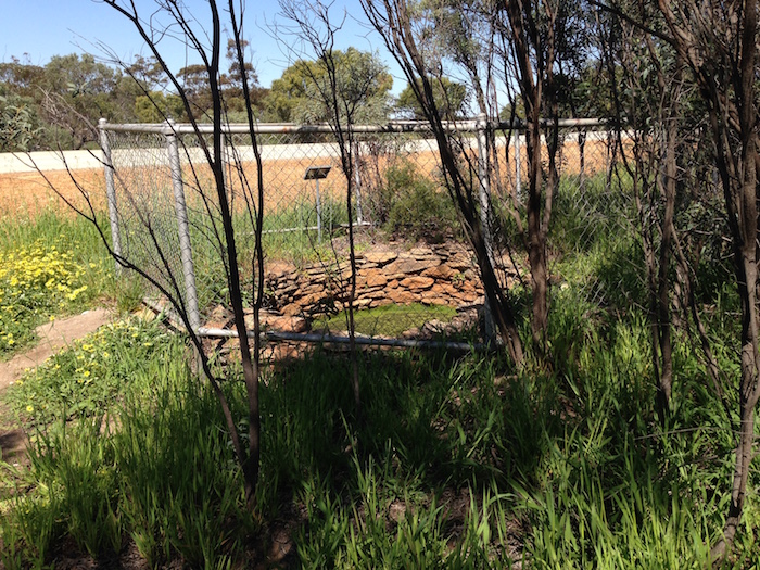
- Trayning Well 2015
-
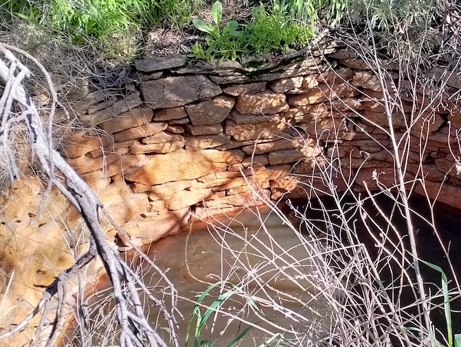
- Trayning Well 2021
-
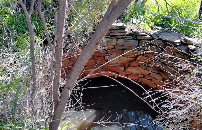
- Trayning Well.
-
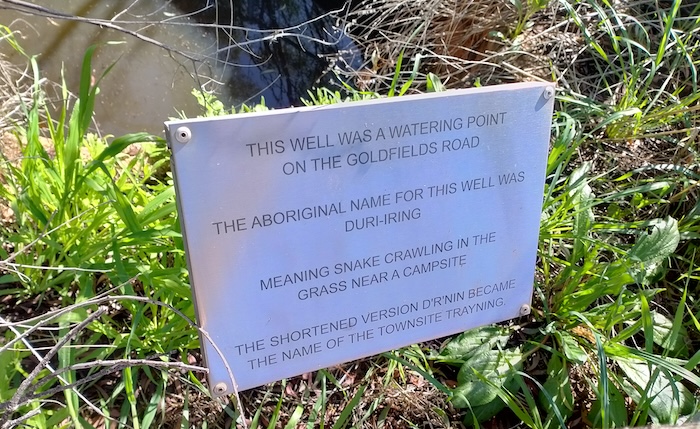
- Sign at Trayning Well
-
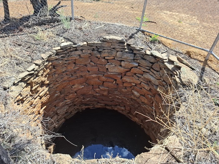
- Trayning Well
-
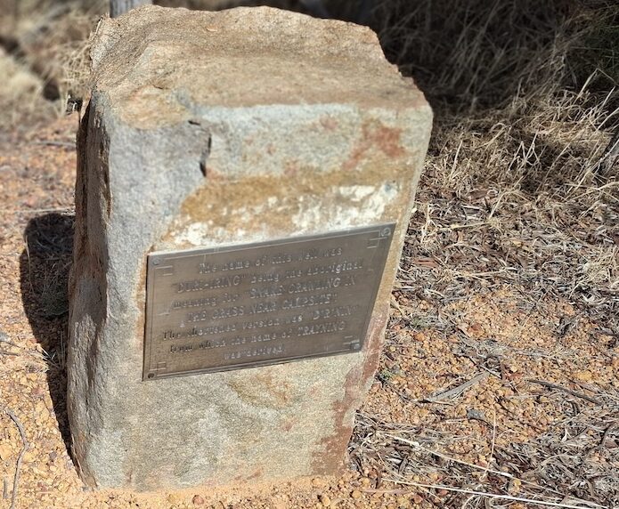
- Trayning Well plaque
Moujakine Homestead Well
Well No. 13 on the Parry Track – Goomalling to Yarragin
Description – Current Day
Location
Moujakine Homestead Well is in a paddock along Moujakine Road between Thompson Road and Keene Road. The well is to the west of the road although close to the fence. On the east side of the road is a sign stating “Original Glass Family Homestead site”.
Download GPX file Trayning Well to Moujakine Homestead Well.
Coordinates
31° 2′ 45.49″ S, 117° 51′ 58.57″ E
-31.04597 117.86627
Naming and History
After a small nugget of gold was found while cleaning out this well early in 1887, the Newcastle and Northam Settlers Association commissioned Bernard Henry Colreavy, a prospector, to examine the area. His party penetrated the country as far as the Yilgarn Hills, a distance of about 320 kilometres.
The gold find in the well and subsequent appointment of Colreavy ultimately led to the discovery of the Golden Valley goldfield by Greaves, Payne and Anstey which sparked off the Yilgarn gold rushes. An important moment in Western Australia’s historical timeline.
-
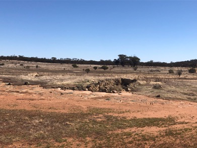
- Moujakine Homestead Well.
-
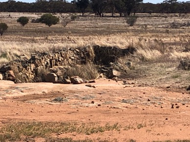
- Moujakine Homestead Well.
White Man Rock Well
Well No. 13b on the Parry Track – Goomalling to Yarragin
Description – Current Day
The historic well is at the end of a dirt track through open bush land, 50 metres past White Man Rock. The well and rock are on private property (an area of bush on a farm) .
The well has been fenced and is reasonable condition, if a little overgrown.
Location
This well is 11 kilometres north-east of Trayning, adjacent to White Man Rock. There are a number of directional signs to White Man Rock but none that mark the actual entry, which is directly opposite the western end of Thompson Road.
It is in bush land on private property (farm) on Moujakine Road.
Download GPX file Moujakine Homestead Well to White Man Rock Well.
Coordinates
31° 2′ 30.54″ S, 117° 51′ 42.55″ E
-31.041817, 117.861819
Naming and History
While surveying in the Moujakine area in 1889, Surveyor H.S. King located an unusual quartz pillar on a ridge of quartz in the NW corner of Charles Glass’s property that he termed ‘the White Man’.
-
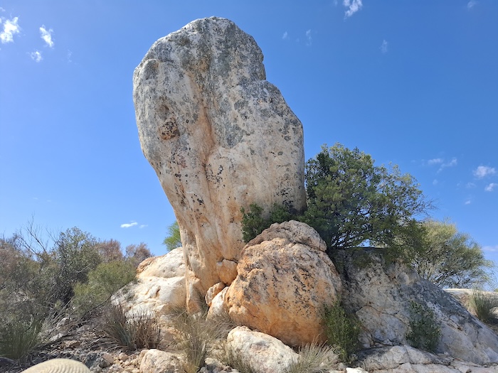
- The stunning quartz oddity named ‘White Man’ from which the well got its name.
-
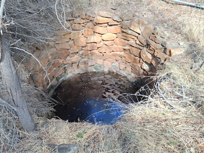
- White Man Rock Well at Moujakine – 2026.
-
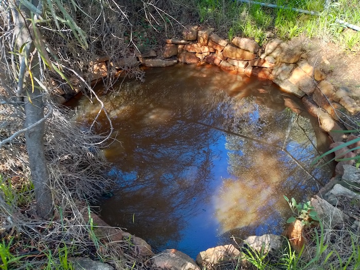
- White Man Rock Well at Moujakine – 2022.
-
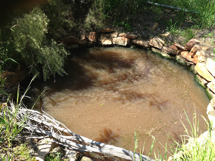
- White Man Rock Well at Moujakine – 2015.
Yarragin Well
The track from Goomalling and the track from York converged at Yarragin. From here travellers either took the Sandalwooders Track or the Adams Track to the goldfields at Ennuin.
Download GPX file White Man Rock Well to Yaragin Well.
References
Go to Sandalwooders Track
Go to Adams Track
Go to Parry Track
Go to Toodyay-Goomalling Feeder Track
Go to Northam-Goomalling Feeder Track
Go to York-Mangowine Feeder Track
© Kim Epton and Gary Arcus 2026
1980 words, 20 photographs, one image.
Feel free to use any part of this document but please do the right thing and give attribution to adventures.net.au. It will enhance the SEO of your website/blog and Adventures.
See Terms of Use.