Day 6 – Thursday 22 May 2025
-
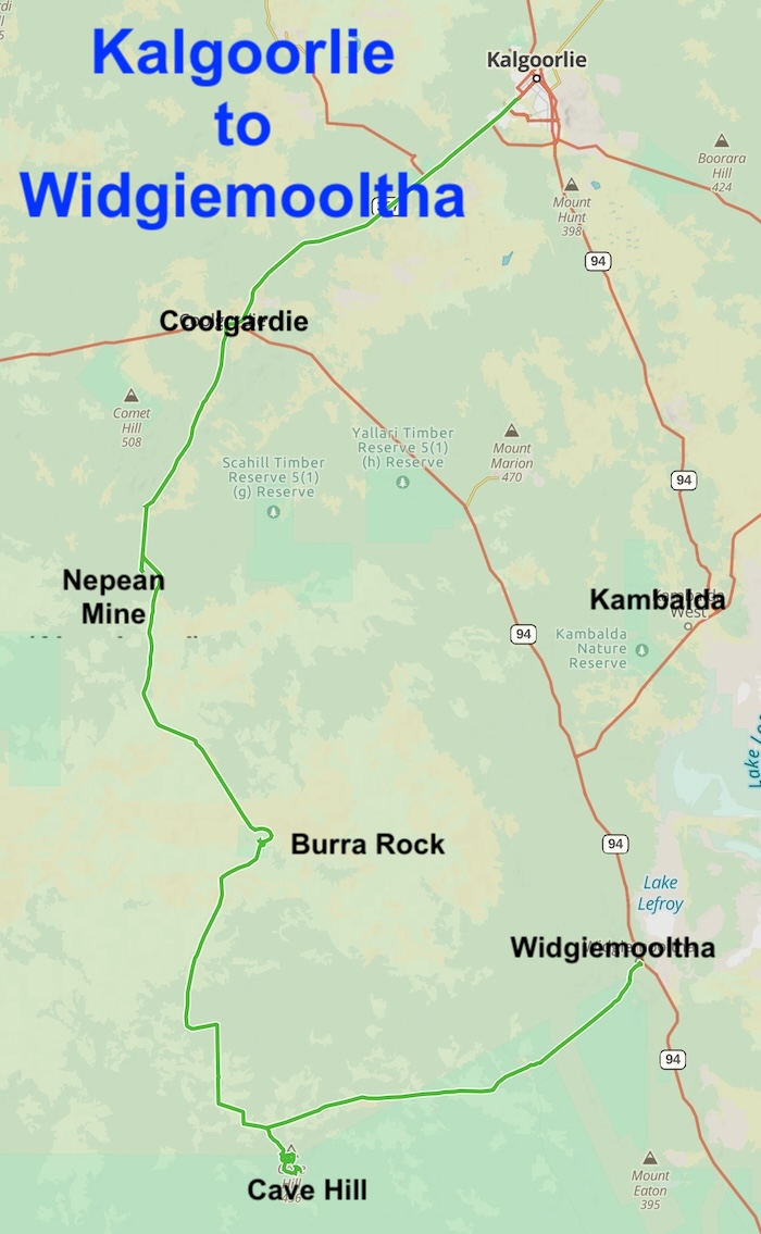
- ROUTE OF DAY 6
Leave Kalgoorlie
The Tour headed out of Kalgoorlie west to Coolgardie and then south to the abandoned Nepean Nickel Mine.
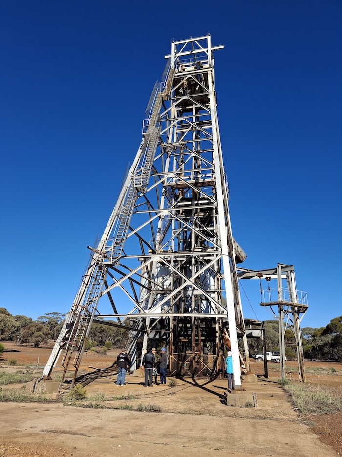
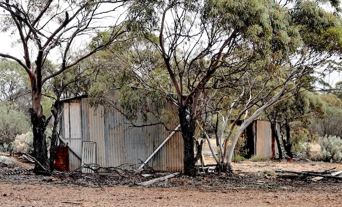
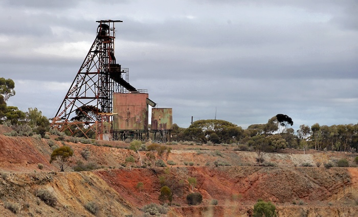
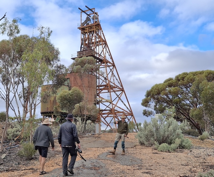
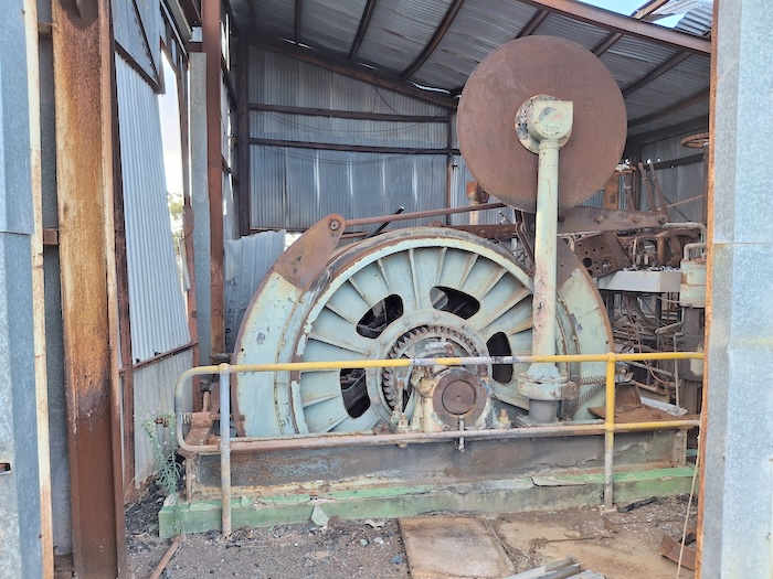
Nepean Nickel Mine
The Nepean Gold Mine was nearby the (now abandoned) Nepean Nickel Mine. It operated from 1897 to 1899 – its short life a consequence of low gold grades.
-
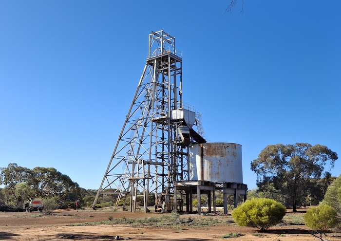
- Nepean Nickel Mine Headframe. Photo Rod Dally.
-
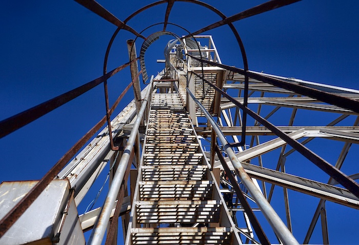
- Nepean Nickel Mine Headframe. Photo Richard Carver.
The Nepean nickel deposit was discovered from drilling by Metals Exploration in March 1968. Mining started in 1970, a joint venture between Metals Exploration NL and Freeport of Australia.
The Nickel Boom
The discovery of nickel sulfides in 1966 marked the beginning of the Western Australia’s nickel boom.
In September 1969, Poseidon NL announced a significant nickel discovery at Mount Windarra, near Laverton, in September 1969.
This discovery sparked a surge in investment on the stock market, particularly in Poseidon shares.
The Vietnam War and the aerospace boom (the Cold War race for the moon) drove up the demand for nickel, a key component in stainless steel used in military equipment and rockets. Additionally, industrial action against the major Canadian supplier Inco caused a shortage. These factors pushed the price of nickel to record levels. While the underlying demand for nickel was real, the rapid rise in share prices, largely driven by speculation and corporate skulduggery at its finest, created a bubble that eventually burst.
Poseidon NL became the symbol/the darling of the boom. The price of Poseidon shares soared from around $1 in October 1969 to $100 by December 1969, topping out at an intraday high of $280 per share on 5 February 1970 – although some pundits forecast a price of $325.
All up, 242 new company floats raised the equivalent of $35b today.
A detailed case study of the 1969-70 nickel boom-bust is here.
Despite all the attention, Poseidon NL Mt Windarra was not the first nickel mine in WA.
The Poseidon bubble revealed a number of improper trade practices. Parliamentary action, notably the Rae Committee report, ultimately led to Australia’s national companies and securities legislation.
-
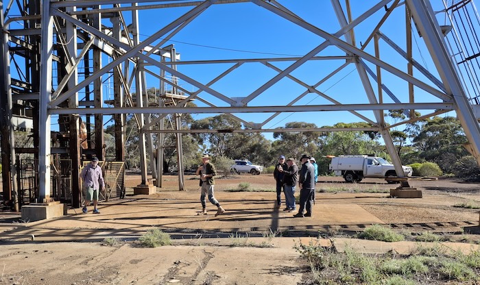
- Some of the group at the Nepean Nickel Mine. Photo Rod Dally.
-

- Winder cage at Nepean Nickel Mine. Photo Rod Dally.
Till the mine closed in 1987, it produced 32,000 tonnes of nickel at an average grade of 3% Ni. The lease is now owned by Focus Minerals which holds most of the gold mines north of here to Coolgardie.
-
- Nepean Nickel Mine Headframe. Photo Rod Dally.
Read more about the Nepean Nickel Mine.
Kambalda had a number of mines operating in the late 1960s.
The Silver Lake nickel mine was a shaft access mine developed on the Lunnon Shoot, on the southeast flank of the Kambalda Dome. It was named after diamond driller Jack Lunnon who drilled the discovery hole, KD1, in 1966. The mine was operated by WMC Resources Ltd (WMC) continuously from 1966 until its closure in 1986, producing 4.5 million tonnes of ore at 2.7% Ni for over 123,000 tonnes of nickel metal.
The historical workings of the Silver Lake mine and the nickel shoots it hosts plunge for approximately 2.5 kilometres to the south-southeast and extend over a vertical distance of at least 350 metres (from lake surface to 50 metres below sea level). Silver Lake was the third largest nickel mine in Kambalda after Otter-Juan and Long Shaft (now both owned by Wyloo).
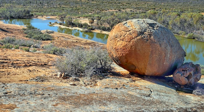
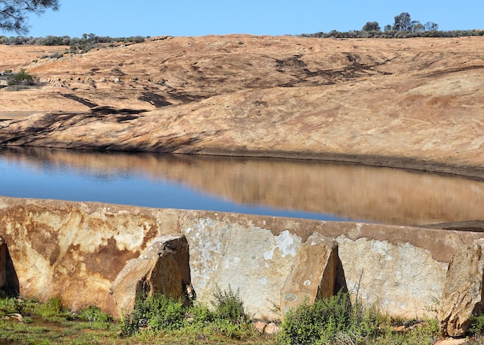
Burra Rock
Leaving Nepean we headed south to Burra Rock. This was an important woodline centre for half a century.
-
- Reservoir at Burra Rock. Photo Richard Carver.
-
- Old Woodline just south of Burra Rock. Photo Richard Carver.
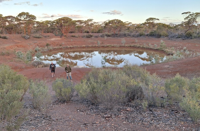
It’s an easy climb to the top of Burra Rock. As with virtually all granite outcrops in the region it has harvest walls and a reservoir. Beautiful craftmanship.
Cave Hill
Cave Hill was named by surveyor/explorer C.C. Hunt in 1864 while he was seeking pastoral land on behalf of the government and, possibly, a route through to South Australia.
Cave Hill was a major woodline depot.
Going back to at least the 1980s (and perhaps for many years prior) the Cave Hill area has been the home of an elusive, almost phantom, herd of feral donkeys. While there is plenty of excrement evidence of their existence, sightings are rare and, for the writer, non-existent.
-
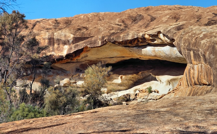
- The ‘cave’ at Cave Hill is great example of a tafone. Photo Richard Carver.
-
- Water catchment a Cabe Hill. Photo Ricgard Carver.
-
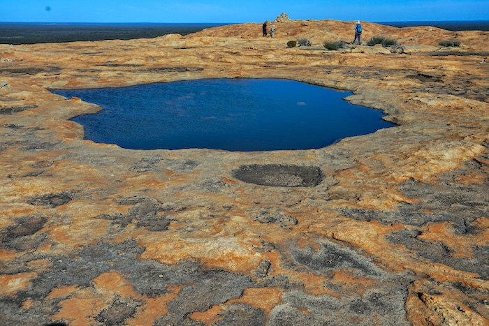
- Pool on top of Cave Hill. Photo Richard Carver.
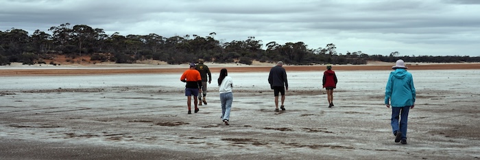
Some chose to climb the outcrop to view the reservoirs and have lunch while on the rock.
-
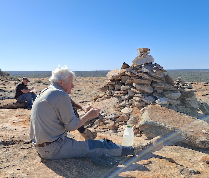
- Wayne having lunch at Cave Hill. Photo Rod Dally.
After an inordinate/inexplicable delay those that wanted to see the cave did so. The ‘cave’ at Cave Hill is a magnificent example of a tafone.
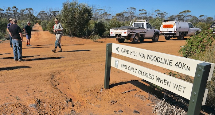
We left Cave Hill intending to hook up with the Cave Hill-Widgiemootha Road. A short distance along the track Wayne and Richard, in the lead vehicle, encountered a long stretch of water over the track.
What to do? Go through, find a way around or return to Widgiemooltha Road the conventional way?
I advised over the radio that, from my previous experience, I considered the track to be ‘problematic’ at best. We searched for a way around the boghole without success and eventually decided to return to the Widgiemooltha Road via the west side of Cave Hill.
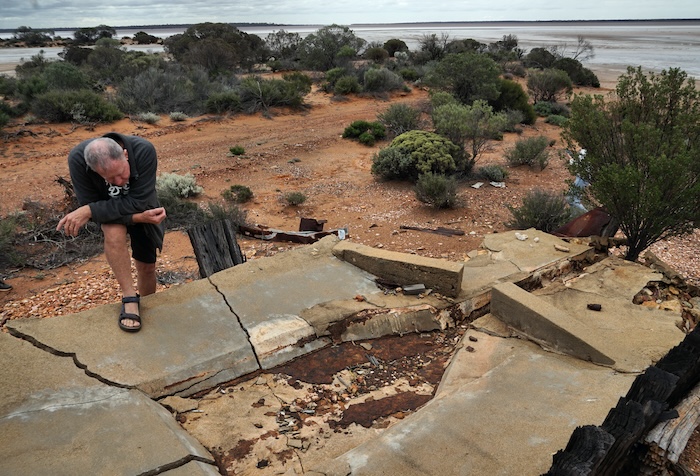
Widgiemooltha
Widgiemooltha, 98 kilometres south of Kalgoorlie-Boulder, is in the Shire of Coolgardie. Gold was discovered in the area in the mid-1890s, not long after the establishment of Coolgardie. It was gazetted as Widgiemooltha in December 1897.
The name is aboriginal in origin and is variously thought to be the name of a hill or nearby rock hole but, more than likely, it means, or is related to the beak of an emu. The difficulties of a non-written language.
-
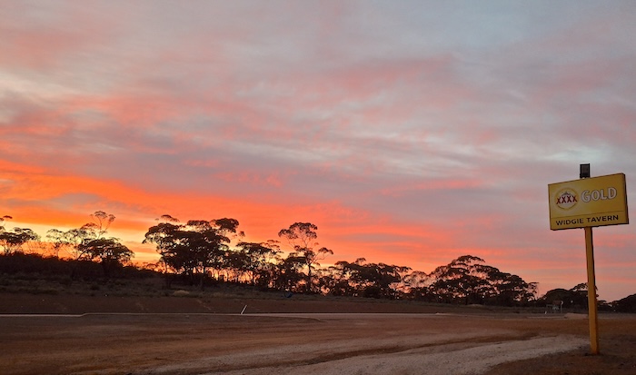
- Sunset from outside the Widgiemooltha Tavern. Photo Rod Dally.
By 1898 the town, on the southern shores of Lake Lefroy, had a population of 100 men and 12 women. After the arrival of the railway line in 1908, the townsite was moved to the siding about 1.5 kilometres southwest of its original location. The 1908 townsite is at the rear of the current Widgiemooltha Tavern and Roadhouse.
By 1909, the town consisted of two hotels, a post office, an empty baker’s shop, and some surveyed yet unoccupied residential lots.
-
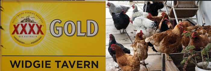
- Resident chopoks at the Widgie Tavern. Photo Richard Carver.
Until 1944 there were up to six variant spellings of the town’s name. after which time the current spelling Widgiemooltha was confirmed.
Currently the town has no electricity supply, no water supply and no waste services. I hope the residents don’t pay rates. Proximity to the Coolgardie-Esperance Highway and the consequent trade from the passing traffic keeps the hamlet alive.
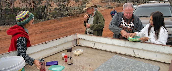
Campfire
On arrival at Widgie, late afternoon Rod and Kim departed on a firewood acquisition mission and, with some difficulty, secured sufficient fuel to counter the zero overnight temperature.
-
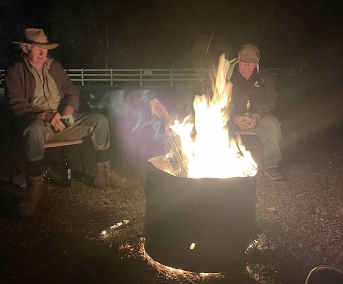
- Wayne and Ivan at the campfire. Photo Tassy Epton.
Rod’s incisive comments on the straightness of the drag marks of Kim’s chair back to his camp were noted. Both nights.
Additional Photographs of Day 6.
Day 7 – Friday 23 May 2025
Widgiemooltha Circuit North
-
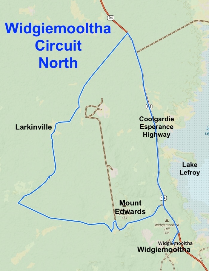
- ROUTE OF DAY 7 WIDGIEMOOLTHA CIRCUIT NORTH
Larkinville
-
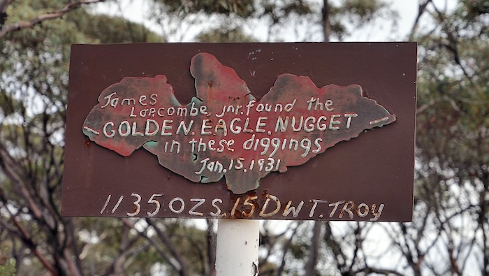
- Site of the Golden Eagle nugget find at Larkinville. Photo Richard Carver.
-
- Prospectors sheds at Larkinville. Photo Richard Carter.
In 1931, 17 year old Jim Larcombe discovered the largest gold nugget ever found in Western Australia. The nugget, named Golden Eagle for its resemblance to a bird, weighed 1,136 ounces and required two men to lift it properly.
The discovery of the Golden Eagle during the Great Depression caused a rush to the Widgiemooltha area.
Mount Edwards
Gold discoveries in the Mount Edwards’ area date back to the 1890s.
However, identification of multiple nickel sulphide deposits in the 1960s and 70s shifted the focus to nickel. Mount Edwards is still an active nickel mining area.
It is reported that Mount Edwards is considered highly prospective for ‘new economy‘ metals.
-
- Kim at Mt Edwards Decline Portal. Photo Richard Carver.
Surveyor/explorer C.C. Hunt named this hill to honour Mounted Constable Thomas Edwards (1833-1907) of Beverley who accompanied H.M. Lefroy on his 1863 exploration and was also with Hunt in 1864.
-
- Ivan scurrying to get his share of Jan’s pikelets before Wayne, Kim and Tassy scoff them all. Photo Richard Carver.
Widgie Cemetery
The Widgie Cemetery is unmarked, unofficial, unusual and isolated but very much worth a visit.
-
- Kim inspects a derelict gold sluice before crossing over to Cemetery Island. Photo Richard Carver.
-
- Rod, Wayne, Tassy, Kim, Jan and Esme crossing to Cemetery Island. Photo Richard Carver.
Read more about Widgiemooltha Cemetery.
Widgiemooltha Circuit South
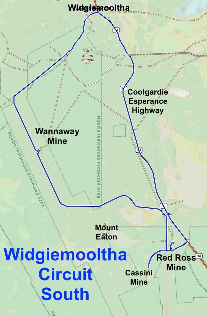
After a brief hiatus at Widgiemooltha the Tour transitioned onto the Coolgardie-Esperance Highway. The journey south, and subsequent exit off the highway onto Redross Road, was chaotic. Given the amount of high speed traffic, much of it multi-trailer, heavy haulage, articulated trucks, it was fortunate there was no traffic incident.
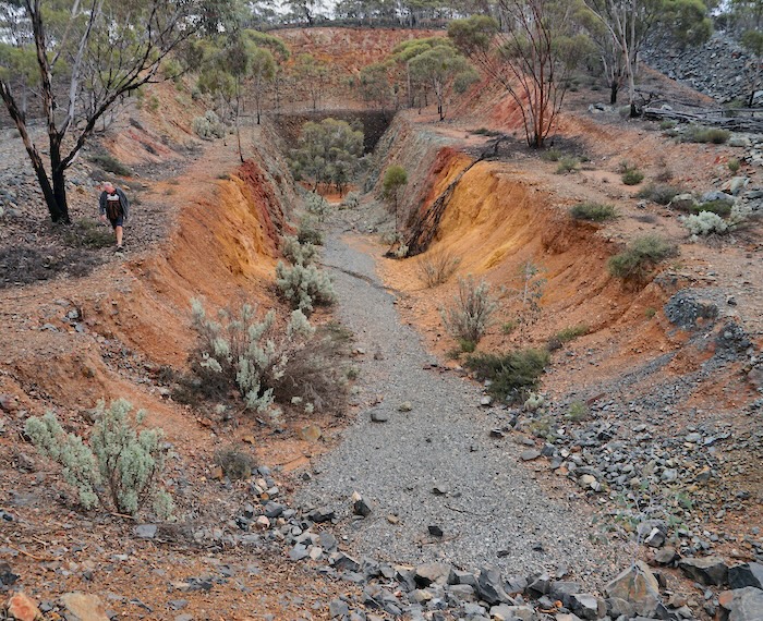
Redross Mine
We visited Cassini Mine (actually just the gate preventing access to the mine) before checking out Redross Mine.
-
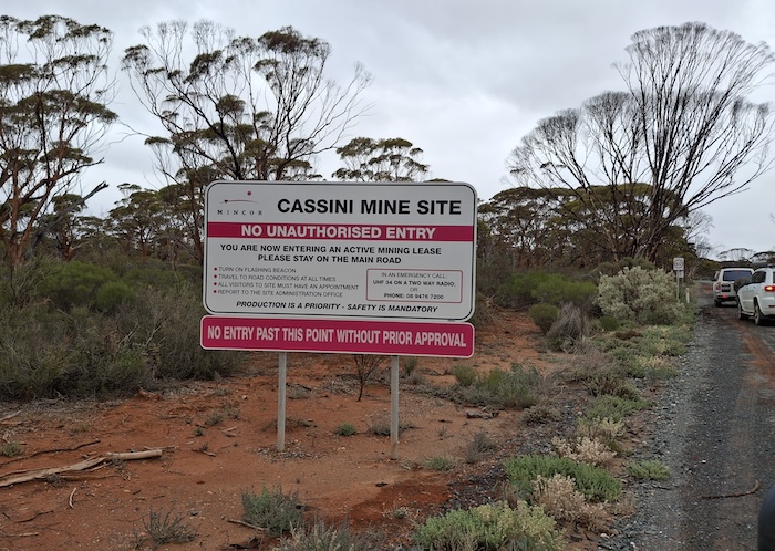
- Entrance to Cassini Mine.
The Redross nickel mine is located about 20 kilometres SSE of Widgiemooltha.
-
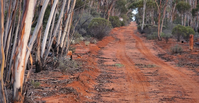
- Track into Red Ross Mine. Photo Richard Carver.
The deposit was discovered in 1968 by Ross Kennedy, a red-headed geologist who worked for Anaconda Resources. Ross found a gossan that assayed well enough to merit follow-up drill testing.
-
- Red Ross Headframe. Photo Richard Carver.
-
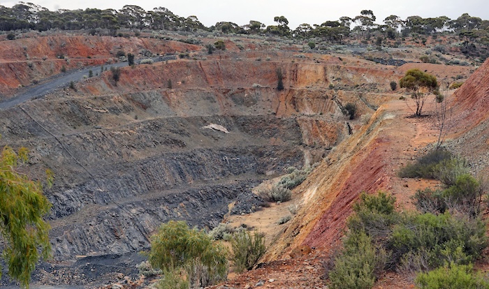
- Red Ross Open Pit. Photo Richard Carver.
Mining started in 1974 but closed early 1978 mainly as a result of low nickel prices. It is claimed by one authoritative source that a contributing factor to the closure was poor management by Anaconda. The value of having a person who was there at the time to counter this is invaluable:
“Anaconda Australia Inc with their JV partners CRA and North Broken Hill was a great company that built many houses in Norseman and supported the local Dundas Demons Football Club with whom I played. The company provided their mine bus named the ‘Redross Roadrunner’ to the Club.” Wayne Monks.
Open pit mining by Western Mining Resources started in the early 1990s. A decline leading to an underground mine was built later. Later still, WMC closed the mine.
-
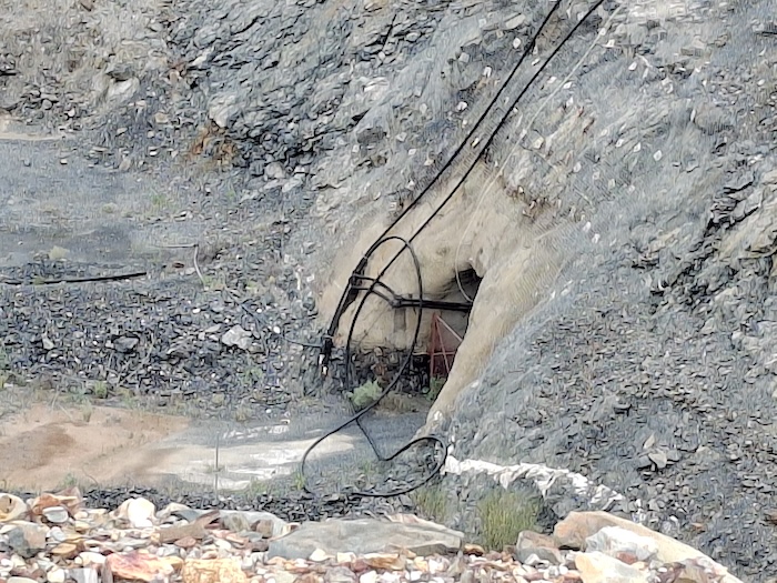
- Portal at Redross Mine. Photo Rod Dally.
-
- Kim, Richard and Wayne walking up to Redross Headframe. Photo Rod Dally.
Redevelopment started in 2003 but the mine closed some years later.
Wannaway Mine (abandoned)
Wannaway was discovered by Anaconda and CRA in 1969. A shaft was sunk to test the deposit across 1971-1972.
It was mined between 1984-1998 by Western Mining Corporation. During this period 553,000 tonnes was mined at 2.3% Ni from 12,560 of Ni ore. The ore body was depleted by 1998 and the mine abandoned.
However, a second higher grade orebody was discovered alongside the original one, and mined by Mincor Resources between 2001-2008 before again this was depleted and the mine closed. During this period 524,000 tonnes of ore was mined at 3% Ni from 15,844 tonnes of Ni ore and 13,931 of Ni concentrates.
At one time Mincor Resources owned and operated all the nickel mines across the Kambalda and Widgiemooltha Domes. The operations at Miitel, Mariners, Cassini, and Otter-Juan came under control of Andrew Forrest’s Wyloo Metals when it acquired Mincor Resources in 2023. Along with Ring of Fire Metals the combination is, since November 2023, known as Wyloo.
-
- Winder at the anbandoned Wannaway Mine. Photo Rod Dally.
Read more about the Wannaway Mine.
Wannaway Dam
-
- Kim and Wayne leaving Wannaway Dam. Photo Rod Dally.
There was not much light left in the day as we returned to Widgiemooltha.
Campfire
Another firewood mission was mounted with good results. Fortunate because it was a another zero degree morning.
As with all boomer gatherings around a campfire the state of world affairs was dissected and the outlook was not good. The only agreed upon determination was that Gen Z has a challenge.
Go to Menu
Go to Around Norseman
© Kim Epton 2025
2010 words, 28 photographs, four images.
Photographs
Richard Carver
Tassy Epton
Rod Dally
Kim Epton (unacknowledged)
Feel free to use any part of this document but please do the right thing and give attribution to adventures.net.au. It will enhance the SEO of your website/blog and Adventures.
See Terms of Use.