The Old North Road Stock Route extended between Geraldton and what is now Star Swamp Reserve in North Beach.
In the 1870s cattle were brought south from Geraldton along this Stock Route and supplies for mining, exploration and general use headed north to Geraldton. Today, it is quite difficult to follow the Stock Route as much of it is now on private land or inaccessible reserves.
However, Gary Arcus managed to put together a route that incorporated a good number of sites from the historic Stock Route. Unfortunately there are no clearly defined wells remaining and a bit of guesswork was needed for some sites, however, the Road Trip successfully visited some rarely-seen places along rarely-used tracks.
Generally, the route was a mix of bitumen, gravel, soft sand tracks, and heavily overgrown tracks.
-
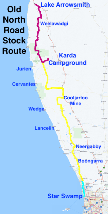
- Star Swamp to Lake Arrowsmith
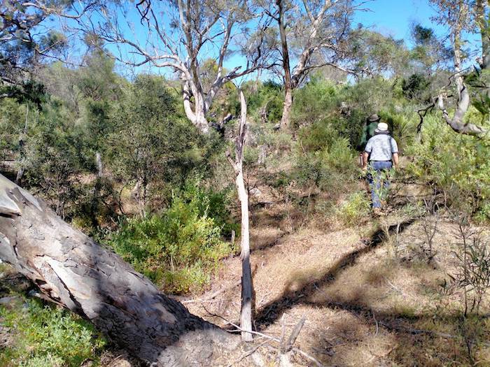
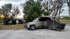
Star Swamp
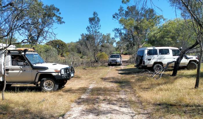
The Road Trip started from Star Swamp on Tuesday 18 October 2022. Gary was Trip Manager in a Pajero Wagon followed by Bob and Cath in a Landcruiser Troopy, Graham and Kim in a 79 series trayback with canopy, Tom in a Pajero Sports Wagon and Keith was Sweep in a V8 Landcruiser trayback with canopy.
Star Swamp was a watering point for drovers taking cattle to Fremantle. From 1896 it was used as a Quarantine Station for camels from India and South Australia destined for the Eastern Goldfields.
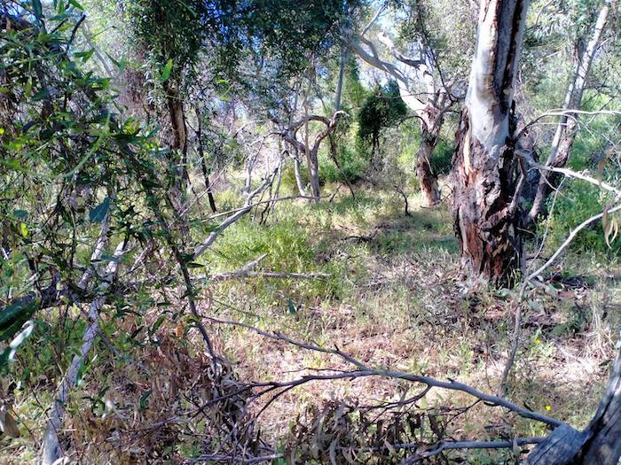
Today, Star Swamp is in 96 hectares of a bushland Nature Reserve.
-

- Star Swamp.
-

- Walk track around the Reserve.
-
- Star Swamp.
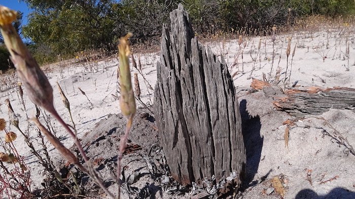
Boongarra Well
From what was the terminus at Star Swamp it is difficult to follow the Stock Route or indeed find any evidence of it until Boongarra Well, about a kilometre west of Indian Ocean Drive at Two Rocks and 45 kilometres north of Star Swamp. This well has been totally overgrown by bushfire regrowth.
Boongarra Well was built by Walter Padbury in the early 1850s on his pastoral lease in the area. He built stockyards at Boongarra that he made available to anyone.
Heritage Council reports in 1994 and 2004 state that Boongarra was a rectangular soakage about 8 metres by 5 metres that had been excavated to a depth of about 3 metres. The excavated earth was held back by large logs and bullrushes were growing in the water. There were no remnants of the stockyard.
The existing location we visited, while it had three logs remaining that most probably did form part of the construction, hardly resembles a well.
Neergabby
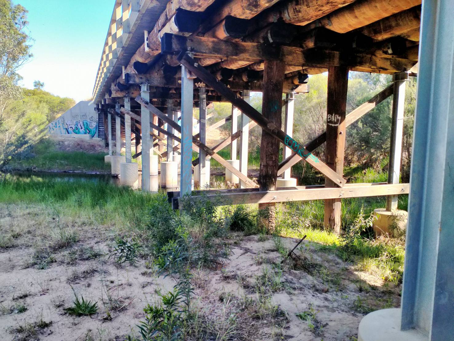
Our journey continued up Indian Ocean Drive past Woodridge and on to Gingin Brook Road. At Neergabby on the banks of the Gingin Brook is the first quality relic of the Stock Route.

The name ‘Neergabby’ was in use from 1847. It was an important resting place and watering hole from at least 1855. The area flooded often and the Junction Bridge over the Gingin Brook was built in 1860 – this being the confluence or junction of the Gingin Brook and the Moore River.
-
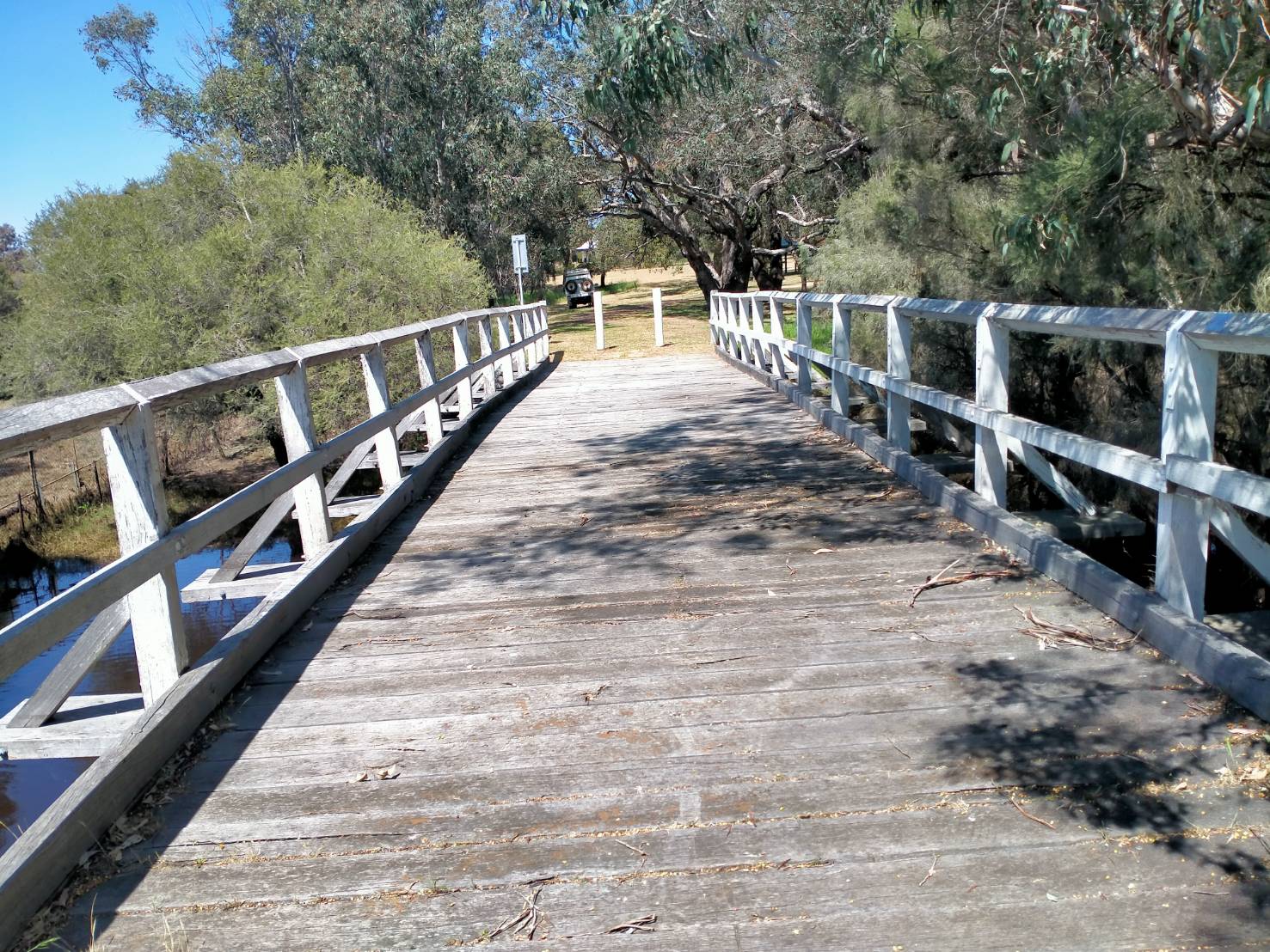
- The old Junction Bridge at Neergabby.
The Junction Hotel was built in 1874 and today it is a private house a short distance north-east of the bridge. This was the only wayside house between Perth and the Hunting Kangaroo Arms at Allanooka Swamp, 255 kilometres to the north.
-
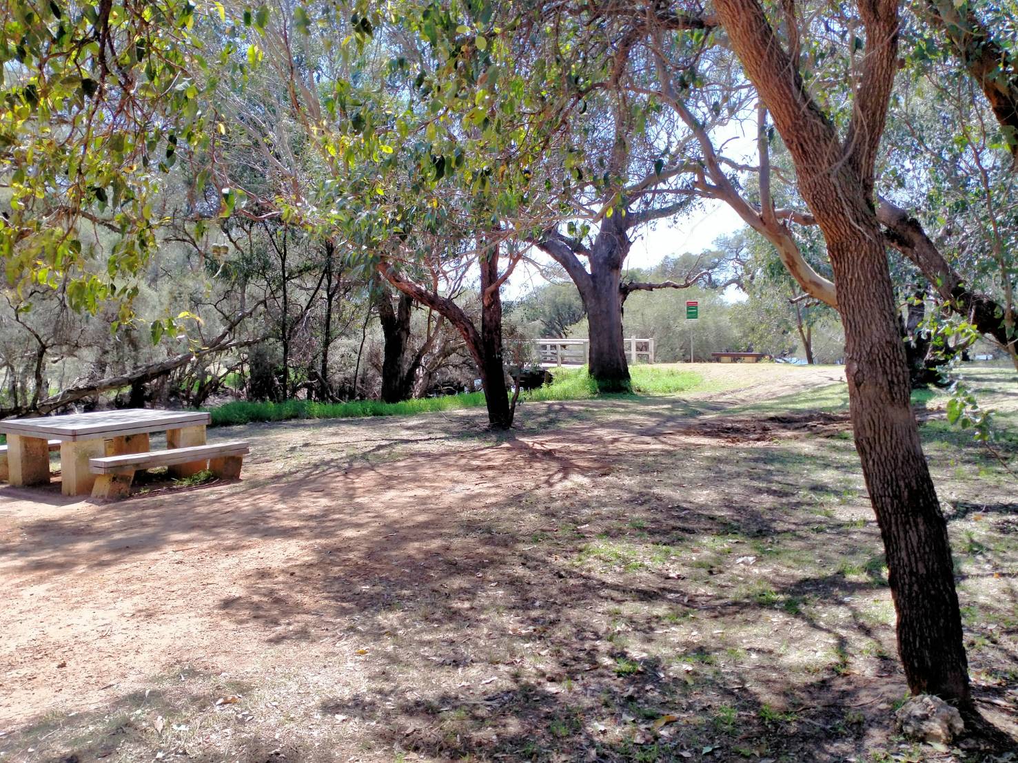
- A beautiful, well-tended Reserve.
A hall, cricket ground and racecourse were built around what was a large camping area for the drovers on the Old North Road, and along with the Junction Hotel this whole precinct was the centre of community life in the district. After the railway line was constructed through Gingin in 1891 there was a gradual decline in the use of the area.
-

- Some of our vehicles at the Junction Bridge Reserve.
-

- The Gingin Brook had spread beyond its banks.
Stone Paved Road
We moved on to Cowalla Road. Just before this historically important road is the remains of a sealed part of the Stock Route. Historically very interesting and very important but without visual appeal for even the keenest history buff let alone your average tourist.
Cowalla Bridge
We again crossed the Moore River at Cowalla Bridge, just past Orange Springs Road.
-
- Bob and Gary at Cowalla Bridge.
Mimegarra Road more closely follows the Stock Route so we turned off Cowalla Road and after eight kilometres pulled in to the site of Nine Mile Well, now unrecognisably altered by the mining of diatomaceous earth, an activity since discontinued. This is on the old Stock Route.
We then continued on Mimegarra Road past Nilgen. It was in this area the Road Trip needed to take a diversion along Meadows Road and an unnamed south/north track to skirt the Lancelin Training Area. After four kilometres or so of westward travel along the northern boundary of this prohibited area we again headed north, again on the actual Stock Route Reserve.
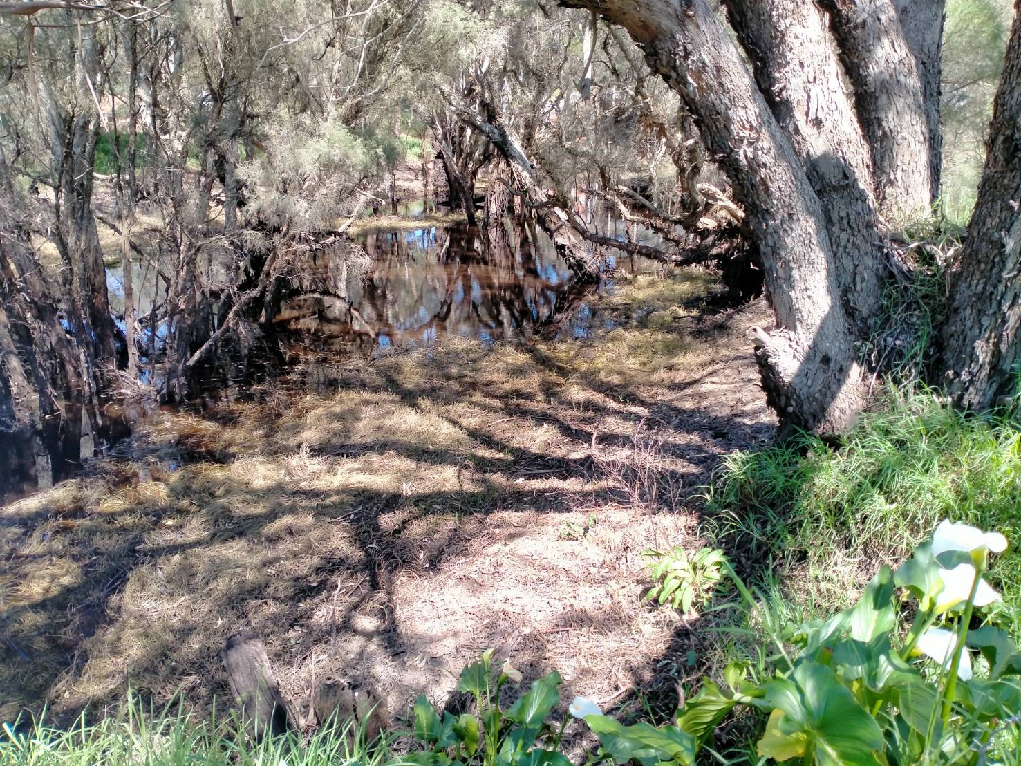
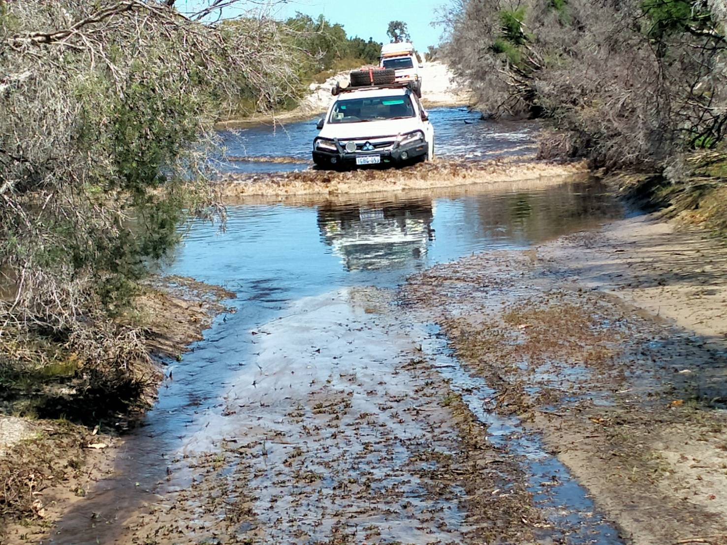
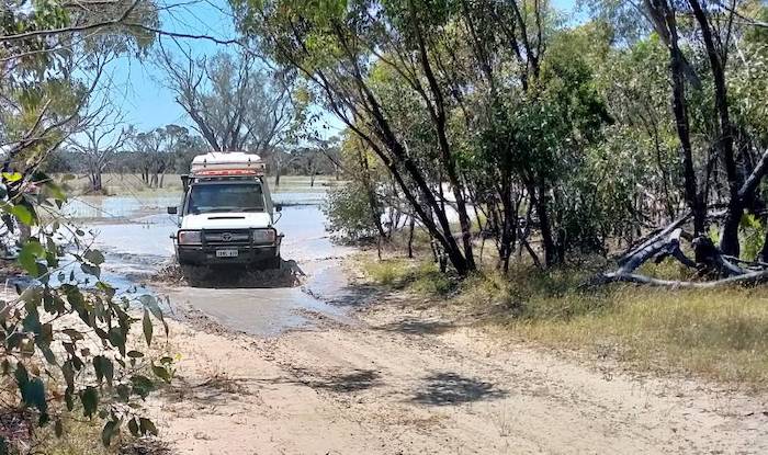
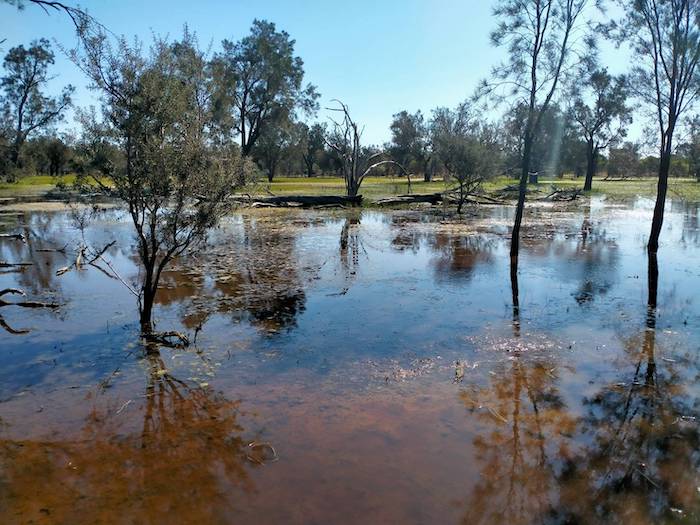
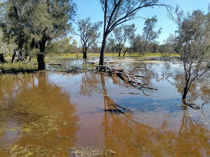
Water Crossing
About halfway along this unnamed track is an unusual 11 kilometre long east-west watercourse that has no clearly defined start point or finish point. We came across it about mid way along its length where it had spread to about 100 metres in width. Upstream two lakes are clearly visible on satellite imagery. The source for these extends to the Cooljarloo mine tenements.
-
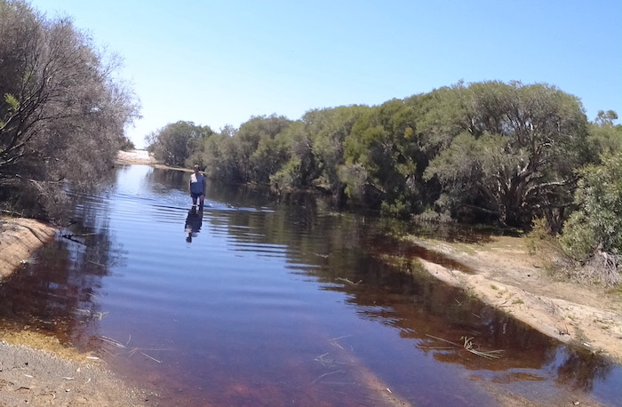
- Cath walked the water.
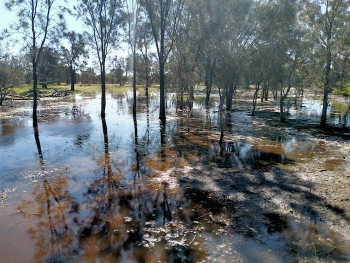
Downstream of where we encountered the water is another lake-like area but beyond that the watercourse is indistinct and its terminus is unclear. A puzzle that only became apparent because of the large amount of rain received in this area this year. Whatever the reason for the existence of the stream, we needed to cross it.
-
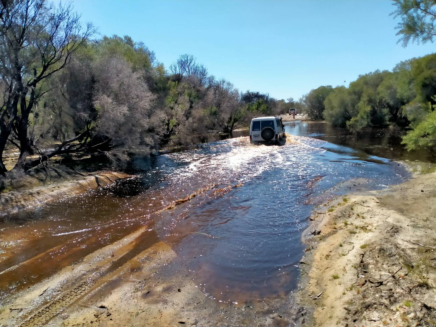
- Bob and Cath in their Troopy.
-
- Tom drove across in his Pajero Sports Wagon.
-

- Keith took his V8 GLX Landcruiser across.
At Neergabby, Cowalla and now here we were presented with a seasonally-unusual abundance of water. This local phenomenon was to continue as we progressed northward. And with the abundance of water came an unexpected but concordant abundance of wildflowers.
-

- Conebush (Petrophile sp.)
-

- Purple Flag (Patersonia occidentalis)
-

- Kangaroo Paw (Anigozanthus sp.)
After visiting Woolka Dam we again had to divert around inaccessible areas of the Old Stock Route and the massive Cooljarloo mineral sands mine. Mining of rutile, zircon and limenite started at Cooljarloo in 1989 and is expected to last until at least 2040. The mine extends 14 kilometres south-east to north-west. Once past the mine we turned onto Brand Highway and headed north for 13 kilometres. At this juncture the Road Trip was a long way from the Stock Route – but without alternative.
After turning off Brand Highway and travelling 22 kilometres west along Wongonderrah Road we were now ‘back on track’. The Road Trip continued north to the bridge over the Hill River.
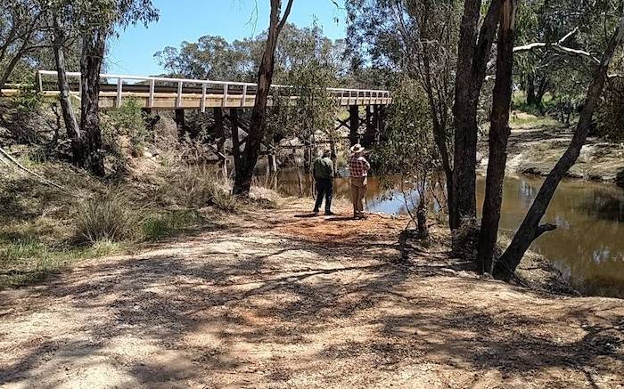
Hill River to Karda Campground
Hill River is about 195 kilometres north-north-west of Perth and during the heyday of the Stock Route it was an important stopping place. It was the junction of two Stock Routes.
-
- Bridge over the Hill River.
After checking out the place for future camping possibilities we moved on to our overnight stop at Karda – a fairly new DPaW campground that has been excised from an operating farm.
It is divided into two loops with camp sites that are absolutely huge. Way bigger than they need to be. It is an absolutely delightful location.
Continuing North
-
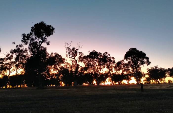
- Sunrise at Karda.
Cockleshell Gully Road took us into Lesueur National Park. The Cockleshell Gully farm abutting the National Park dates back to 1855.
The Diamond of the Desert
Before driving to the vicinity of The Diamond of the Desert we sprayed the underbody of each vehicle with a 70% methylated spirits solution to aid in preventing the spread of dieback (Phytophthora cinnamomi).
-
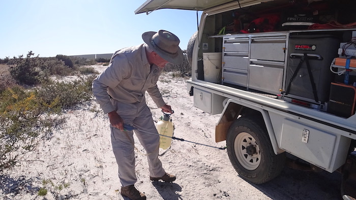
- Keith sprays the wheels and underbody of his vehicle to aid in prevention of the spread of dieback.
In The Drummonds of Hawthornden (page 132) Rica Erickson writes that The Diamond of the Desert was named by Major Logue (his name, not his rank) in 1850.
“There are isolated watering holes in this vast area and they can be identified from a distance of several miles from rising ground, especially by a man on horseback. The springs and swamps are surrounded by large Flooded Gums and show as dark green patches dotted on the lighter background of the surrounding scrub.”
-
- There is evidence that at one time the area saw considerable use, however, time has taken its toll and the bush is reclaiming the former watering hole.
It is surmised that the springs and swamps were named after an oasis in Sir Walter Scott’s novel The Talisman, a novel about the Crusades published in 1825 that was very popular reading.
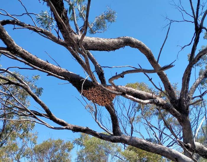
-

- Bob checks out the cave. There were lots of bees around.
Although, on page 59 of her book Ancient Landmarks, Sister Mary Albertus Bain states:
[Pemberton] Walcott found the limestone hollows, Davis drove the flock of sheep to the place and called it ‘The Diamond of the Desert’.
So while there is no doubt about the name there is some mild controversy over who named it.
-
- The Diamond of the Desert is largely overgrown.
A Heritage Council report in 2021 recorded:
“On the eastern side of the waterhole is a cleared, open white sandy area which was likely the site of a horse or cattle yard, as indicated by the remnants of a timber post.”
This is a blazed timber post at the cleared area and it is possibly a survey mark, although there is very little left of it from which to make a confident determination.
-
- Blazed post at cleared area.
We left the historic watering hole and made our back through thick prickly scrub to where the vehicles were parked. This is a rarely visited site. It is not very well known and not easy to access. It will be only a matter of time before this site is totally lost to the surroundings. During the Trip most people got a tick or two, more than likely from this walk through the bush.
Little Three Springs
Next stop for the day was at Little Three Springs a swampy area thick with paperbark trees (Melaleuca sp.), 14 kilometres to the north.
-

- Vehicles parked at Little Three Springs.
Until at least the 1930s there was a horse mustering yard at Little Three Springs, however, there is now nothing remaining other than a grassy paddock.
A long stock watering trough, reputedly preserved by being half buried in the waters of the spring, was not able to be located nor were the memorial trees planted by the Bicentennial Cattle Drove in 1988. Some signage would make the task of finding these relics, should they still exist, considerably easier.
It is thought that the continuously bubbling water emanates from a spring controlled by a fault in the underlying limestone.
The drive north from Little Three Springs was across a a sandy plain of low scrubby plants, highlighted by a magnificent display of Smoke Bush in flower. We turned north onto Cockleshell Gully Road and headed to Stockyard Gully.
Stockyard Gully

Stockyard Gully was an important campsite on the Stock Route, used as a natural, safe, temporary containment for stock.
As everyone had seen this popular, historic and unusual feature previously we bypassed it and came out on the Eneabba Coolimba Road. This is the start of the abandoned Woodada Gas Field that extends north for 15 kilometres.
Lake Logue
The normally dry Lake Logue and Lake Weelawadgi (not even marked on the map as a lake) were a sight to behold. Heritage Council documents state that Lake Logue was not part of the Stock Route, however, that claim would appear to be unsustainable given the lake’s location vis a vis known points on the Stock Route to the north and south.
Weelawadgi
To the north of Lake Logue is the Weelawadgi Flats. When we traversed this country the Weelawadgi Flats were the Weelawadgi Lake – as previously mentioned, not shown on most maps although the name is in official records. The country is generally described as ‘flats and claypans’. Amazing what some consistent, persistent, unseasonal rain does.
-

- The way is blocked by an overflowing lake.
-

- The water level in Weelawadgii Lake had dropped considerably since Gary’s recce three weeks prior.
-

- Gary led the way around the edge of the lake.
-
- Keith negotiates the inundated track around the edge of the lake.
We came across a mob of about 20 brumbies crossing the lake at the same time as we drove around it.
-
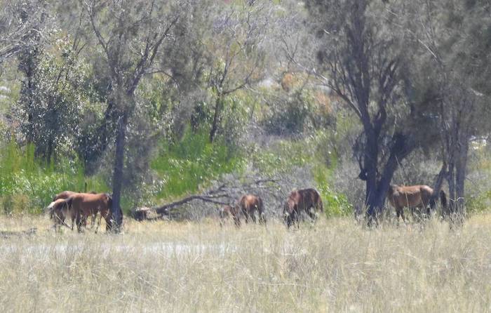
- Wild horses at Weelawadgi.
Arro Well and Lake
Beekeepers Road took us to Arro Well.
The Well is described as being 25 metres downstream from the road crossing. As the well was dug within the confines of the watercourse we posited that it was submerged by the unseasonal water in the stream. A 1994 Heritage Council visit showed it to be “not now visible as a separate entity, but there is a pretty, boggy pool, in which have fallen tree trunks and which is covered by delicate water plants”.
-
- Beehive on the track into Arro Lake.
The name ‘Arro’ is a locally used name applied to several features in this vicinity and it is likely that it is a diminutive of Arrowsmith, the name of the river, hill and lake all located a short distance to the north.
The name Arro Well was recorded in the late 1880s.
-
- At Arro Lake.
-
- Arro Lake.
-
- Arro Lake. The Arro Well is submerged.
-
- Arrow Lake.
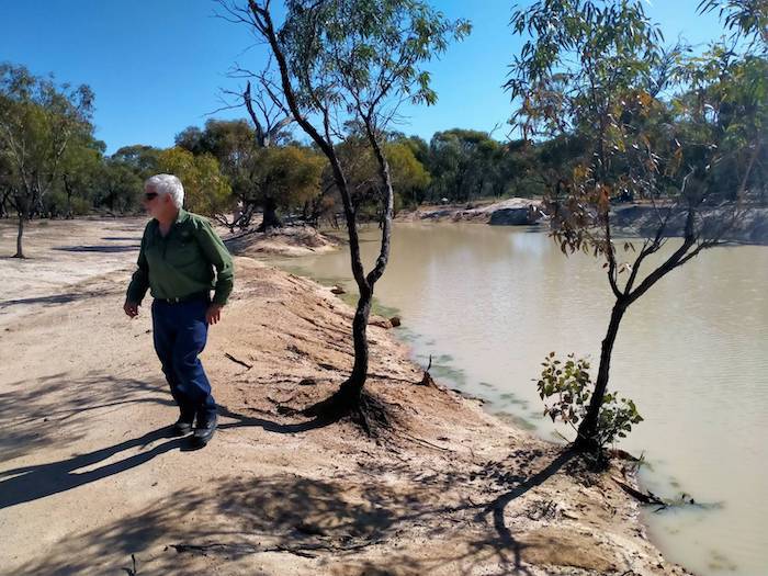
Podoloo Well
We stopped at Podoloo. The Podoloo Well has been lost, however, a tank/dam has been constructed nearby.
-
- Bob at the Podoloo Dam.
Arrowsmith River
The Dog Road crossing of the Arrowsmith River is only a few kilometres up the road. The Arrowsmith River does not flow into the ocean, instead draining into Lake Arrowsmith, seven kilometres to the north-west of this point and nine kilometres from the coast.
-
- Only a few weeks earlier these culverts were underwater.
-

- Our group on the Dog Road Crossing.
Lake Arrowsmith
The last highlight of the Road Trip was Lake Arrowsmith:
“The lake was a well known watering and resting place along the Old North Road.”
As of 1994 the lake and its surrounds were leased from the government by Mr N. Summers of Green Grove for the express purpose of conserving it as a nature reserve for birds (Heritage Council documentation). The currency of this information was not confirmed.
The overnight stop was at Cliff Head, near the top of Indian Ocean Drive.
-

- Cliff Head campsite on the coast.
-
- A fairly sterile campsite.
-
- No fire at this time of year.
There is still a more northerly portion of the Stock Route to cover, however, that will left to another day. Everyone made their own way home, or to other destinations.
References:
Historic watering holes survey. The Old North Road – Wanneroo to Walkaway coastal stock route Western Australia. Connor, Mary & Gibbs, Martin. Heritage Council of Western Australia. 1994 (original report by Mary Connor, March 1988 )
Register of Heritage Places – Assessment Documentation. North West Stock Route (fmr). 20/04/2004
Register of Heritage Places – North West Stock Route.
Geonoma
© Kim Epton 2022-2024
2456 words, 42 photograph, one image.
Photographs
Kim Epton
Keith Low
Research
Research by Gary Arcus enhanced this Report. Any conclusions drawn from that research are the responsibility of the Author.
Wildflowers
Identification of wildflowers by Keith Low.
Feel free to use any part of this document but please do the right thing and give attribution to adventures.net.au. It will enhance the SEO of your website/blog and Adventures.
See Terms of Use.