Don’t Beeline to Kalbarri
While Kalbarri is most definitely a desirable destination – even an iconic one – there is much to see in the intervening 600 kilometres from Perth. Some of it little-known, all of it worthwhile. Take the time to make your Road Trip epic!
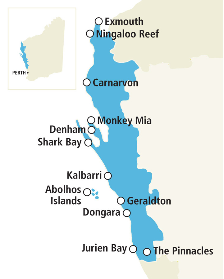
The Western Australian coast from Cervantes (200 kilometres north of Perth) to Exmouth, a distance of more than 1100 kilometres, is known as the Coral Coast.
-
- The Coral Coast of Western Australia.
This Road Trip included only about 100 kilometres of that amazing stretch of coastal beauty.
Get Out of Town
Northlink is a great escape route from the Perth conurbation.
The large Muchea interchange directs traffic to either the Great Northern Highway or the Brand Highway. We took the Brand Highway, a 370 kilometre link to Geraldton, named after former Premier of Western Australia, Sir David Brand. The selection of this route avoided (deliberately) the Indian Ocean Drive which would have taken us along the most southerly stretch of the Coral Coast.
The Dandaragan Way
From Regans Ford we travelled through Dandaragan to Badgingarra – The Dandaragan Way.
Badgingarra is about halfway between Perth and Geraldton.
Windblown Coast
After our short foray in search of wildflowers on The Dandaragan Way to Badgingarra we arrived at Port Denison, visited friends at Dongarra for a short time and then continued north on Brand Highway.
This windblown stretch of the Western Australian coast is renowned for its strong and persistent, onshore winds.
-
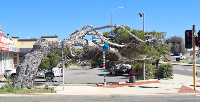
- While most of the leaning trees are on the Greenough Flats, this exemplar is in the City of Geraldton, near Subway.at the corner of Sanford and Durlacher streets.
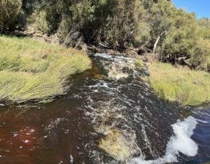
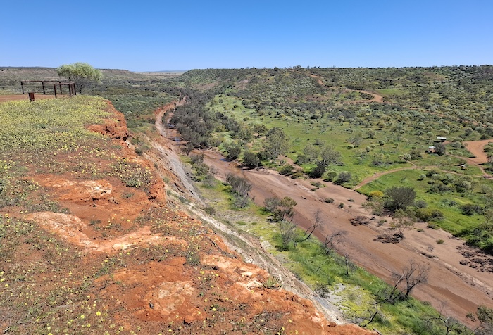
Ellendale Pool is a popular picnic and free camping spot on the Greenough River with toilet facilities, gas barbecues, picnic tables and shade. Too popular for us. As a result of the time spent socialising in Dongara we arrived too late to secure a place to park at Ellendale Pool. But not to worry!
-
- Our camp at Ellendale Pool – actually 200 metres west of the main camping area.
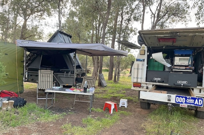
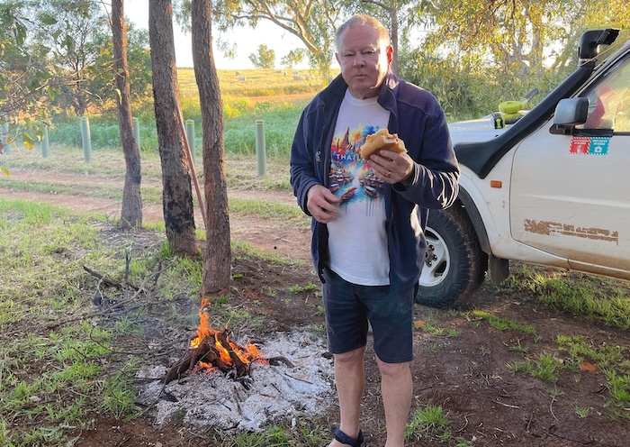
I noticed a smaller area on the approach road to Ellendale Pool – about 200 metres to the west. A uncrowded spot that allowed for a warming campfire on what was quite a chilly night.
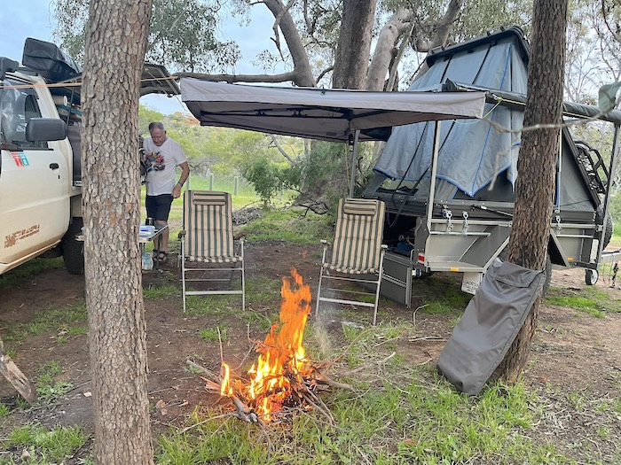
It was fortunate that we decided not to camp with the crowd at the main Ellendale Pool site. We had a delightful, uncrowded spot only 200 metres distant – with more spots available for anyone who cared to check it out. Our sole neighbour joined us for a delightful evening around the campfire.
-
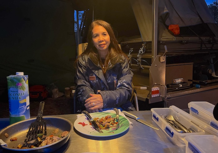
- Eatring breakfast by the fire.
-
- Tassy at Ellendale.
-
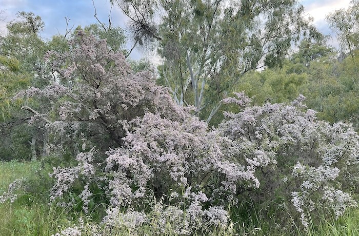
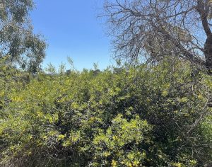
- It seemed that everything was in flower.
In transitioning from Ellendale Pool back to the coast at Geraldton we passed Western Australia’s very own Spy Base at Kojarena.
-
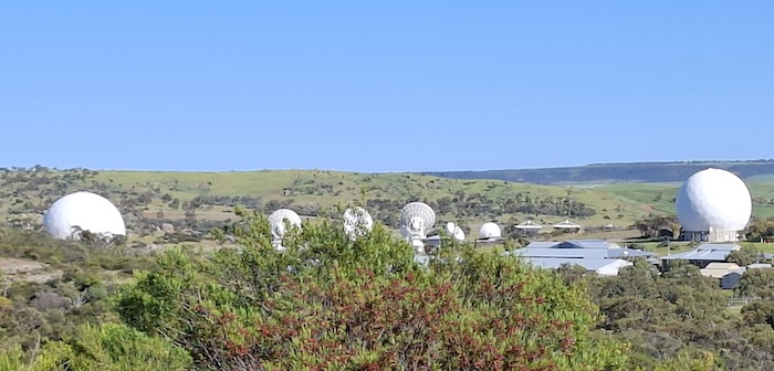
- Australian Communications Defence Station.
Coastal Capital of the Mid West
Located 400 kilometres north of Perth, the port city of Geraldton has transformed from a sleepy seaside holiday town into a vibrant hub of industry, tourism, and community life.
Even if just passing through Geraldton it would still be worthwhile to make time to visit the HMAS Sydney II Memorial at Mount Scott overlooking the city. It commemorates the 1941 loss of all 645 crew of the light cruiser in the dark days of WWII.
Also, a lot of work has been carried out at the foreshore to transform the disused railway marshalling yard into what is now a spectacular public use area.
-
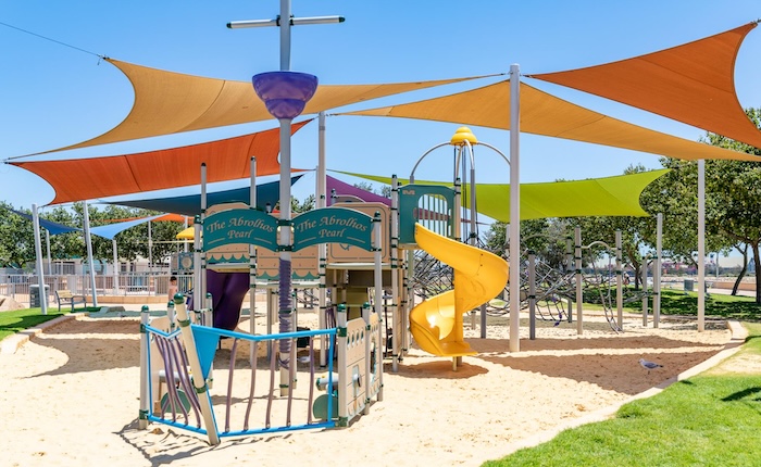
- Colourful playground is part of the Geraldton foreshore redevelopment.
At the southern end, the new Esplanade offers views of the city, Port, Champion Bay and Moresby Ranges from a 360-degree viewing platform. And take a stroll along the boardwalk at the Batavia Coast Marina.
Scenic, Historic Chapman Valley
Chapman Valley Road is seven kilometres north of Geraldton. This 60 kilometre alternative route/diversion to Northampton is full of delightful surprises.
-
- Scenic Chapman Valley.
-
- Chapman River.
-
- Bush in flower.
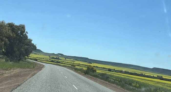
-
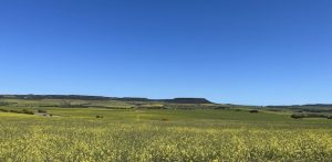
- Canola crop.
-
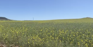
- Broad acre canola cropping..
-
- Coffee break at Fig Tree Crossing.
-
- Colourful weed.
Nabawa
The museum at Nabawa is well worth a visit.
Northampton to Horrocks
The diversion through the Chapman Valley leads away from the coast following the upper course of the Chapman River. The return to the coast is through the historic town of Northampton and continues to Horrocks and Port Gregory.
-
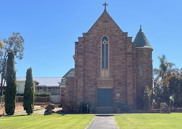
- Northampton Church
I contemplated staying at Horrocks Caravan Park, however, the site that was offered was totally exposed to the wind. Poor quality and few-in-number unpowered sites is a trend noticeable in the major (corporate) caravan parks Australia-wide. Expect to pay $50/night going forward.
We moved on to Lynton and the Linga Longa Farm Stay where we stayed the night in the lee of a wind-shielding, thickly-bushed tree. Good value at $30 for two people. Clean showers and toilets and a small Camp Kitchen.
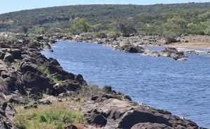
To Port Gregory and then the Spectacular Kalbarri Coastal Gorges
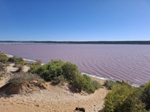
The first highlight after leaving our overnight camp was the Port Gregory Pink Lake – actually Hutt Lagoon. Finally a pink lake that is actually pink!
Hutt Lagoon is easily accessible (a sealed road on the way to Kalbarri with a convenient lookout/parking area), pink most of the time, and is clearly the ‘best value pink lake’ in Australia.
Pink Lake at Port Gregory
-
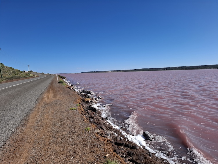
- Port Gregory Road runs alongside the western side of Pink Lake. George Grey Road traverses the eastern shore of the lake.
-

- Pink Lake (Hutt Lagoon) Port Gregory.
-
- Pink Lake (Hutt Lagoon) Port Gregory.
-
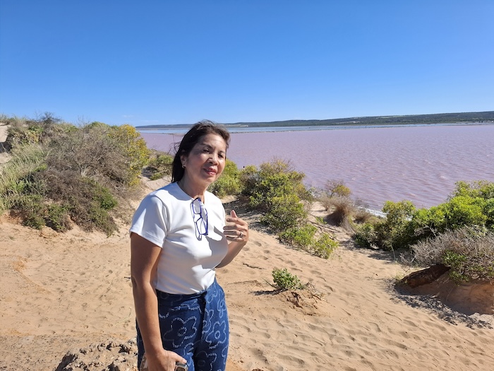
- Tassy at Pink Lake, Port Gregory.
George Grey Drive heads north from the Hutt Lagoon to the southern boundary of Kalbarri National Park.
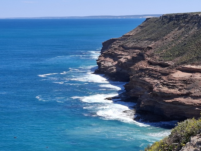
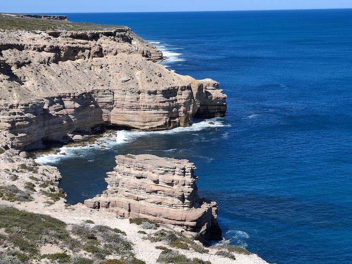
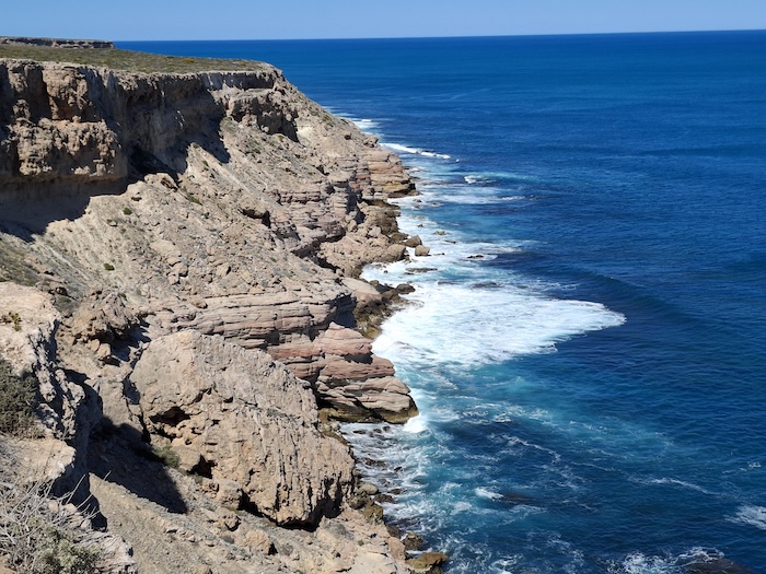
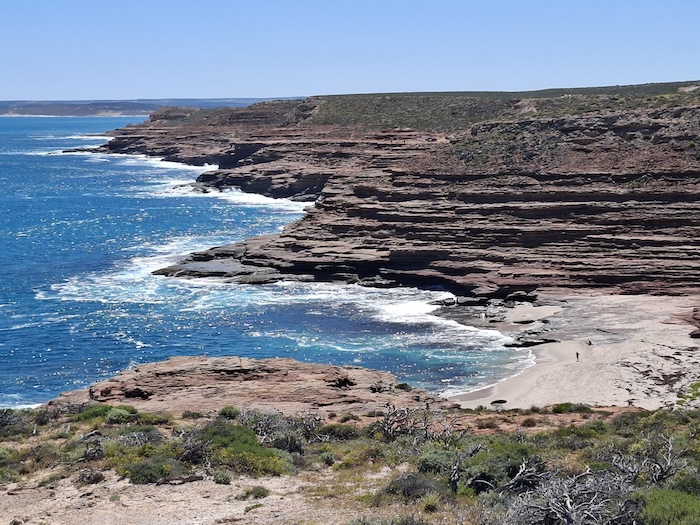
The spectacular coastal gorges south of Kalbarri include Natural Bridge, Castle Cove Lookout, Island Rock, Grandstand Lookout, Eagle Gorge, Pot Alley, Rainbow Valley, Mushroom Rock, and Red Bluff.
-
- Shell House Lookout.
-
- Island Rock Lookout.
-
- Approached the Island Rock Lookout from Port Gregory.
-
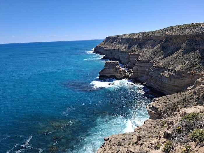
- Castle Cove.
-
- From Natural Bridge Lookout.
-
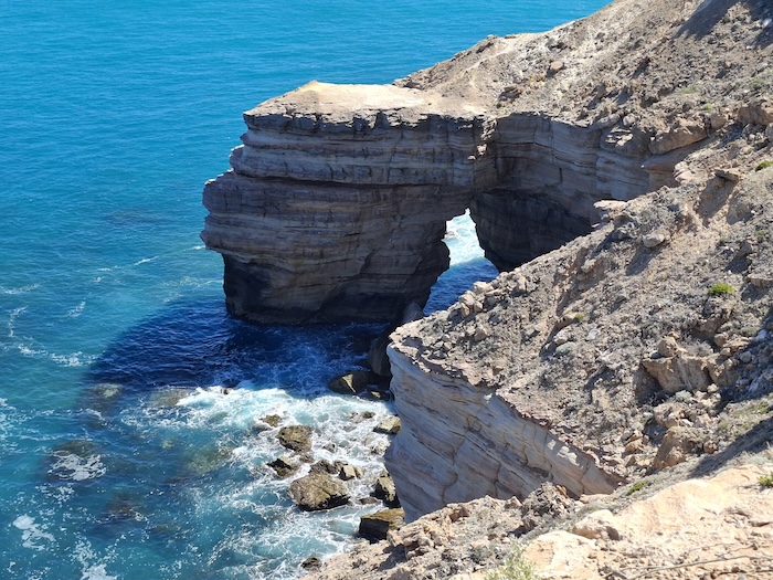
- Natural Bridge.
-
- In the carpark at Pot Alley
-
- Eagle Gorge.
All gorges and their access roads are well signed and are accessible by sealed roads.
Kalbarri
This popular seaside holiday town 600 kilometres north of Perth is at the mouth of the Murchison River, Western Australia’s second longest. Kalbarri was devastated by Cyclone Seroja in 2021 and appears to have recovered completely from that punishment of nature, however, anecodatally there is still much to be done to get the town operating to pre-cyclone conditions.
-
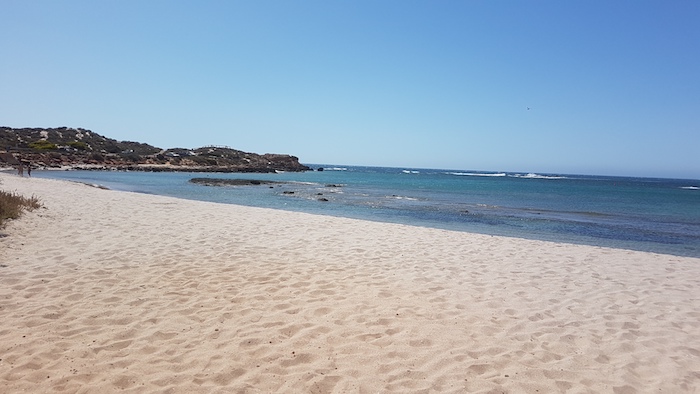
- Chinaman Beach at the mouth of the Murchison River, Kalbarri.
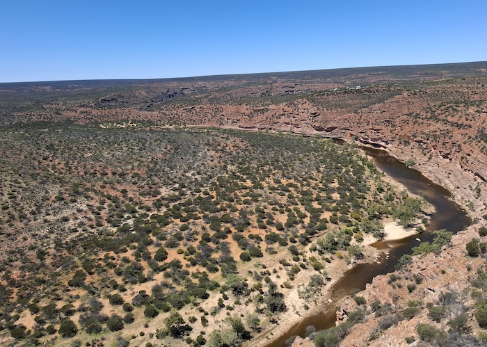
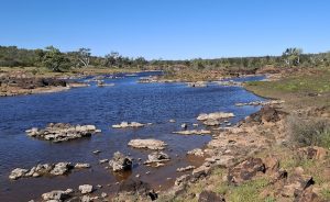
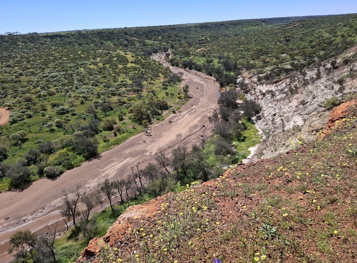
We headed east out of Kalbarri to see the spectacular Murchison River Gorges – Kalbarri Skywalk, Natures Window, The Loop, Z Bend, Hawks Head, Ross Graham Lookout and Hardabut Rapid.
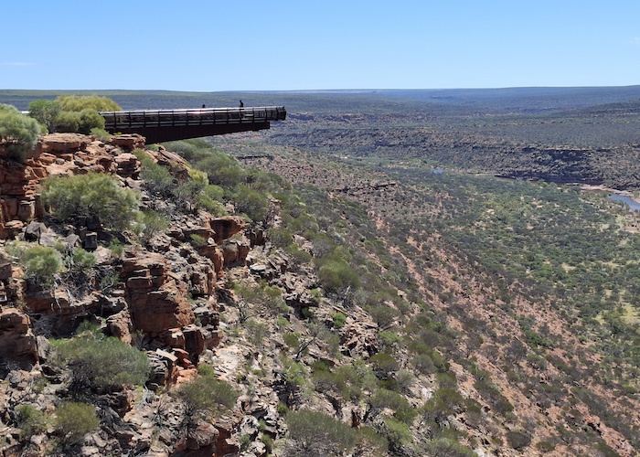
Kalbarri Skywalk
Construction of the Skywalk was completed in 2020. It is adjacent to Natures Window at The Loop, overlooking the Murchison River.
-
- The Kalbarri Skywalk
-
- Looking upriver.
-
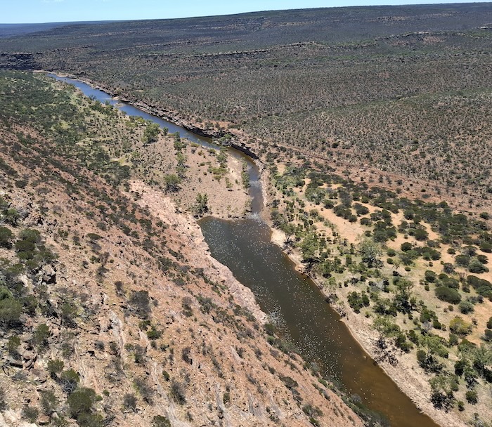
- Looking downriver.
-
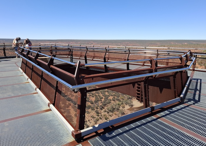
- The platform of the Skywalk.
-
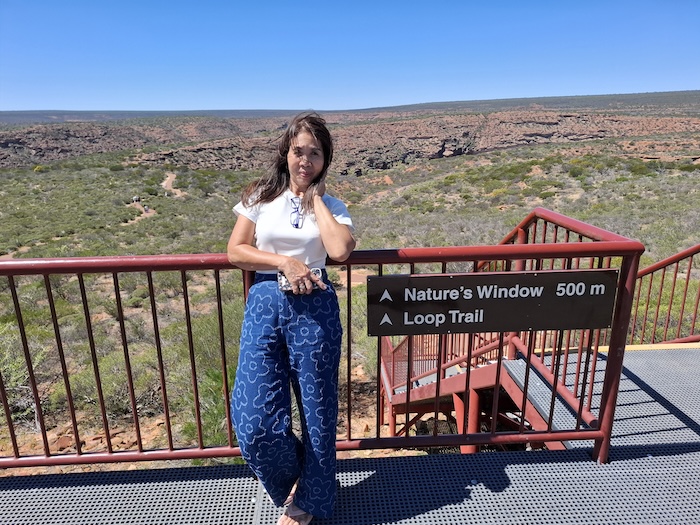
- Tassy at The Loop.
Hardabut Pool
Black swans on Hardabut Pool at the top of Hardabut Rapid, 55 kilometres upriver from Kalbarri, make a peaceful river scene. However, when the river is in flood the giant rapid is a fearsome sight.
-
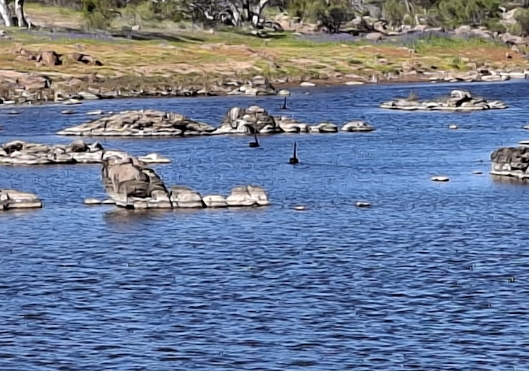
- Black swans on Hardabut Pool.
-
- Hardabut Pool
-
- Above Hardabut Rapid.
The track into Hardabut Pool is difficult to find and difficult to negotiate. A high clearance vehicle is recommended. Download GPX file.
Yuna
The final leg of our Day Two route took us through Ajana (adj – a – nah) and then along some back roads to the tiny town of Yuna. Free camping is permitted at the rear of the primary school. Clean toilets, no showers.
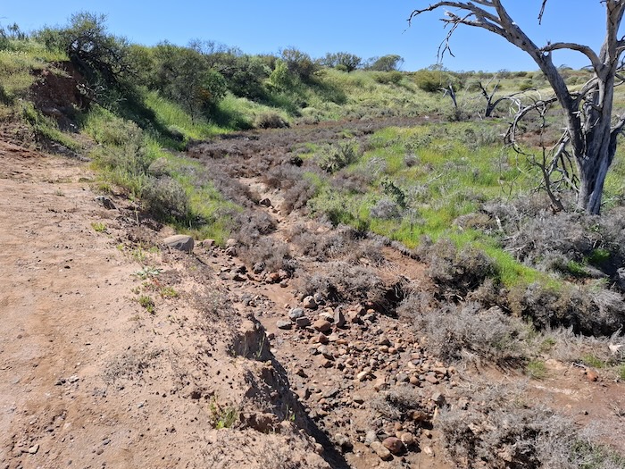
Noondamurra Pool and Breakaway
The planned route from Yuna to Mullewa encompassed a range of attractions not previously seen, although from experience of previous trips in the area the expectation of a high quality attractions was not high. Noondamurra Pool and Breakaway was an exception.
-
- Tassy at Noondamurra Pool.
The Pool is a permanent stretch of water on the Greenough River. It is more of a picnic spot than a campsite, however, there are good campsites about a kilometre away in the box canyon breakaway.
Bindoo Glacier Bed
The Bindoo Glacier Beds, 142 kilometres from the mouth of the Greenough River and easily accessible from the Yuna-Tenindewa Road, are a compact example of the effects of ancient geological processes.
-
- Greenough River at Bindoo.
-
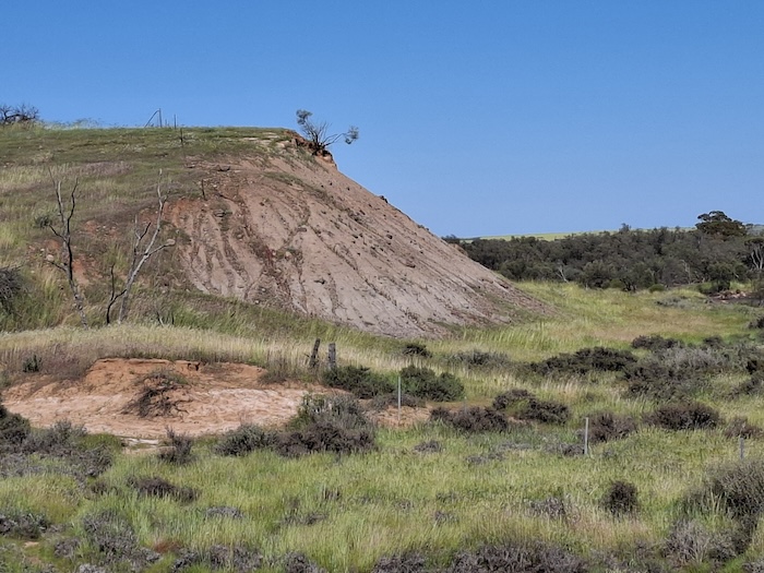
- This headland at Bindoo is evidence of galcial movement – apparently.
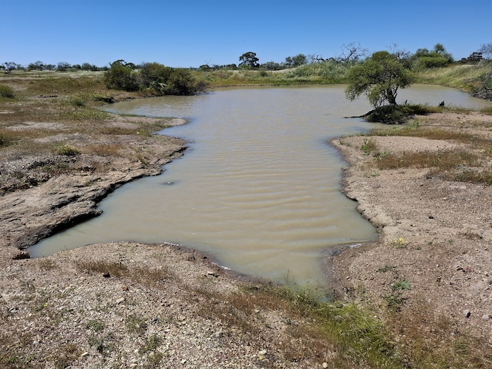
Arthurs Rest Campground/Woolya Well Campground
These two camping areas blend into one huge campground with many hundreds of good sites in open bushland.
The Woolya Pioneer Well (dry rock construction) is in good condition. It was constructed in the 1880s on the road that serviced early pastoral stations on the Murchison. It became an important water source for later prospectors heading to Murchison Goldfields.
-
- Woolya Dam just north of historic Woolya Well.
The associated pioneer dam 100 metres to the north is is good condition.
Tenindewa
Tenindewa is a small northern Wheatbelt town/siding on the Geraldton-Mullewa railway. It was a CBH Receival Point from 1936 (only three years after CBH started) to its closure in 1974. The railway siding still exists.
One of Tenindewa’s ‘claims to fame’ is that it was Western Australia’s last manually operated telephone exchange – closing in 1985.
For more information about Tenindewa go to this very detailed website.
Mullewa
Mullewa signifies the change from the Murchison to the Mid West, from station country to farm land, from ‘outback’ to ‘country’.
After a quick tour of the town and a top up of fuel we head south to Coalseam Conservation Park.
Coalseam
Rare in the world, at Coalseam ,coal is present at the surface. The coal seam after which the conservation park is named never proved viable. However, in 1846, so early in the Colony’s development, it was a important and significant find. It lies at the southern edge of the ancient landform known as the Victorian Plateau.
-
- Irwin River at Coalseam Conservation Park, looking upriver.
-
- Irwin River at Coalseam Conservation Park, looking downriver.
The Irwin River runs through Coalseam to its outfall at Dongara.
Today, Coalseam is known for its explosion of colour in the wildflower season, bushland nature walks, fossilised marine life in the riverbank, and its great diversity of wildlife.
-
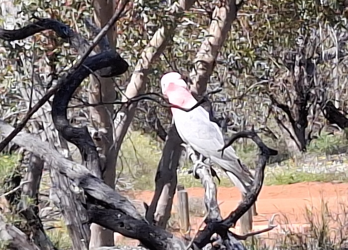
- Pink and Grey Galah at Coalseam.
Mingenew
The 2025 wildflower season did not treat Mngenew kindly. Wildflowers were not as prolific as expected. It is difficult to complain about this as they are wild flowers.
-
- View from Mingenew Hill.
We stayed the night at the Mingenew Caravan Park – virtually on the street. No fences. Fortunately no issues.
Three Springs
The agriculture and mining community of Three Springs is 300 kilometres north of Perth on the Midlands Road. The town was gazetted in 1907 although pastoral properties were established in the area from 1867. Not unexpectedly the town got its name from nearby springs.
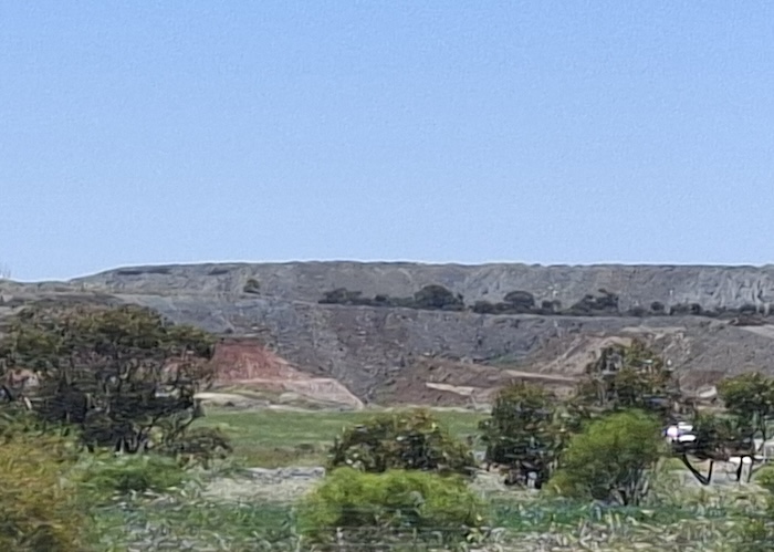
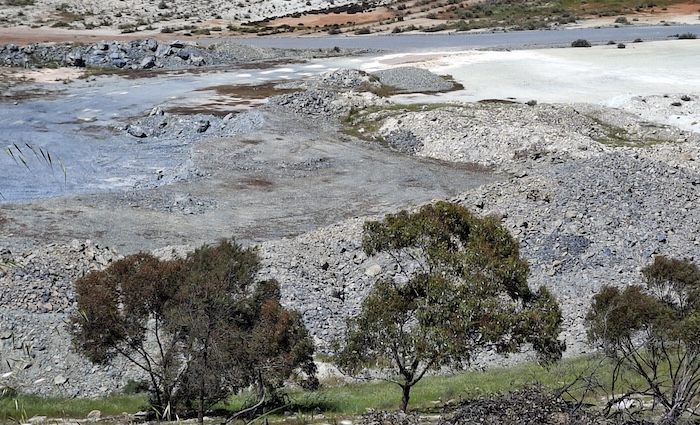
Australia’s Largest Talc Mine
The Three Springs open-cut talc mine is located 11 kilometres (by road) north-east of the town. With an annual production around a quarter of a million tonnes it is the largest talc mine in Australia and, indeed, the largest in the Southern Hemisphere. It is the world’s second largest talc mine.
-
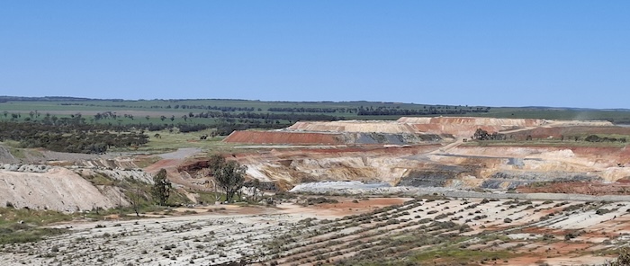
- Revegatation of strip mining at the Three Springs talc mine.
-
- Overburden at the Three Springs talc mine.
All employees of the talc mine reside locally and the benefits derived by the local community are immense.
The talc produced at the Three Springs mine is purchased by the paint, paper, cosmetic, agricultural and ceramic industry. Some is sold as carving blocks.
-
- Three Springs Talc Mine.
The viewing area is easy to access, gives a great view, and well worth the drive.
Unique Wreath Flowers of Western Australia
Since about Tenindewa we had been looking for the wreath flower, unique in the world to Western Australia.
-
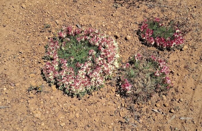
- Wreath flowers on Bateman Road, Three Springs.
The small patch of wreath flowers on Bateman Road towards Perenjori is conveniently co-located only a short distance from the Talc Mine Lookout.
-
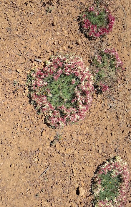
- Wreath flowers on Bateman Road, Three Springs.
Big Tractor – Carnamah
The Big Tractor in Carnamah was unveiled in October 2024. It is a replica of the first tractor made in WA – the Chamberlain 40K, which was manufactured from 1949.
The Big Tractor has proved to be a successful tourist attraction project for Carnamah – a small northern wheatbelt town with a population of only 400.
Coorow and Watheroo
Along with Mingenew, Perenjori, Morawa, Carnamah, and Three Springs, these Mid West towns – and others – vie for the reputation of having the most magnificent seasonal display of wildflowers. A purchase at the local store, a fill up at a servo, a meal at the pub, overnight at a motel or the caravan park, or a visit to a fee-attracting museum or other attraction all adds to the viability of the town. Wildflowers are big money.
Moora
Moora is an important regional centre. We stayed overnight at the Moora Caravan Park. But not without some intense negotiating about our accommodation requirements. Note to self: Just state that our desire for an unpowered site is because we have a tent.
Moora Caravan Park is secure, clean and tidy. The coded lock on the ablutions is indicative of a deeper social problem in the town.
Return
In the morning it was a stress free, incident free, easy run to Jandakot.
The Mid West Spring Tour took place in September 2025.
Download the GPX file for this Road Trip – 2135-Mid West Spring Tour 2025.
© Kim Epton 2025
2061 words, yy photographs, zz images.
Feel free to use any part of this document but please do the right thing and give attribution to adventures.net.au. It will enhance the SEO of your website/blog and Adventures.
See Terms of Use.